Starting point: Podmeja (724 m)
| Latitude/Longitude: | 46,18610°N 15,06180°E |
| |
Walking time: 1 h 15 min
Difficulty: easy marked way
Elevation gain: 398 m
Elevation difference along the route: 415 m
Map:
Recommended equipment (summer):
Recommended equipment (winter):
Views: 124.904
 | 6 people like this post |
Access to starting point:
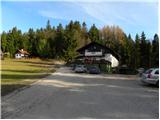
From the Ljubljana–Celje highway, take the Šempeter exit and continue driving towards Prebold and later Trbovlje. Then follow the serpentine road to the Podmeja pass, where we park on the parking lot near the hunting lodge.
From Zasavje, we first drive to Trbovlje, then continue driving towards Prebold. When we arrive at the Podmeja pass, we park on the parking lot near the hunting lodge.
Route description:
From the Podmeja pass we first walk to the hunting lodge, where on the left side we will notice signposts for Mrzlica, which direct us right into the forest. The path, which moderately ascends, quickly brings us to the indistinct Svinski vrh (766 m), from which the path gradually begins to descend. After a few minutes of descent we step out of the forest and the path brings us to the road leading towards Mrzlica. We follow the mentioned road to the right, which past a hamlet with a few houses brings us into the forest, where it then moderately ascends. Higher the road flattens and brings us out of the forest onto panoramic grassy slopes, from which a nice view opens up of the peaks surrounding the Savinja Valley. Here the path from the valley (Marija Reka) joins almost unnoticeably from the left, and we continue along the road to the marked junction, where we have two options for continuing:
If we want first to the summit of Mrzlica and only then to the mountain hut, we continue slightly right (otherwise straight on the moderately steep macadam road) on a quite steep path, which after a good 10 minutes flattens and brings us out of the forest onto a larger grassy clearing, where to the right a path branches off leading to the nearby viewpoint "K Skalci". Here we continue left (the turn-off for the summit is not marked) and in a few minutes of further walking we step onto the summit of Mrzlica.
From the summit we then descend to the mountain hut on Mrzlica in less than 5 minutes.

Photos:
 1
1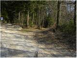 2
2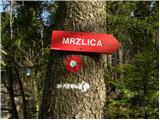 3
3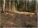 4
4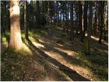 5
5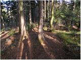 6
6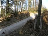 7
7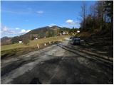 8
8 9
9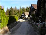 10
10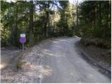 11
11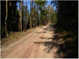 12
12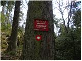 13
13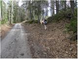 14
14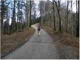 15
15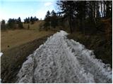 16
16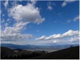 17
17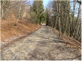 18
18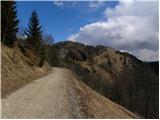 19
19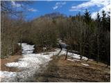 20
20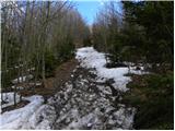 21
21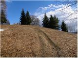 22
22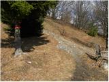 23
23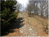 24
24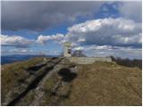 25
25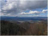 26
26 27
27
Discussion about the trip Podmeja - Mrzlica
|
| lubi28. 04. 2008 |
Zasavci and Zasavsko hribovje have completely conquered us this spring. Or maybe we them, who knows??
Just the right height goals, sufficiently safe accesses, well-marked paths and mountain lodges that stand out from the mountaineering average in equipment, offer and friendliness. Playgrounds available in front of the hut on Mrzlica and Kalu additionally motivate the young mountaineers, while parents in good company exchange experiences, impressions and news.
Yesterday's holiday was magical. Beautiful warm spring Sunday in the company of simple and cheerful Trbovci, Zagorci and Hrastničani.
Next is KUM's turn.
Nadka
|
|
|
|
| Lucy16. 01. 2011 |
Because it was a nice sunny day I headed to Mrzlica. I chose Lovski dom as the starting point. The path itself was easy and pleasant, suitable for all ages. The hut is very nice, staff friendly, food tasty, service quick. Visiting the hut on Mrzlica was pleasant and I recommend it to everyone who hasn't visited it yet. I'll definitely come again.
|
|
|
|
| čru30. 11. 2012 |
Just to remind you a bit. Tomorrow, Saturday, there is a night hike to Mrzlica. So, a bit different than usual. For many a really nice experience.
For those nice ones St. Nicholas comes. For us a little devil.
|
|
|
|
| francimedved30. 11. 2012 |
Yes really, and if you do more St. Nicholas hikes, you get a commemorative badge.
Bronze for three participations,
Silver for five,
for seven gold.
For ten participations a commemorative plaque.
|
|
|
|
| laik5. 02. 2013 |
I'm interested, what are the snow conditions like on Mrzlica.. since I'm a beginner, I'd rather check beforehand so that it doesn't... THANKS 
|
|
|
|
| geppo5. 02. 2013 |
Conditions are changing and tomorrow they will be completely different from today. If you go from Podmeja, you have nothing to fear...
The frequency of hikers here is always high. It is usually trampled and easy to follow.
best regards (and no fear)
|
|
|
|
| laik5. 02. 2013 |
thank you very much...nice regards :-)
|
|
|
|
| balon5. 04. 2014 |
Is the path passable or not?
|
|
|
|
| možiček5. 04. 2014 |
On this path there wasn't much broken. So no problems..
|
|
|
|
| slavkovoda31. 05. 2014 |
Today we were on Mrzlica, started from Podmeja - Lovski dom. Nice, pleasant, undemanding path, but on some slopes the pulse is a bit elevated anyway. Exceptional view from the top, friendly and not overpriced at the nearby hut. Well marked.
|
|
|
|
| balon5. 06. 2014 |
Is the path quite muddy?
Balončki
|
|
|
|
| otiv5. 06. 2014 |
The path for the most part follows the road, so fear of mud is unnecessary.
Best regards
|
|
|
|
| biba5. 06. 2014 |
Although I hike to Mrzlica via another path, I would dare to say no. The path mostly follows the road. Otherwise, it's raining right now. Best regards.
|
|
|
|
| Stamp19. 07. 2019 |
Slightly modified trip, up the described path, but down the unmarked one, over Čeče and so on.. described in the album CLICK HERE
Very pleasant hiking, and very fine meal in Lovački hut. 
|
|
|
To post a comment you must log in:
If you do not yet have a username, you must first
register.