Sovodenj - Ermanovec (by road)
Starting point: Sovodenj (592 m)
| Latitude/Longitude: | 46,08500°N 14,03860°E |
| |
Route name: by road
Walking time: 1 h 40 min
Difficulty: easy marked way
Elevation gain: 434 m
Elevation difference along the route: 434 m
Map: Škofjeloško in Cerkljansko hribovje 1:50.000
Recommended equipment (summer):
Recommended equipment (winter):
Views: 2.460
 | 1 person like this post |
Access to starting point:
A) First, we drive to Gorenjo vas in Poljanska dolina (to here from Škofja Loka, new bypass road which bypasses Škofja Loka, Horjul or Polhov Gradec), and then we continue driving towards Žiri and Cerkno. After the settlement Trebija and just before the bridge over Poljanska Sora, we leave the main road towards Žiri and continue driving right in the direction of Cerkno. Further on, we drive on a somewhat more winding road, on which we quickly arrive at the settlement Sovodenj, where in the middle of the settlement we park on a large parking lot near the Mercator store.
B) We drive to Žiri (to here from Vrhnika or Logatec), and then we continue driving towards Škofja Loka. Before the settlement Trebija we turn left, onto the road in the direction of Cerkno. Further on, we drive on a somewhat more winding road, on which we quickly arrive at the settlement Sovodenj, where in the middle of the settlement we park on a large parking lot near the Mercator store.
C) We leave the main road Idrija–Straža–Želin at the turn-off for the settlement Jazne, and then we ascend to the mentioned settlement, from where we continue driving towards Sovodenj. After a smaller saddle, where the marked path to Bevkov vrh branches off to the left, the road starts descending, and we drive along it to the settlement Sovodenj, where we park on a large parking lot near the Mercator store.
D) We drive to Cerkno, and from there we continue driving in the direction of Škofja Loka. Further on, we drive on an ascending road that takes us through Planina pri Cerknem on a winding road to the pass Kladje, after which we start descending towards Sovodenj. When we arrive in Sovodenj we park on a large parking lot near the Mercator store.
Route description:
From the center of Sovodenj we continue on the main road towards Cerkno, which after a few hundred meters we leave and continue slightly right in the direction of the mountain hut Koča na Ermanovcu. The path ahead leads us on a somewhat narrower asphalt road that runs along the stream Zakoparska grapa. After a few minutes, the path splits into two parts, and we continue right in the direction of Ermanovec on the road (straight footpath to Ermanovec). There follows a short ascent through the forest, then we emerge from the forest and after a few more minutes we arrive at a smaller hamlet, where at a smaller crossroads we continue left in the direction of Ermanovec. Further on, we cross a strip of forest once again, then the road leads us along panoramic grassy slopes. After the hamlet Na Sivk we quickly arrive at a smaller saddle, where there is a marked junction at the chapel and bell.
From the junction we continue sharply right onto a cart track (left Koča na Ermanovcu, slightly right Dom na Slajki on Hotavlje), along which we start to gently ascend along a panoramic ridge. When the cart track turns somewhat to the right, we continue slightly left onto a path that ascends over a somewhat steeper grassy slope directly towards the summit. A little below the summit the path levels out and brings us into the forest, where the summit of Ermanovec is located.
Description and pictures refer to the condition in the year 2016 (January).

Photos:
 1
1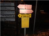 2
2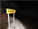 3
3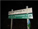 4
4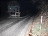 5
5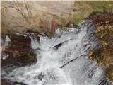 6
6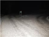 7
7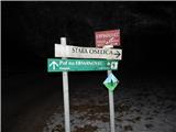 8
8 9
9 10
10 11
11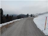 12
12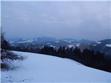 13
13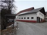 14
14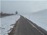 15
15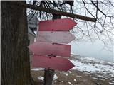 16
16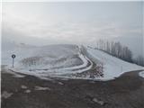 17
17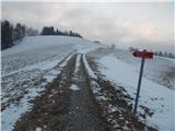 18
18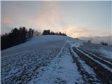 19
19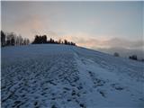 20
20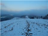 21
21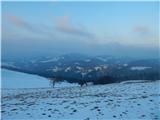 22
22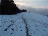 23
23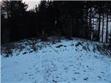 24
24 25
25
Discussion about the trip Sovodenj - Ermanovec (by road)
To post a comment you must log in:
If you do not yet have a username, you must first
register.