Starting point: Potoki (600 m)
| Latitude/Longitude: | 46,41740°N 14,12090°E |
| |
Walking time: 1 h
Difficulty: easy marked way
Elevation gain: 446 m
Elevation difference along the route: 446 m
Map: Karavanke - osrednji del 1:50.000
Recommended equipment (summer):
Recommended equipment (winter): ice axe, crampons
Views: 35.899
 | 5 people like this post |
Access to starting point:
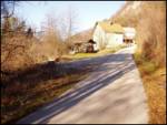
From the Ljubljana–Jesenice highway, we take the Vrba exit and follow the road ahead in the direction of Jesenice. Soon after Žirovnica, when on the right side of the road we notice the sign for the municipality of Jesenice, we put on the right turn signal because only a few dozen meters after this sign we turn right into the underpass (under the railway). The road on the other side of the railway turns left and we follow it to the end of the fence, where we park on a smaller parking lot by the road.
Route description:
We start walking on the road alongside which we parked. When we come to the first houses, we go right on a poorer road which brings us to the spot where logs are stored. From here, we head onto the right cart track which goes along the right side of the stream. The path starts to ascend more steeply and eventually brings us to the place where water springs from the path. This spring dries up in dry periods. This part of the path is also quite muddy. The path continues ascending along the cart track and brings us to a junction at the stream.
We go right following the signs for Ajdna. The cart track from here on has quite a few junctions, all marked but the markings are poorly visible in some places. Even if we don't notice the marks, we go right. The cart track then turns into a footpath which joins the upper path that comes from the Valvasorjev dom mountain hut (or from the starting point Na Sušeh). Here we go right and after a few minutes of ascent from the junction with the upper path, the path brings us to the vantage point where we go left along the small ridge. This path brings us in a few steps to the archaeological settlements. In this part, the path goes left across the old settlements and brings us to the ridge, where the climbing path joins us. From here to the top, we have only a few meters left.

Photos:
 1
1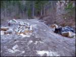 2
2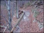 3
3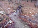 4
4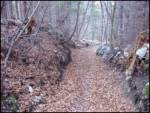 5
5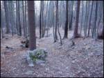 6
6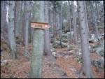 7
7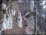 8
8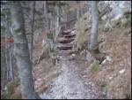 9
9 10
10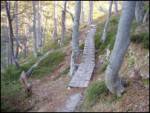 11
11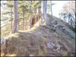 12
12 13
13 14
14
Discussion about the trip Potoki - Ajdna
|
| navdušena30. 07. 2015 |
Oh, is there a stamp in the box too?
|
|
|
|
| marezt30. 07. 2015 |
No... there hasn't been a stamp in the box for a long time
|
|
|
|
| andrejazg7. 09. 2016 |
There is still no stamp in the box. But it's logging road and the whole path is in worse condition (fallen trees) and also very poorly marked. This path is described in the book With children to the mountains, but I don't recommend it for small children. At the top there's a wonderful view of the surroundings.
|
|
|
|
| hribolazecales11. 08. 2019 |
In the book "Z otroki v gore" the route is described from the other direction (from Valvazorjev dom).
|
|
|
|
| Klemenko202. 01. 2020 |
Super tour  True, the path is a bit poorly marked but you can't get lost. At the top the view is gorgeous True, the path is a bit poorly marked but you can't get lost. At the top the view is gorgeous
|
|
|
To post a comment you must log in:
If you do not yet have a username, you must first
register.