Zagreben (pri Dikcu) - Malič
Starting point: Zagreben (pri Dikcu) (670 m)
| Latitude/Longitude: | 46,18760°N 15,16140°E |
| |
Walking time: 1 h 30 min
Difficulty: easy marked way
Elevation gain: 266 m
Elevation difference along the route: 350 m
Map: Posavsko hribovje - zahodni del 1:50.000
Recommended equipment (summer):
Recommended equipment (winter):
Views: 8.122
 | 1 person like this post |
Access to starting point:
From the Ljubljana–Maribor motorway we take the exit for Žalec, then continue driving towards Arja vas. At the main intersection at the end of the village we drive straight ahead in the direction of Liboje. The route leads us through the entire settlement of Liboje, after which the road begins to climb noticeably into the hills and winds through a short forested section.
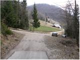
After some time the route brings us to a marked intersection, where we continue straight on the main road, while a path branches off to the right towards the Beškovnik farm. From this junction we continue driving a few hundred metres uphill until we reach the next important intersection, next to which there is a suitable parking place. This starting point is easily recognised by the traffic sign on the left branch road that prohibits further driving for all vehicles and where our footpath then begins.
Route description:
From the starting point we head onto the left asphalt road, which is closed to public traffic by a traffic sign. We begin the route at a light pace, as the road initially only moderately ascends and allows for a pleasant warm-up. The asphalt surface soon turns into compacted gravel, and the surroundings become noticeably quieter. The picturesque road surrounded by forest quickly leads us to the first more important intersection. At this point we follow the signposts and continue on the left path towards Šmohor.
In the continuation we are led by a fairly gentle and wide road, which offers comfortable stepping. While walking on the left side in a wide arc we bypass the forested peak Perniče, which rises 881 meters high. The forest then gradually thins out and the road leads us out of the shade of the trees onto an extensive, scenic and sunlit grassy ridge.
When we cross these vast grassy slopes, the historic Church of St. Mohor soon appears before us, representing a wonderful spot for a short stop. From the church we then continue the path eastwards. Initially we walk on a compacted road, but the markings soon direct us onto a pleasant, soft footpath. This leads us across a rolling meadow, from which views already open towards our intermediate goal, which we reach after just a few minutes of light walking – the Mountain Hut on Šmohor.
Further we continue the path in the direction of Liboj and Malič, along a path that first descends slightly, then leads us past a newly built house to a junction of paths, where we continue straight towards Malič. The path then enters the forest and ascends parallel to the road. With a few ascents and descents the path leads us to the paragliding takeoff site. Further the path ascends steeply and quickly leads us to the summit along the western ridge of Malič covered with forest.

Photos:
 1
1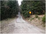 2
2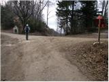 3
3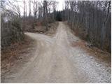 4
4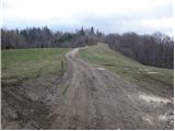 5
5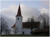 6
6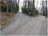 7
7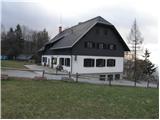 8
8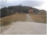 9
9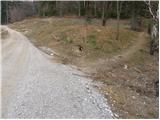 10
10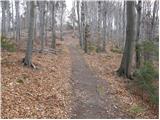 11
11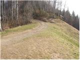 12
12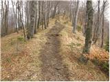 13
13 14
14
Discussion about the trip Zagreben (pri Dikcu) - Malič
|
| aleš88827. 05. 2014 |
Beautiful day for a hike. The path is well marked and quite undemanding.
|
|
|
To post a comment you must log in:
If you do not yet have a username, you must first
register.