Podolševa (Sveti Duh, Strevc) - Govca (Olševa) (via Obel kamen)
Starting point: Podolševa (Sveti Duh, Strevc) (1235 m)
| Latitude/Longitude: | 46,43550°N 14,65970°E |
| |
Route name: via Obel kamen
Walking time: 2 h 30 min
Difficulty: difficult marked way
Elevation gain: 694 m
Elevation difference along the route: 740 m
Map: Kamniške in Savinjske Alpe 1:50.000
Recommended equipment (summer): helmet
Recommended equipment (winter): helmet, ice axe, crampons
Views: 15.500
 | 1 person like this post |
Access to starting point:
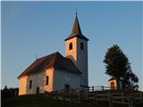
A) We drive to Luče, then continue driving towards Logarska dolina. In the settlement Solčava, before the bridge over the river Savinja, we leave the road towards Logarska dolina and continue right in the direction of Podolševa and Črna na Koroškem. After approximately 5 km of ascent, we arrive at a crossroad, where we go left towards Sveti Duh (right Črna na Koroškem), then drive on the Solčava Panorama road to the tourist farm Strevc, which is situated below the church of the Holy Spirit. From the main road to the starting point, there is approximately 8 km.
B) We drive to Črna na Koroškem, then continue driving in the direction of Koprivna and Solčava. Further on, we drive for some time through the valley along the river Meža, then go left in the direction of Solčava and Logarska dolina. Next follows an ascent to the mountain pass Spodnje Sleme, from there some descent to a crossroad, where we go right towards Sveti Duh, then drive on the Solčava Panorama road to the tourist farm Strevc, which is situated below the church of the Holy Spirit. From the center of Črna na Koroškem to the starting point, there is approximately 23 km.
C) Via the border crossing Pavličev Vrh, we drive into Slovenia and begin descending towards Solčava. Soon after the mountain hut Majerhold, we go left in the direction of Podolševa and Solčava Panorama road. On the panorama road, we drive to the tourist farm Strevc, which is situated below the church of the Holy Spirit. From the border crossing Pavličev Vrh to the starting point, there is approximately 10 km.
Route description:
From the starting point, we head on the path in the direction of Olševa, sv. Lenart and Potočka zijalka. We bypass the tourist farm Strevc on the left side, and the path goes above the farm into the forest, where for a short time we continue on a cart track. We quickly reach the macadam road, on which we ascend to a smaller crossroad.
From the crossroad, we continue sharply right (straight sv. Lenart) and continue the ascent on the macadam road, by which there are no marks. After a few minutes, we join the marked path which leads past the tourist farm Rogar, and we continue left on the path in the direction of Potočka zijalka, Obel kamen and Govca. Further, we ascend on a well-beaten and gradually steeper path, which higher reaches the national border. Next follows a few minutes of steep ascent and from the left the path from Austria joins us.
We continue right and then follows more than 10 minutes of ascent and the path brings us to the archaeological site Potočka zijalka.
We continue on the marked path, which on the right side bypasses the cave and with the help of fixed safety gear ascends on the right side of a quite steep gully. A little further with the help of iron spikes we cross the gully, then steeply ascend out of the gully. Also further on the path is quite steep, and with every gained altitude meter also more panoramic.
On a smaller ridge the path splits, and we choose the left path in the direction of Obel kamen (straight Govca). Next follows a steep ascent on a mostly grassy slope, which higher is overgrown by dwarf pines. When we reach the main ridge, on the first secondary peak we already notice the first inscription box (inscription box of the Mountaineering Club Skala), in which in August 2018 there was only a stamp. From the first secondary peak follows a shorter ascent and we arrive at the next secondary peak, where next to the cross there is also the second inscription box.
We continue right, and the path leads us on the panoramic border ridge of Olševa, where we mostly walk on the Slovenian side of the ridge. After a few minutes of quite gentle walking the path ascends more steeply and brings us to Obel kamen, which we recognize by the border stone with no. XXII 1.
We continue along the ridge, initially still with some shorter descents and ascents, then we arrive at a shorter demanding descent. After the demanding spot, where there are no fixed safety gear, we descend for a short time, then the path turns left and crosses the slopes to the junction with the usual path which leads to Govca.
From the junction follows a short ascent and the path returns to the ridge. On the ridge in a belt of dwarf pines, from the left almost unnoticeably joins an unmarked path from Zadnji travnik, and we continue straight and in a few minutes ascend to the highest peak of Olševa.
Starting point - Potočka zijalka 1:10, Potočka zijalka - Obel kamen 0:50, Obel kamen - Govca 0:30.
Description and pictures refer to the condition in 2018 (August and July).

Photos:
 1
1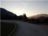 2
2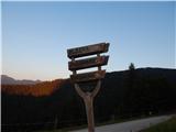 3
3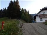 4
4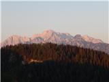 5
5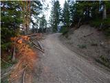 6
6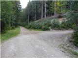 7
7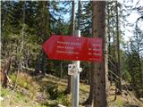 8
8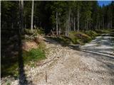 9
9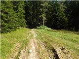 10
10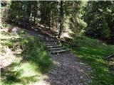 11
11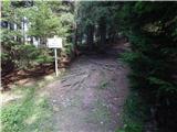 12
12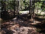 13
13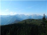 14
14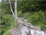 15
15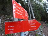 16
16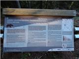 17
17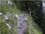 18
18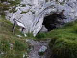 19
19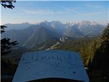 20
20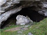 21
21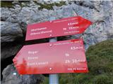 22
22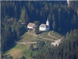 23
23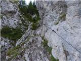 24
24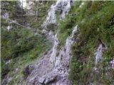 25
25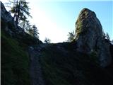 26
26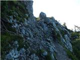 27
27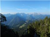 28
28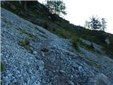 29
29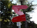 30
30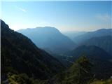 31
31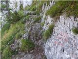 32
32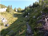 33
33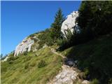 34
34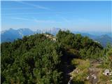 35
35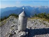 36
36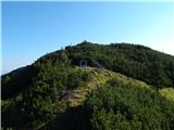 37
37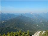 38
38 39
39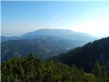 40
40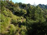 41
41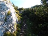 42
42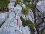 43
43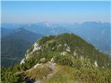 44
44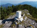 45
45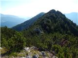 46
46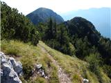 47
47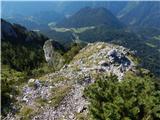 48
48 49
49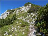 50
50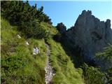 51
51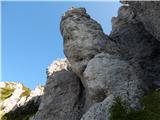 52
52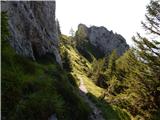 53
53 54
54 55
55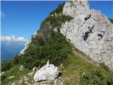 56
56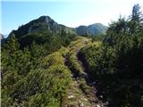 57
57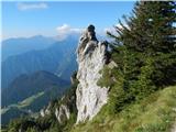 58
58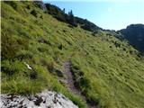 59
59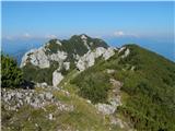 60
60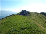 61
61 62
62
Discussion about the trip Podolševa (Sveti Duh, Strevc) - Govca (Olševa) (via Obel kamen)
|
| ovi17. 06. 2023 19:41:10 |
nice hike, suitable for children over 10 years, well marked - ideal for a trip with a medium or larger dog (smaller ones you'll have to carry in places) - caution - take enough water with you (if returning via the circular path) - great trip - which will take 8-9 hours of normal walking with breaks (without transport to access).
Beautiful views of Logar Valley and Kamnik-Savinja Alps and Jodlarja ;-)))
|
|
|
|
| garmont17. 06. 2023 21:52:58 |
8-9 hours is too much depending on the path starting point.
4-5 hours is more accurate.
|
|
|
|
| zokipoki17. 06. 2023 23:46:15 |
With children (depending on age and fitness) the path can quickly approach the 8h schedule 
|
|
|
|
| turbo18. 06. 2023 08:57:14 |
Important that the child is not less than ten years old, if this condition is met, the schedule is not so important
|
|
|
To post a comment you must log in:
If you do not yet have a username, you must first
register.