Polhov Gradec (Blagajev grad) - Kalvarija (north path)
Starting point: Polhov Gradec (Blagajev grad) (377 m)
| Latitude/Longitude: | 46,06790°N 14,31370°E |
| |
Route name: north path
Walking time: 15 min
Difficulty: easy marked way
Elevation gain: 83 m
Elevation difference along the route: 83 m
Map: Ljubljana - okolica 1:50.000
Recommended equipment (summer):
Recommended equipment (winter):
Views: 768
 | 1 person like this post |
Access to starting point:
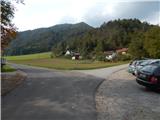
A) From Dobrove, Horjul or Gorenja vas we drive to Polhov Gradec, there from the main intersection we continue in the direction of Črni Vrh. After a short ascent we arrive at the Polhov Gradec manor, where the road leads us through the enclosure, then behind the enclosure we turn left and park at an appropriate place beside the road, where there are also hiking signposts (a smaller parking lot is also before the enclosure of the Polhov Gradec manor).
B) From Črni Vrh we descend to Polhov Gradec, there before the enclosure we turn right and park at an appropriate place beside the road.
Route description:
From the starting point we return to the main road, then we continue through the courtyard of the manor, and when we leave the courtyard, behind the wall we continue sharply right. After a few steps we continue along the wall, then on the left we notice a steep path that begins to ascend the slope. This is followed by an ascent through the forest, after a few minutes we join the path that leads from the parish church. We reach the mentioned path at the 5th station of the Way of the Cross, and on the wide path, past the remaining stations, we quickly reach the summit of Kalvarija or Stari grad.
Description and pictures refer to the condition in 2016 (October).
Photos:
 1
1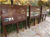 2
2 3
3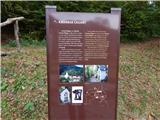 4
4 5
5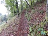 6
6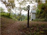 7
7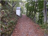 8
8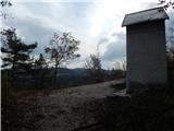 9
9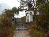 10
10 11
11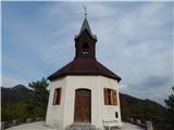 12
12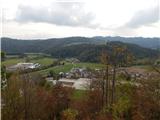 13
13
Discussion about the trip Polhov Gradec (Blagajev grad) - Kalvarija (north path)
To post a comment you must log in:
If you do not yet have a username, you must first
register.