Polhov Gradec (Blagajev grad) - Kalvarija (south path)
Starting point: Polhov Gradec (Blagajev grad) (377 m)
| Latitude/Longitude: | 46,06790°N 14,31370°E |
| |
Route name: south path
Walking time: 15 min
Difficulty: easy marked way
Elevation gain: 83 m
Elevation difference along the route: 83 m
Map: Ljubljana - okolica 1:50.000
Recommended equipment (summer):
Recommended equipment (winter):
Views: 6.495
 | 2 people like this post |
Access to starting point:
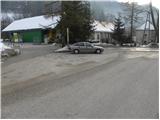
A) From Dobrova, Horjul or Gorenja vas we drive to Polhov Gradec, there from the main intersection we continue in the direction of Črni Vrh. After a short ascent, we arrive at the Polhograjska Mansion, where the road leads us through the enclosure, then behind the enclosure we turn left and park at a suitable place by the road, where there are also hiking signposts (a smaller parking lot is also before the enclosure of the Polhograjska Mansion).
B) From Črni Vrh we descend to Polhov Gradec, there before the enclosure we turn right and park at a suitable place by the road.
Route description:
At the beginning of the mansion, viewed from the direction of Polhov Gradec, we will notice on the left side a walking path, along which already after a few meters we notice an information board for Kalvarija. Here we continue slightly left and continue the ascent along the path, which enters the forest and ascends further in a few zigzags. The path soon levels out and higher up joins the path from the church. Here we continue sharply right and then continue the ascent along the wide path, along which we notice numerous stations of the Way of the Cross. We follow this path, from which a nice view of Polhov Gradec soon opens up, all the way to the panoramic summit.
Photos:
 1
1 2
2 3
3 4
4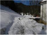 5
5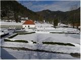 6
6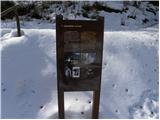 7
7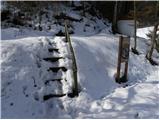 8
8 9
9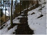 10
10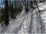 11
11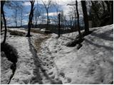 12
12 13
13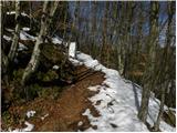 14
14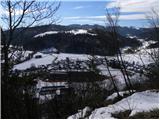 15
15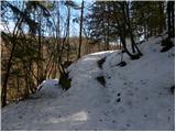 16
16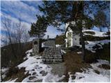 17
17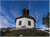 18
18
Discussion about the trip Polhov Gradec (Blagajev grad) - Kalvarija (south path)
To post a comment you must log in:
If you do not yet have a username, you must first
register.