Poljana (Završnica) - Hochstuhl/Stol (Žirovniška pot)
Starting point: Poljana (Završnica) (640 m)
| Latitude/Longitude: | 46,40720°N 14,14610°E |
| |
Route name: Žirovniška pot
Walking time: 4 h 20 min
Difficulty: easy marked way
Elevation gain: 1596 m
Elevation difference along the route: 1635 m
Map: Karavanke - osrednji del 1:50.000
Recommended equipment (summer):
Recommended equipment (winter): ice axe, crampons
Views: 28.979
 | 2 people like this post |
Access to starting point:
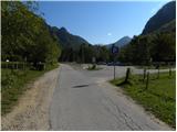
From the highway Ljubljana - Jesenice, take the Lesce exit and follow the road ahead in the direction of Žirovnica and Jesenice. After a few km of driving, we will get to a crossroad, where the road to Žirovnica and Moste branches off to the right (from the direction of Jesenice, left). Only a few meters ahead, at the next crossroad, we turn left to Moste (right Žirovnica). Further, we drive past the monument to the fallen fighters, where the road starts ascending the hill under the railway track. At the top of the hill we turn right (at the sign Vila Karin), but we continue straight towards Završniško jezero and Valvasorjev dom. The road then flattens and brings us to a crossroad, where the road to Valvasorjev dom branches off to the left. Here we continue straight towards Završnica and then after 100 m park on the well-maintained asphalt parking lot.
Route description:
From the parking lot, we return on the asphalt road to the crossroad, and from there we continue in the direction of Valvasorjev dom pod Stolom and Potoška planina. From the crossroad, for some time we walk on a scenic macadam road, and then blazes and signs for Valvasorjev dom point us to the left on a marked footpath which gently descends to the nearby stream Rečica. Over the footbridge we cross the mentioned stream and then we arrive at a larger meadow, through which we gently ascend slightly to the left. On the other side of the meadow, the path goes into the forest and turns into a relatively steep cart track, on which we ascend to an indistinct saddle between the peaks Sivo rebro and Smolnik.
From here we continue on the cart track only briefly, and then signs direct us to the right on a footpath which ascends transversely over a short rough slope. The well-maintained path then turns to the left and further ascends transversely over occasionally steeper slopes of the peak Smolnik. The quite wide path all the time higher brings us to a forest road, which we only cross. On the other side of the road we continue to the right and continue the ascent on a poorly marked path, which higher also has some unmarked shortcuts. We follow this path, which in the upper part due to numerous small paths is also somewhat more difficult orientationally, all the way to Valvasorjev dom pod Stolom.
From Valvasorjev dom we head right on the footpath in the direction of Stol. The path soon enters the forest, where it gently ascends and brings us to a smaller junction, where we continue right. The path then brings us out of the forest, where it crosses the slopes below Monštranca. We follow this gentle and partly scenic path, which somewhat further crosses a short strip of forest, to the junction on Žirovniška planina.
We continue left in the direction of »Stol - Žirovniška pot« (slightly right Stol Zabreška pot) on the path which only somewhat higher enters dense forest, where it continues for the next 10 minutes. The forest then thins out, the path passes among bushes, through which it then ascends all the way to the next strip of forest. When we step into the forest again, we will come to a pile of stacked logs and signs above them which "ask" us, if possible, to carry one with us to Prešernova koča. Somewhat further we step out of the forest, along the edge of which we then ascend more steeply. Higher the path turns somewhat to the left and crosses a short slightly exposed grassy slope. The path then levels off slightly for a short time and brings us to a pleasant rest area, from which a nice view of Gorenjska opens up.
The path ahead ascends steeply again, this time on a slope which is mostly overgrown with dwarf pines. Higher the path turns slightly to the right and brings us from the dwarf pines to grassy slopes, where we also arrive at a less noticeable junction. We continue slightly right (left Potoški Stol and Vajnež) on the still relatively steep path, which soon turns onto the ridge of Mali Stol. We follow this increasingly scenic path, which higher leads past the memorial plaque, all the way to Prešernova koča na Stolu.
From the hut we continue slightly right, where past the sign in a few steps we ascend to the summit of Mali Stol. A short descent follows and the path brings us to the saddle between both Stols, where there is also a marked junction. We continue in the direction of Stol (right Celovška koča and Zelenica) on the transverse path, which after 10 minutes of further walking brings us to the highest peak of the Karawanks.

Photos:
 1
1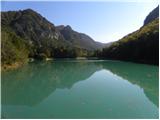 2
2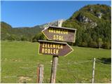 3
3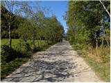 4
4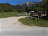 5
5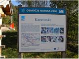 6
6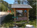 7
7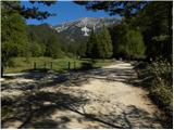 8
8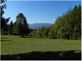 9
9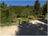 10
10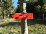 11
11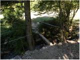 12
12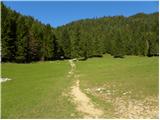 13
13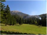 14
14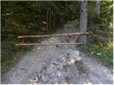 15
15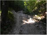 16
16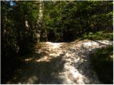 17
17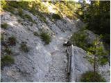 18
18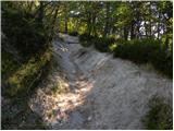 19
19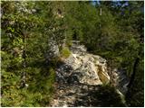 20
20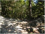 21
21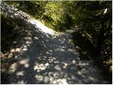 22
22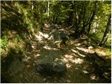 23
23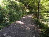 24
24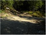 25
25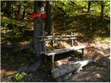 26
26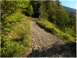 27
27 28
28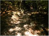 29
29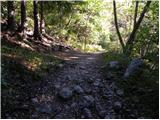 30
30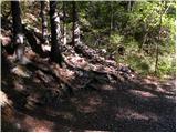 31
31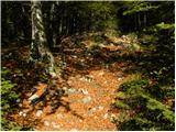 32
32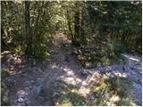 33
33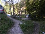 34
34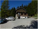 35
35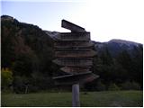 36
36 37
37 38
38 39
39 40
40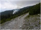 41
41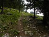 42
42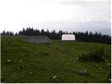 43
43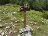 44
44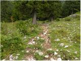 45
45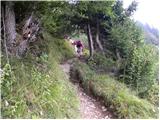 46
46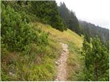 47
47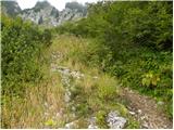 48
48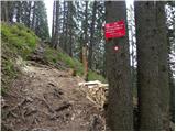 49
49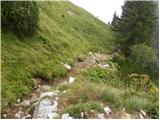 50
50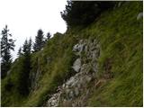 51
51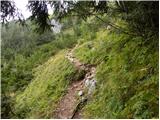 52
52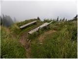 53
53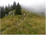 54
54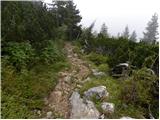 55
55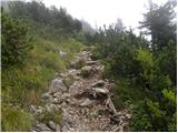 56
56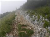 57
57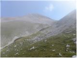 58
58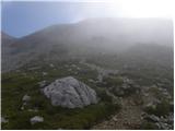 59
59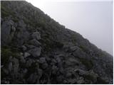 60
60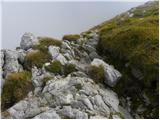 61
61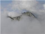 62
62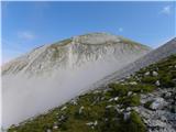 63
63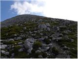 64
64 65
65 66
66 67
67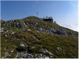 68
68 69
69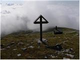 70
70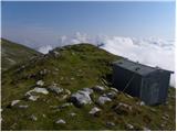 71
71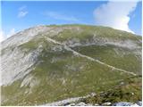 72
72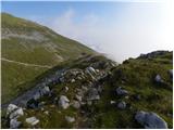 73
73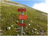 74
74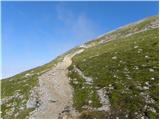 75
75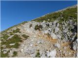 76
76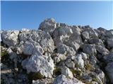 77
77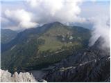 78
78
Discussion about the trip Poljana (Završnica) - Hochstuhl/Stol (Žirovniška pot)
|
| Sim7913. 08. 2012 |
Very nice description of the trail. Today I ascended Stol via this path, descended via Zabreška. It was my first time on Stol and I think it's fantastic  . The weather was excellent. It's good to have a lot of stamina – otherwise the path can drag on a lot . The weather was excellent. It's good to have a lot of stamina – otherwise the path can drag on a lot  . I took 3 h 50 min including all breaks, and due to fatigue I didn't have a very fast pace. . I took 3 h 50 min including all breaks, and due to fatigue I didn't have a very fast pace.
|
|
|
|
| robi210731. 12. 2016 |
The comment on picture 36 is wrong. Of course we don't continue towards Belščice if heading to Stol, but turn across the meadow as the signpost shows. Moderator, it makes sense to correct the wrong comment so no one gets wrong information.
|
|
|
|
| Jusk26. 09. 2019 |
Quite a long and steep path, but with good spirits and good fitness no problem the view occasionally interrupted by clouds, but still nice. I was alone at the top. Return to planina Stamare and on to Završnica. the view occasionally interrupted by clouds, but still nice. I was alone at the top. Return to planina Stamare and on to Završnica.
|
|
|
|
| Rozlje22. 08. 2021 12:37:12 |
This part of the description is wrong because they moved the road:
The road then levels out and brings us to a junction where the road to Valvasorjev dom branches left. Here we continue straight towards Završnica and then after 100 m we park
Now the gravel road to Valvasorjev dom starts right BEHIND the parking lot, which even Google Maps doesn't know yet
|
|
|
|
| Enka9. 07. 2022 19:59:38 |
It's true, I got a bit lost today  . It would make sense to correct the description. In short, the trail to Stol starts opposite the exit from the asphalt parking lot, first along the (newly asphalted) road towards Valvasorjev dom, from which signs soon invite us left to the area of the bull on pasture . It would make sense to correct the description. In short, the trail to Stol starts opposite the exit from the asphalt parking lot, first along the (newly asphalted) road towards Valvasorjev dom, from which signs soon invite us left to the area of the bull on pasture
|
|
|
|
| Toni-k10. 07. 2022 12:26:45 |
Up to where is it newly asphalted?
Up to Valvazorja?
|
|
|
|
| lubadar10. 07. 2022 17:48:49 |
I don't know if there's 500 m of new asphalt, the rest of the road is quite ribbed, today's experience. The ramp for road closure is already in readiness.
|
|
|
|
| Enka10. 07. 2022 17:56:13 |
Asphalt is only at the beginning, I wrote a bit clumsily.
|
|
|
To post a comment you must log in:
If you do not yet have a username, you must first
register.