Starting point: Polje (523 m)
| Latitude/Longitude: | 46,26950°N 13,91280°E |
| |
Walking time: 3 h 45 min
Difficulty: easy marked way
Elevation gain: 1321 m
Elevation difference along the route: 1335 m
Map: Škofjeloško in Cerkljansko hribovje 1:50.000
Recommended equipment (summer):
Recommended equipment (winter): ice axe, crampons
Views: 11.606
 | 1 person like this post |
Access to starting point:
From the Ljubljana-Jesenice highway we take the Lesce exit, then continue driving towards Bled and Bohinjska Bistrica. From Bohinjska Bistrica we continue on the main road towards Lake Bohinj, but after the village of Kamnje we pay attention, because on the right side, only a few meters before the beginning of the village Polje, we park on the parking lot by the Sava Bohinjka river.
Route description:
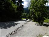
From the parking lot first carefully cross the road, then for a short time continue along the main road towards Polje. When we arrive in Polje, continue left onto the local road, along which we quickly walk to a smaller intersection, where we notice the first mountain signposts for Orožnova koča mountain hut, Planina Osredki mountain pasture and Črna prst. Continue in the mentioned direction and further walk along a narrower asphalt road, which in a gentle ascent leads us to the next intersection, where we continue along the lower right road (left Bohinjska Bistrica). The path further leads us to the beginning of the village Žlan and somewhat further to the center of the mentioned village. Above the village the asphalt ends and the macadam road leads us to a sort of turning area and a water trough (we can also reach here by car, which shortens the path by approximately 20 minutes).
From the trough continue left, where first cross the nearby stream over a small bridge, then start moderately ascending along the edge of the expansive pasture. A little higher cross the pasture fence, so moving to the inner side of the pasture. Further ascend across the expansive pasture, where the path mostly leads through very sparse forest. Higher leave the pasture, and the path transitions into dense forest. Further cross the erosion-very damaged cart track, then for a short time ascend along the smaller torrent stream. The path ahead rises to a poor forest road, along which we continue the ascent for some time. When we arrive at the intersection, where we join the wider macadam road (road leading from Raven to Planina Storeča raven), follow it left and even descend slightly along it (when reaching the road do not continue straight onto the ascending cart track, which the mountain signpost partly misleadingly indicates). After a short descent, a marked cart track branches off to the right.
Continue along the slightly overgrown cart track, which after a few minutes of further walking brings us to a marked junction.
Continue straight (left Črna prst past Orožnova koča and Planina za Liscem) along the cart track, which higher brings us to a small valley, up which we ascend to the next forest road. When stepping onto the road, continue a few steps left, then the mountain sign for Črna prst directs us right into the forest, where it starts steeply ascending. The path somewhat higher crosses an overgrown clearing (ferns and raspberry bushes) and then returns to the forest, continuing all the way to Planina Osredki.
From the mountain pasture where there are two smaller wooden huts (one renovated into a bivouac), continue along the left side of the watering hole, along the poorly visible path that starts moderately ascending among bushes and individual trees. The still poorly visible but well-marked path further brings us higher to a somewhat larger meadow, along whose edge we notice the next watering hole. The path then ascends ever more steeply and slowly turns to the left. At the top of the ascent step onto a smaller saddle, behind which the path turns right and ascends transversely. Followed by a few more minutes of ascent along the slope overgrown with dwarf pines, and the path brings us to the main ridge of the Spodnje Bohinjske gore.
Continue left (right Rodica) and follow the relatively even path running along the panoramic ridge to Črna prst, which we reach after 10 minutes of further walking.

Photos:
 1
1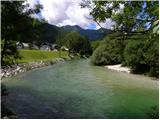 2
2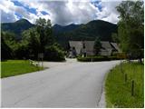 3
3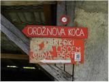 4
4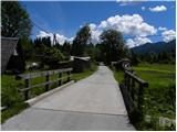 5
5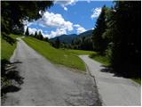 6
6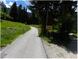 7
7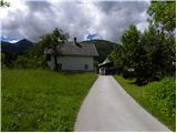 8
8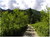 9
9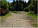 10
10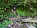 11
11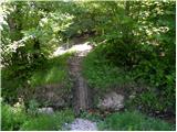 12
12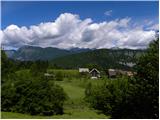 13
13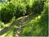 14
14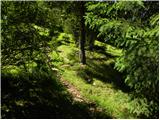 15
15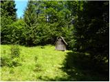 16
16 17
17 18
18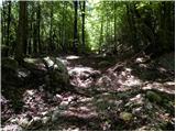 19
19 20
20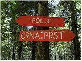 21
21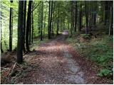 22
22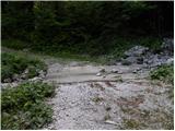 23
23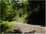 24
24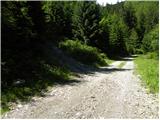 25
25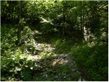 26
26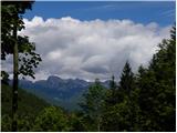 27
27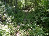 28
28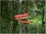 29
29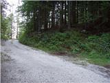 30
30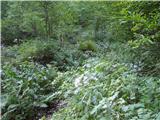 31
31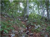 32
32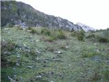 33
33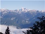 34
34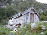 35
35 36
36 37
37 38
38 39
39 40
40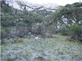 41
41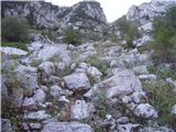 42
42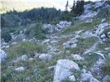 43
43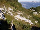 44
44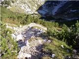 45
45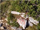 46
46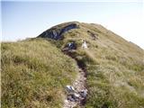 47
47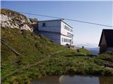 48
48 49
49
Discussion about the trip Polje - Črna prst
|
| Gost16. 08. 2012 |
I hiked this trail yesterday. I'd like to warn about picture 24. There, a barely visible overgrown path turns left. I, like my predecessors, went straight on the cart track (the signpost is indeed turned awkwardly). You can see that the path along the cart track and further on is quite well trodden, but it soon ends uphill afterwards. Someone has set up some cairns but they don't help much.
From there on, there are no major zigzags, the path is overgrown but well visible. From Črna prst I went to Rodica and then via Suha planina to the valley. Just before Bohinj, a forest road branches off that takes you back to the starting point along the slope.
|
|
|
|
| main16. 08. 2012 |
From picture 24 onwards to the road, it's practically unmarked. We went on this path last month. Despite the map and Garmin, after half an hour we barely found the upper road. The path was also poorly trodden, so we were looking for broken twigs and moved stones along the way. The path is poorly traceable, in places completely overgrown with young trees and full of leaves. We returned on this path from Rodica via Suha back to the upper road below Črna prst. Be careful, especially if night is approaching. LP
|
|
|
|
| smatjaz25. 06. 2013 |
main, you're pretty good, my son and I missed it already at picture no. 10 !!! Because everything is so messed up due to timber hauling to the valley, it looks like all paths are right !!! The marking section could try harder in the lower part. Luck that we entered the path into GPS and found it after crossing the forest off the path. Higher up the path is well marked, the problem is only through the forest, where GPS occasionally fails too (that's why we didn't enter the track). Otherwise a fantastic trip especially if extended to Rodica, where bad weather unfortunately caught us and we descended to Ribčev laz, otherwise we would have climbed to Vogel and descended with the gondola cable car. 
|
|
|
|
| smatjaz25. 06. 2013 |
Yes, yes, yes at picture 24 already the second time!!!
|
|
|
|
| iUnknown29. 08. 2015 |
Maybe someone knows if there's a parking meter at the parking lot by Bohinjka (the first one mentioned) or how to park there so Bohinj locals don't charge a fine?
And how is it at the turning area above the village Žlan?
|
|
|
|
| istrumel29. 08. 2015 |
That parking lot is not paid. To be sure go to Bohinj.si and click on Bohinj guest card, where paid parking lots are nicely marked. Have you considered the path from Mencingerjeva koča past Orožnova and back via the alpine pasture behind Črna gora, it's much nicer and more interesting path (parking free).
|
|
|
|
| iUnknown29. 08. 2015 |
Thanks for the info. I would intentionally like this path in the village Polje, because I plan to do a circular route namely from Polje to Črna prst, then along the ridge to Suha planina and then directly down from Suha planina to Polje.
Last time I did a similar route I left the car in Ribčev laz by the lake. But then I was returning from Komna and it was more convenient there.
|
|
|
|
| istrumel30. 08. 2015 |
Long tour. I'm not familiar with the path from Suha to Polje even though I've been spending my 10-year annual vacation in these parts.
|
|
|
|
| iUnknown30. 08. 2015 |
According to the PZS Julijske Alpe map, I haven't been there myself, the path is drawn from the road that goes from the parking lot for Suha Planina near Javorje to Laski Rovt / Ribcev Laz. When you reach Repnicev graben along the road, there is a path drawn to the right to Laski Rovt and Polje.
According to the map on hribi.net, this path also starts at the sharp bend of the same road, where the aforementioned road is most easterly, and connects there to the path coming from Planina Poljana.
Among other things, that's why these paths are not drawn on openstreetmap.org. That's why I hike them to get a GPX trace and then draw them on the map.
|
|
|
|
| istrumel30. 08. 2015 |
Nice. From Laški Rovt I have already gone to Rodica and I know it. I know there are many paths that can be hiked and are not marked, but I prefer to stick to marked paths. But it will be welcome if there is a new map with new paths since in ten years I have already hiked almost everything and something new is always welcome. Happy trails.
|
|
|
|
| marepn95518. 10. 2022 20:15:00 |
Yesterday morning at 5:00 I parked at the ski jumps above the village of Polje "illegally", when I returned the car was luckily o.k. (the parking lot before the village by the new bridge only allows parking for two hours). Then I headed through the village of Žlan and at the end of the village left into the forest and managed to find the markings (through the village I saw only one marking, at the end of the village I luckily chose left). Continued across the Osredki pasture, where there is a pleasant bivouac (the path is nicer to me - more open than the path past Oražnova koča), and then to the ridge, where there is a junction left Črna prst 15 min, right Rodica and Vogel. On the ridge the sun warmed me and I changed into shorts, enjoyed a snack and wonderful views. Continued over Rodica to Šija and then descent to Viharnik for strudel and radler. Continued in the direction of Bellvi and Ribčev laz. Then another approx. 3 km along the road to the ski jumps and the loop was completed. Some statistics: total path duration with stops 10 hours 10 min, 31 km 1940 m elevation gain. Wonderful day, wonderful views, simply a day of superlatives, in the end tired but satisfied with the completed path.
|
|
|
To post a comment you must log in:
If you do not yet have a username, you must first
register.