Polje - Črna prst (via Orožnova koča)
Starting point: Polje (523 m)
| Latitude/Longitude: | 46,27010°N 13,91286°E |
| |
Route name: via Orožnova koča
Walking time: 4 h
Difficulty: easy marked way
Elevation gain: 1321 m
Elevation difference along the route: 1345 m
Map: Škofjeloško in Cerkljansko hribovje 1:50.000
Recommended equipment (summer):
Recommended equipment (winter): ice axe, crampons
Views: 7.530
 | 1 person like this post |
Access to starting point:
From the highway Ljubljana-Jesenice, take the Lesce exit, then continue driving towards Bled and Bohinjska Bistrica. From Bohinjska Bistrica, continue on the main road towards Lake Bohinj, and after the village Kamnje pay attention, because on the right side, only a few meters before the beginning of the village Polje, we will park on the parking lot by the river Sava Bohinjka.
Route description:
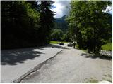
From the parking lot, first carefully cross the road, then for a short time continue along the main road towards Polje. When we arrive in Polje, continue left onto the local road, along which we quickly walk to a smaller crossroads, where we notice the first mountain signposts for Orožnova koča, Planina Osredki and Črna prst. Continue in the mentioned direction and further walk on a narrower asphalt road, which in a gentle ascent brings us to the next crossroads, where we continue on the lower right road (left Bohinjska Bistrica). The path ahead brings us to the beginning of the village Žlan and a little further to the center of the mentioned village. Above the village, the asphalt ends and the macadam road brings us to a sort of turning area and a trough with water (we can also reach here by car, which shortens the path by approximately 20 minutes).
From the trough, continue left, where first over a smaller bridge we cross the nearby stream, then we begin to ascend moderately along the edge of the expansive pasture. A little higher, we cross the pasture fence, so we move to the inner side of the pasture. Further, we ascend across the expansive pasture, and the path mostly leads through a very sparse forest. Higher, we leave the pasture, and the path transitions into dense forest. Further, we cross an erosion-damaged cart track, then for a short time ascend along a smaller torrent stream. The path ahead ascends to a poor forest road, along which we continue the ascent for some time. When we reach the crossroads where we join the wider macadam road (road leading from Ravne towards Planina Storeča raven), we follow it left and even descend a little along it (when we reach the road, we do not continue straight onto the ascending cart track, which the mountain signpost partly misleadingly indicates). After a short descent, a marked cart track branches off to the right.
Continue on the slightly overgrown cart track, which after a few minutes of further walking brings us to a marked junction.
Continue left in the direction of Orožnova koča and Planina za Liscem (slightly right Planina Osredki) on the path that continues through the forest. Several successive junctions follow, where we carefully follow the occasionally rare blazes. Higher, we reach the forest road, follow it a few steps to the left, then continue on the ascending path towards Črna prst. The path ahead ascends more steeply for a short time, then levels out and crosses the slopes to the left. After a short crossing, it joins the cart track or timber slide. Here we join the path from Bohinjska Bistrica (also the path from the starting point Ravne and Dom dr. Janeza Mencingerja), and we continue along the timber slide to the point where it changes into a gentler footpath. Higher, the trail begins to ascend more steeply again, then joins the steep path from Dom dr. Janeza Mencingerja. Here, continue straight and after 2 minutes of further walking arrive at Orožnova koča, from which a nice view opens onto Črna prst and Triglav.
From Orožnova koča, continue on the marked path towards Črna prst. The path goes immediately behind the hut into the forest, through which it begins to ascend more steeply. Higher, the trail turns slightly to the right and brings us from the forest into a belt of bushes. A little higher, the belt of bushes ends, and from the right an old path joins almost imperceptibly (via the old path we can descend back to Orožnova koča). Further, the increasingly scenic path gradually brings us below the walls of Črna prst, where it leads into a smaller gully. We ascend the gully, which leads along the edge of the wall. After a short ascent in the gully, the path turns left and transitions to somewhat steeper slopes. A traversing ascent to the left follows, where just below the saddle Čez Suho the path from Planina za Črno goro joins.
From the point where the mentioned path joins, we ascend in a few steps to the aforementioned saddle, where the next junction is.
Here, continue right and with views of Baška grapa, Bohinj and the highest peaks of the Julian Alps, in a few minutes ascend to Dom na Črni prsti, located only a few meters below the summit.
Bypass Dom Zorka Jelinčiča on the left side and over a short steep slope in a few steps ascend to the panoramic summit.

Photos:
 1
1 2
2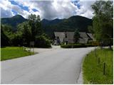 3
3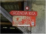 4
4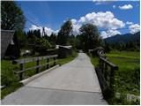 5
5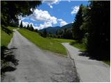 6
6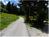 7
7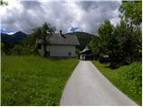 8
8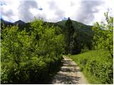 9
9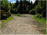 10
10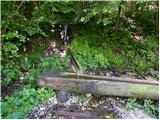 11
11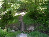 12
12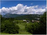 13
13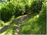 14
14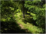 15
15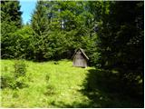 16
16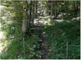 17
17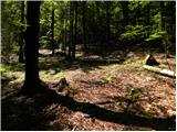 18
18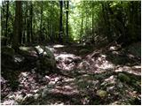 19
19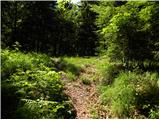 20
20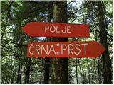 21
21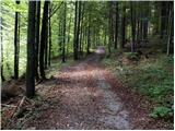 22
22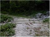 23
23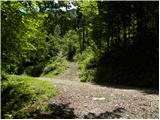 24
24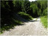 25
25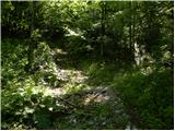 26
26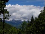 27
27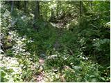 28
28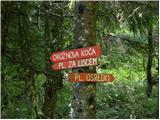 29
29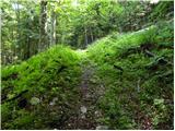 30
30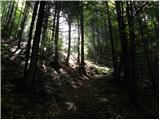 31
31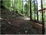 32
32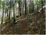 33
33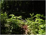 34
34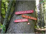 35
35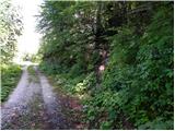 36
36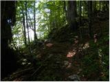 37
37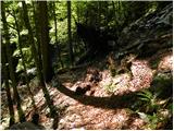 38
38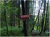 39
39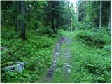 40
40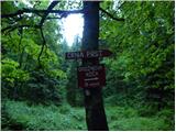 41
41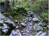 42
42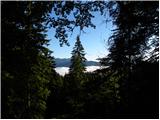 43
43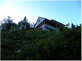 44
44 45
45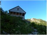 46
46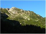 47
47 48
48 49
49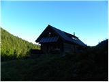 50
50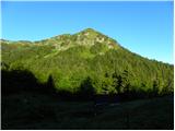 51
51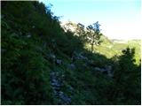 52
52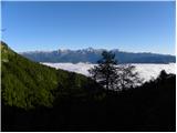 53
53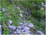 54
54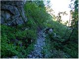 55
55 56
56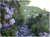 57
57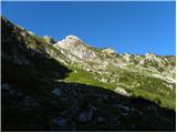 58
58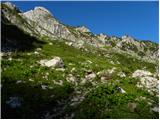 59
59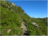 60
60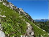 61
61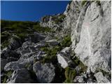 62
62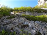 63
63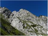 64
64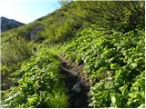 65
65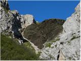 66
66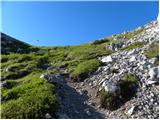 67
67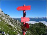 68
68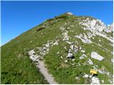 69
69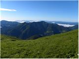 70
70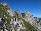 71
71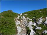 72
72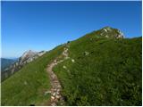 73
73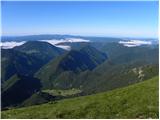 74
74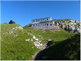 75
75 76
76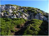 77
77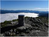 78
78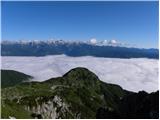 79
79
Discussion about the trip Polje - Črna prst (via Orožnova koča)
|
| jezičnik13. 08. 2012 |
For those considering visiting Črna prst via this path, I'll note some warnings so you won't have the same problems as my wife and I did.
After about an hour you reach the junction mentioned in this text part:
When we reach the junction where we join the wider macadam road (road from Raven to planina Storeča raven) we follow it left and even descend a bit on it (when reaching the road we don't continue straight to the ascending track, which the mountain signpost partially misleadingly points to). After a short descent, a marked track branches off to the right.
The description is wrong, as you need to continue straight to the ascending track (sign Črna prst), which we follow for only about 20 meters. Then there's a mark on the rock directing us left to a narrow path into the forest. We walk mostly flat for a while, then marks direct us right again to a fairly steep track, from where we reach the sign for Orožnova koča.
My wife and I followed the instructions and since there was no marked track to follow after the short descent, we walked a long time in one direction, also searching our location on the phone, wasting more than an hour. Consequently, night caught us and it was quite hard to walk in the dark forest over all the roots and rocks.
When higher up we reach the next macadam road, the description is again very misleading. It says:
Higher we reach the forest road, follow it a few steps left, then continue on the ascending path towards Črna prst.
Of course it was even more problematic for us because nothing was visible, but the important info is that those few steps mean about 300 m by feel.
In short, if whoever maintains these descriptions reads this, I'd ask them to ensure an accurate description, and I'd also appreciate more precise data, because "some time", "a few steps" etc. can be quite misleading.
Otherwise, the path is very beautiful, at least in my opinion much nicer than the one that doesn't go past Orožnova koča.
|
|
|
To post a comment you must log in:
If you do not yet have a username, you must first
register.