Ponte de Ru Curto - La Rocchetta
Starting point: Ponte de Ru Curto (1695 m)
| Latitude/Longitude: | 46,50595°N 12,07937°E |
| |
Walking time: 3 h 20 min
Difficulty: easy pathless terrain
Elevation gain: 801 m
Elevation difference along the route: 850 m
Map: Tabacco 03 1:25.000
Recommended equipment (summer): helmet
Recommended equipment (winter): helmet, ice axe, crampons
Views: 1.982
 | 3 people like this post |
Access to starting point:
Access from Gorenjska: Through the border crossing Rateče or Predel to Trbiž / Tarvisio and then on the highway in the direction of Videm / Udine to the Tolmezzo exit. From Tolmezzo we follow the road in the direction of the village Ampezzo and mountain pass Passo della Mauria. The road then descends and brings us to a crossroad, where we continue left (also right possible) in the direction of Cortina d'Ampezzo. At all next crossroads we follow the signs for Cortina d'Ampezzo.
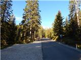
In Cortina d'Ampezzo we then follow the signs for the alpine pass Passo di Falzarego. We follow this ascending road to a crossroad at an altitude of approximately 1400m. At the crossroad we continue left in the direction of the alpine pass Passo di Giau and Marmolada. From the mentioned crossroad we continue driving another 4km, then a few hundred meters before the bridge Ponte de Ru Curto we park on the parking lot on the left side of the road.
From the Primorska side: We drive on the highway towards Venice / Venezia. At the town Portogruaro we leave the highway towards Venice and continue right on the highway towards Pordenone. At the next highway junction near Conegliano we continue right towards Belluno. Near Belluno the highway ends, and we at the next crossroads continue in the direction of Cortina d'Ampezzo. Further we follow the above description.
Route description:
From the parking lot we head left onto the footpath following the signs »Rif. Croda da Lago«. The footpath first slightly descends and crosses the stream Rio Costeana. The path then turns left and mostly in a gentle ascent crosses the slopes towards the east. The path here runs through the forest, despite this occasionally a nice view opens towards the Tofane. The path then turns slightly right and crosses another stream, then it begins to ascend somewhat more steeply through the forest. The path then brings us to a marked junction.
From the left the path from the bridge Pezie de Paru joins us, right leads the path through the valley Val Formin, we continue straight following the signs »Rifugio Croda da Lago«. From the junction the path continues ascending through the forest and then turns slightly left, bringing us under the eastern slopes of the peak Ciadenes. Views towards the east also begin to open from the path, where mountain groups Cristallo, Sorapiss and Antelao stand out. The path then becomes flatter and crosses a pasture fence. Further we walk in the valley named Val Negra and occasionally descend slightly. Such a path then brings us to the lake Lago Federa. At the lake from the left also joins the path from the hut Rifugio Lago de Aial and to the hut Rifugio Croda da Lago only some easy walking along the lake follows.
From the hut we continue on path 434 towards the saddle Forcella Ambrizola. The wide and relatively flat path here runs towards the south under the slopes of the peak Croda da Lago. Soon the last trees disappear and from the path we have a wonderful view on the mountain groups east of Cortina d'Ampezzo and on the nearby Croda da Lago and Becco di Mezzodi. The panoramic path continues gently ascending all the way to the saddle Forcella Ambrizola, which is located on the northwestern side of the peak Becco di Mezzodi.
On the saddle where there is a marked junction we continue left towards the place San Vito di Cadore, right leads the path towards the saddle Forcella Rossa and pass Passo Giau. The path from the saddle then crosses slopes under the peak Becco di Mezzodi and a view towards the peak Monte Pelmo also begins to open. The path then begins to descend slightly and soon brings us to the saddle Forcella Col Duro where we cross the fence.
Here we leave the marked path and head left upwards onto pathless terrain. We ascend the scree towards the southern ridge of the peak Becco di Mezzodi. During the ascent cairns will assist us, when we approach the ridge of the mentioned peak we will notice also a somewhat less trodden path. The path then from the southern slopes leads towards the saddle on the eastern side of the peak. The slope towards the saddle becomes quite steep, but in dry conditions does not cause major problems.
When we reach the saddle we continue right on the easy ridge towards the summit La Rocchetta. Here we walk all the time on a very panoramic ridge towards the southeast. On the ridge we first reach the forepeak from which we continue on the ridge. The summit on which a small cross also stands we already see in front of us. To the summit then only a short easy ascent follows.

Along the route: Cason di Formin (1845m), Lago Federa (2038m),
Rifugio Croda da Lago (2046m), Forcella Ambrizola (2277m), Forcella Col Duro (2293m)
Photos:
 1
1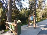 2
2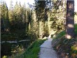 3
3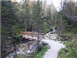 4
4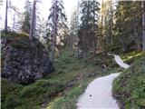 5
5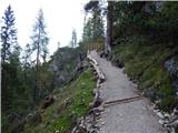 6
6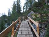 7
7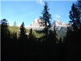 8
8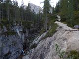 9
9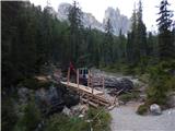 10
10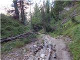 11
11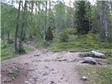 12
12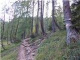 13
13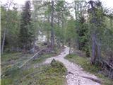 14
14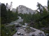 15
15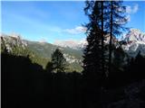 16
16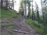 17
17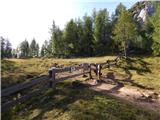 18
18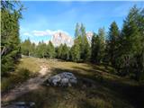 19
19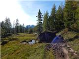 20
20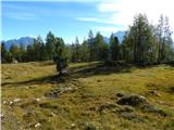 21
21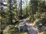 22
22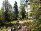 23
23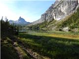 24
24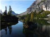 25
25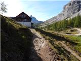 26
26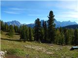 27
27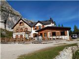 28
28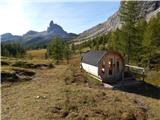 29
29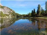 30
30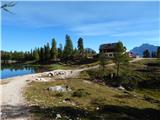 31
31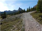 32
32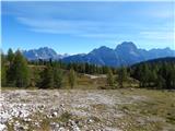 33
33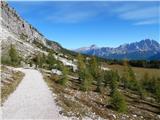 34
34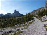 35
35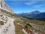 36
36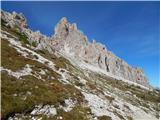 37
37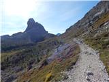 38
38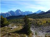 39
39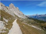 40
40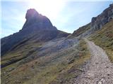 41
41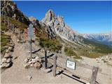 42
42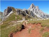 43
43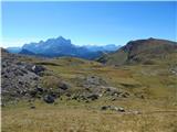 44
44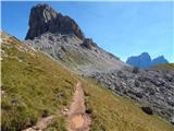 45
45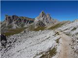 46
46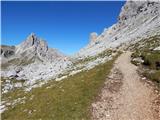 47
47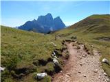 48
48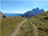 49
49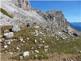 50
50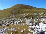 51
51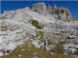 52
52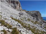 53
53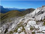 54
54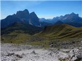 55
55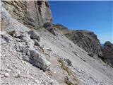 56
56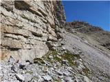 57
57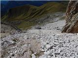 58
58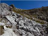 59
59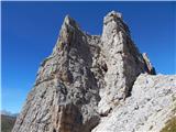 60
60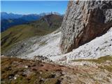 61
61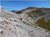 62
62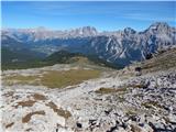 63
63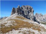 64
64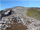 65
65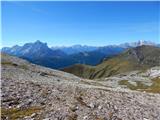 66
66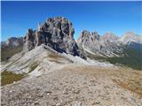 67
67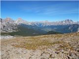 68
68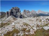 69
69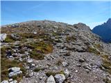 70
70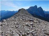 71
71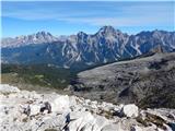 72
72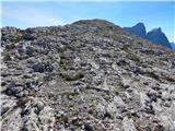 73
73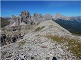 74
74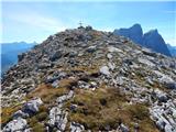 75
75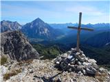 76
76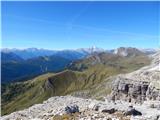 77
77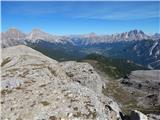 78
78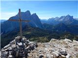 79
79
Discussion about the trip Ponte de Ru Curto - La Rocchetta
To post a comment you must log in:
If you do not yet have a username, you must first
register.