Ponte de Ru Curto - Rifugio Cinque Torri
Starting point: Ponte de Ru Curto (1695 m)
| Latitude/Longitude: | 46,50595°N 12,07937°E |
| |
Walking time: 1 h 15 min
Difficulty: easy marked way
Elevation gain: 442 m
Elevation difference along the route: 442 m
Map: Tabacco 03 1:25.000
Recommended equipment (summer):
Recommended equipment (winter): ice axe, crampons
Views: 3.060
 | 2 people like this post |
Access to starting point:
Access from Gorenjska: Via border crossings Rateče or Predel to Trbiž / Tarvisio and then on the highway in the direction of Vidma / Udine to the exit Tolmezzo. From Tolmezzo we follow the road in the direction of the settlement Ampezzo and mountain pass Passo della Mauria. The road then descends and brings us to a crossroads, where we continue left (also possible right) in the direction of Cortina d'Ampezzo. At all next crossroads, we follow the signs for Cortina d'Ampezzo.
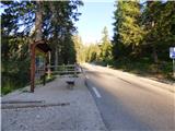
In Cortina d'Ampezzo we then follow the signs for the alpine pass Passo di Falzarego. We follow this ascending road to a crossroads at an altitude of approximately 1400m. At the crossroads we continue left in the direction of the alpine pass Passo di Giau and Marmolada. From the mentioned crossroads we continue driving another 4km, then a few hundred meters before the bridge Ponte de Ru Curto we park on the parking lot on the left side of the road. By the parking lot there are also signposts and information boards.
From Primorska: We drive on the highway towards Venice / Venezia. At the town Portogruaro we leave the highway towards Venice and continue right on the highway towards Pordenone. At the next highway junction near Conegliano we continue right towards Belluno. Near Belluno the highway ends and at the next crossroads we continue in the direction of Cortina d'Ampezzo. Further we follow the above description.
Route description:
From the mentioned parking lot we continue a few tens of meters on the main road in the direction towards the pass Passo Giau, then on the right side of the road we will notice signposts that direct us right onto path 437 towards the hut Rifugio Cinque Torri.
The path ascends from the road across a meadow and initially turns slightly to the left, then more decisively right upwards and brings us into the forest. Further on we ascend through the forest for quite some time, and a few times the path also leads us through shorter clearings. Occasionally a view opens up towards the south where Croda da Lago and Monte Formin are visible. Higher the path turns slightly to the left and along the path we will notice a smaller waterfall. The forest further becomes sparser and a view opens up also towards the summit Ra Gusela and the towers Cinque Torri. Further we ascend across meadows surrounded by forest and slightly higher a view also starts opening towards the north where Tofana di Rozes is clearly visible. The path then leads us past a smaller weekend hut and brings us to a cart track.
We continue along the cart track where path 439 from Cian Zope soon joins from the right. Further we continue ascending along the nicely maintained cart track from which even nicer views of the surrounding peaks start to open up. Higher we join the asphalt road from where a view already opens towards the hut Rifugio Cinque Torri. We continue left along the road and only a short ascent to the mentioned hut follows.

Photos:
 1
1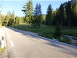 2
2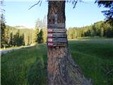 3
3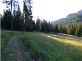 4
4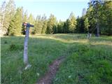 5
5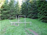 6
6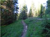 7
7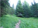 8
8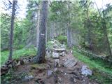 9
9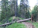 10
10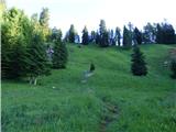 11
11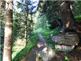 12
12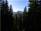 13
13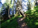 14
14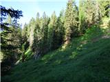 15
15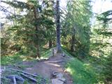 16
16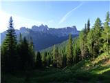 17
17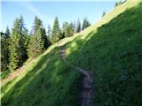 18
18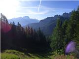 19
19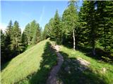 20
20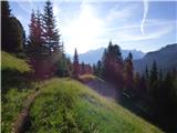 21
21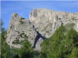 22
22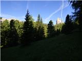 23
23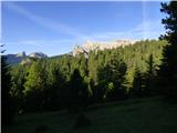 24
24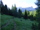 25
25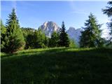 26
26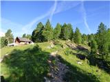 27
27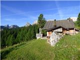 28
28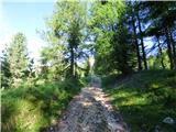 29
29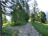 30
30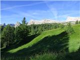 31
31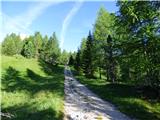 32
32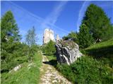 33
33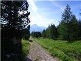 34
34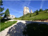 35
35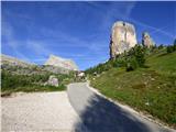 36
36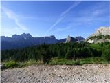 37
37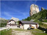 38
38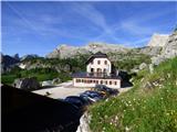 39
39
Discussion about the trip Ponte de Ru Curto - Rifugio Cinque Torri
To post a comment you must log in:
If you do not yet have a username, you must first
register.