Povlje - Grebenc (by cart track)
Starting point: Povlje (710 m)
| Latitude/Longitude: | 46,32960°N 14,37680°E |
| |
Route name: by cart track
Walking time: 2 h 5 min
Difficulty: easy unmarked way
Elevation gain: 769 m
Elevation difference along the route: 775 m
Map: Karavanke - osrednji del 1:50.000
Recommended equipment (summer):
Recommended equipment (winter): ice axe, crampons
Views: 1.402
 | 1 person like this post |
Access to starting point:
a) From the Ljubljana-Jesenice motorway take the Brnik exit, then upon reaching the Mengeš-Kranj road continue left towards Kranj. Drive along the main road towards Kranj to the first roundabout, from where take the first right exit towards Šenčur. Continue through Šenčur on the main road, then upon reaching the Kranj-Zgornje Jezersko road continue right towards Jezersko. When arriving in Preddvor leave the main road and continue left towards the centre of the mentioned place, from there follow the signs for Bašelj settlement. Somewhat after Bašelj settlement the road descends to the Milka stream and crosses it over a bridge. Here first a road branches right to Babni Vrt village, good 100 m further also to Povlje village. Continue on the ascending road towards Povlje, park at a small parking lot above the village. At the starting point there is a small junction, several mountaineering direction signs and a large information board of the Trstenik walking-educational trail "path under Storžič".
b) From the Jesenice-Ljubljana motorway take the Kranj west exit, then continue driving towards Golnik. When arriving in Tenetiše leave the main road towards Golnik and continue right towards Trstenik. Approximately 1 km after Trstenik settlement arrive at a small junction, where continue left towards Povlje village. Continue on the ascending road towards Povlje, park at a small parking lot above the village. At the starting point there is a small junction, several mountaineering direction signs and a large information board of the Trstenik walking-educational trail "path under Storžič".
Route description:
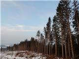
From the starting point continue on the asphalt road, which at the marked junction turns right. When after a few metres the spruce forest ends on the left, we will notice just a few steps further the beginning of the cart track, which starts ascending the initially gentle slope. The cart track leading us along the slope affected by severe ice storm in 2014 has a few smaller junctions higher up, but we continue straight or slightly right at all of them. Higher up we reach the marked path Povlje - planina Javornik, which we follow only briefly, then at the first cart track junction continue right (even if continuing straight, we rejoin the cart track higher up via the marked path). The cart track then turns left and ascends more steeply across the initially scenic slope, from which a nice view opens to Tolsti vrh. A bit further, where the view towards Storžič opens, the cart track turns even more left and then ascends transversely. During the traverse we cross the marked path Povlje - planina Javornik, but continue straight towards Velika Poljana.
In continuation we ascend transversely for some time, then first the Dolenčeva path from Povlje village joins from the left, one or two minutes further at the right bend also the path from Gorič, Zaloga and another path from Povlje.
Continue on the cart track, which briefly runs along an indistinct ridge, leading past the "second refreshment point". A little further a marked path branches off the cart track, but we continue on the well-visible cart track through the forest for a few more minutes, then after crossing a pasture fence for a few more minutes along the somewhat more scenic grassy slope of Velika Poljana. When we step out of the forest we already see the Koča na Veliki Poljani hut in front of us, just a few minutes of ascent away.
From the shepherd hut continue transversely left (straight to Dom pod Storžičem, Mala Poljana and Storžič, sharply right to planina Javornik), reaching Koča na Grebencu in less than 5 minutes, from where a nice view opens further to the west to southwest.
Behind the hut a poorer path branches somewhat right, crossing the fence and leading further towards the summit of Grebenc. The path ahead is not well trodden, but relatively easy to follow as it mostly runs along or beside the scenic ridge. Higher up the path crosses a few forest belts, always sticking to the main ridge, avoiding difficult spots mostly on the right side. During the ascent the path steepens considerably a few times, occasionally traversing potentially slippery exposed slopes, but in dry conditions it poses no major danger as we can always detour right into the forest from difficult sections and rejoin the ridge. After approx. 15 minutes ascent from Koča na Grebencu we reach the fairly panoramic summit.
Starting point - first refreshment point 0:45, first - second refreshment point 0:30, second refreshment point - Koča na Veliki Poljani 0:30, Koča na Veliki Poljani - Grebenc 0:20.
Description and photos refer to the conditions in 2015 (January).

Along the route: Prva okrepčevalnica (998m), Druga okrepčevalnica (1198m),
Velika Poljana (1385m), Koča na Grebencu (1401m)
Photos:
 1
1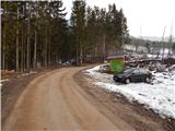 2
2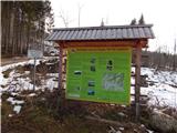 3
3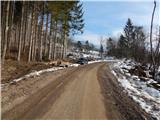 4
4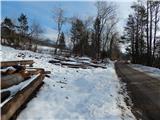 5
5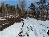 6
6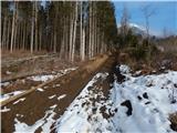 7
7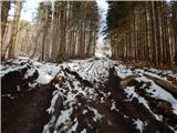 8
8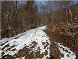 9
9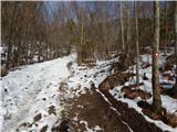 10
10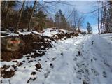 11
11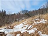 12
12 13
13 14
14 15
15 16
16 17
17 18
18 19
19 20
20 21
21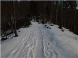 22
22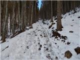 23
23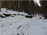 24
24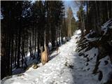 25
25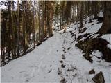 26
26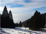 27
27 28
28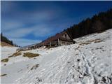 29
29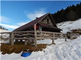 30
30 31
31 32
32 33
33 34
34 35
35 36
36 37
37 38
38 39
39 40
40 41
41 42
42 43
43 44
44 45
45 46
46 47
47 48
48 49
49 50
50 51
51 52
52
Discussion about the trip Povlje - Grebenc (by cart track)
To post a comment you must log in:
If you do not yet have a username, you must first
register.