Povlje - Velika Poljana (via Javornik)
Starting point: Povlje (710 m)
| Latitude/Longitude: | 46,32960°N 14,37680°E |
| |
Route name: via Javornik
Walking time: 2 h 30 min
Difficulty: easy marked way
Elevation gain: 675 m
Elevation difference along the route: 750 m
Map: Karavanke - osrednji del 1:50.000
Recommended equipment (summer):
Recommended equipment (winter): ice axe, crampons
Views: 11.097
 | 1 person like this post |
Access to starting point:
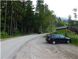
a) From the Ljubljana-Jesenice motorway take the Brnik exit, and when reaching the Mengeš-Kranj road, continue left towards Kranj. Drive along the main road towards Kranj to the first roundabout, from which take the first right exit towards Šenčur. Continue through Šenčur along the main road, then, upon reaching the Kranj-Zgornje Jezersko road, continue right towards Jezersko. Upon arriving in Preddvor, leave the main road and continue left towards the centre of the said place, from there follow the signs to the Bašelj settlement. Somewhat past the Bašelj settlement the road descends to the Milka stream and crosses it over a bridge. Here a road first branches right to the villages of Babni Vrt, some 100 m further also to the village of Povlje. Continue along the ascending road towards Povlje, parking at a small car park above the village. At the starting point there is a small junction, several mountaineering direction signs and a large information board for the Trstenik educational walking trail "path under Storžič".
b) From the Jesenice-Ljubljana motorway take the Kranj west exit, then continue driving towards Golnik. Upon arriving in Tenetiše leave the main road to Golnik and continue right towards Trstenik. Approximately 1 km past the Trstenik settlement arrive at a small junction, where continue left towards the village of Povlje. Continue along the ascending road towards Povlje, parking at a small car park above the village. At the starting point there is a small junction, several mountaineering direction signs and a large information board for the Trstenik educational walking trail "path under Storžič".
Route description:
From the parking lot continue along the left road, from it immediately slightly right onto the footpath towards Storžič, Kališče, Planina Javornik and Dolenčeva path to Velika Poljana. The path ahead first gently, then moderately ascends through the forest, soon leading to a forest road. Continue the ascent on the occasionally steeper forest road, where due to numerous junctions carefully follow the markers, leaving the forest road several times as the markers occasionally lead along a path. For some time we still walk alternately on the path and forest road, on the slope badly damaged by weather disasters, so there are several large clearings along the path.
Higher up, at the marked junction continue towards Storžič, Kališče and Planina Javornik (the forest road continues to Velika Poljana). From the junction the path becomes quite steep, as the already steep old path has become impassable due to numerous fallen trees, then the path turns right and temporarily flattens. Follow a few-minute traverse to the right, then exit the forest and arrive at the south-western gully of Storžič, along which we ascend to the nearby marked junction.
From the junction continue left (straight to Storžič, which bypasses Krničarjeva hut and is about a minute shorter) and traverse up the scenic slope to Krničarjeva hut on Planina Javornik.
At the hut head left towards Poljana (right Storžič) and continue along the path that traverses the slopes to the west with slight ascents and descents. Follow this path, which is somewhat exposed in places and especially dangerous for slipping when wet, to Velika Poljana, which we reach after about 30 minutes of traversing.
Starting point - first refreshment point 0:45, first refreshment point - junction below Planina Javornik 1:10, junction below Planina Javornik - Planina Javornik 0:05, Planina Javornik - Velika Poljana 0:30.

Photos:
 1
1 2
2 3
3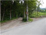 4
4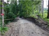 5
5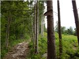 6
6 7
7 8
8 9
9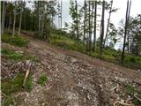 10
10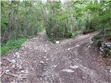 11
11 12
12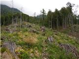 13
13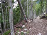 14
14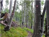 15
15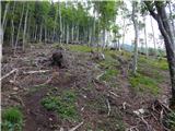 16
16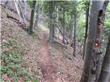 17
17 18
18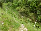 19
19 20
20 21
21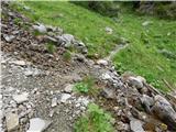 22
22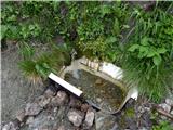 23
23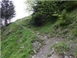 24
24 25
25 26
26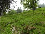 27
27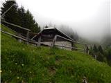 28
28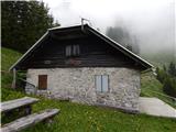 29
29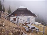 30
30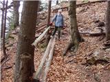 31
31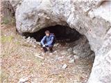 32
32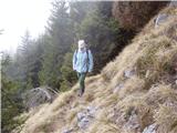 33
33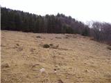 34
34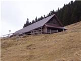 35
35
Discussion about the trip Povlje - Velika Poljana (via Javornik)
|
| Gost9. 04. 2007 |
If someone is tired of ice axe and crampons and wants a less demanding hike, I warmly recommend it. I don't fully agree with the path description which says that the path from the refreshment point onwards gently ascends. The path to Javornik pasture is quite steep and anyone who reads this description would think it's a Sunday outing. Otherwise everything as written.
|
|
|
To post a comment you must log in:
If you do not yet have a username, you must first
register.