Starting point: Praproče (559 m)
| Latitude/Longitude: | 46,06140°N 14,28790°E |
| |
Walking time: 35 min
Difficulty: easy marked way
Elevation gain: 149 m
Elevation difference along the route: 170 m
Map: Ljubljana - okolica 1:50.000
Recommended equipment (summer):
Recommended equipment (winter):
Views: 7.441
 | 3 people like this post |
Access to starting point:
From Horjul or Dobrova we drive to Polhov Gradec, and then we continue driving towards Gorenja vas. Only a little after Polhov Gradec, in the settlement Briše, we continue driving right and then drive towards the village Praproče (turn-off from the main road is marked and is situated at the bus stop). Further, we drive on a narrow and steep road which quickly brings us to the village Praproče. We follow the road to the upper part of the village, where we come to a smaller crossroads by which we notice a cross and hiking signposts.
At the starting point, there aren't any appropriate parking spots. So we can park a little lower on an appropriate place by the road, or we drive with a car a little further and then we park on an appropriate place by the road.
Route description:
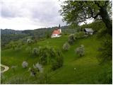
From the starting point we head onto the initially still asphalted road in the direction of Mali vrh. The road first slightly descends, and then brings us to a panoramic grassy ridge, from which a nice view opens up towards Koreno and Črni vrh. We continue on the ascending road which, past a hamlet of a few houses, brings us to the edge of the forest.
After a few minutes of additional walking, the road splits into two parts. The right one leads towards Setnik, and we continue on the slightly left one, which after a short ascent brings us to a water supply structure, after which an unmarked path from the church of St. Martin joins.
We go right and continue the ascent on the often quite muddy cart track, which we follow to the upper grassy slope of Mali vrh. When we step out of the forest, only a short walk on the more and more scenic path separates us from the top.
Photos:
 1
1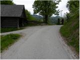 2
2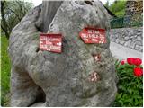 3
3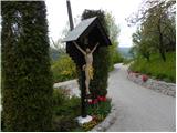 4
4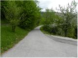 5
5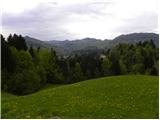 6
6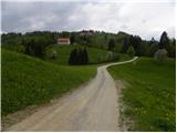 7
7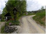 8
8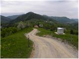 9
9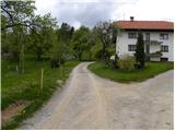 10
10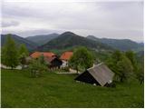 11
11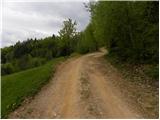 12
12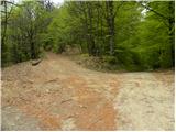 13
13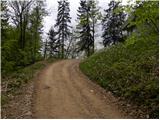 14
14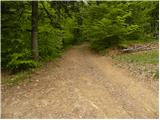 15
15 16
16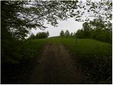 17
17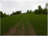 18
18 19
19 20
20
Discussion about the trip Praproče - Mali vrh
|
| Gost3. 12. 2007 |
MT-The trail is not strenuous but somewhat muddy. Wonderful views. I recommend continuing the trail towards Setnik (pr Žul) and Srednji vrh (ca. +2h) along the marked trail.(PPP)
|
|
|
|
| grega_p28. 02. 2010 |
It's true that mud marks the path, especially now in the melting season, but I recommend it to everyone who wants to see Polhograjce from another perspective.
|
|
|
|
| rokeg15. 02. 2023 18:23:46 |
And does anyone know where Veliki vrh is (written on the sign in the 3rd picture)? It says 788 m, which seems to me like one of the Klešča peaks?
|
|
|
|
| gamsek122. 02. 2023 16:53:43 |
This Veliki vrh (788 m) apparently doesn't exist at all, but that's only the name of a farm west of Mali vrh (708 m), and at the 788 m point it's Klešč.
|
|
|
|
| rokeg22. 02. 2023 21:34:25 |
Interesting. Thanks for the reply gamsek1.
|
|
|
|
| bumbi25. 02. 2023 13:57:05 |
On the map Polhograjsko hribovje z okolico, published by Turistično društvo Polhov Gradec, there are two names written at the 788 m point: Klešc and Veliki vrh in brackets. To the north there are two farms. One is Zgornji Velkovrh and the other Spodnji Velkovrh.
|
|
|
|
| rokeg28. 02. 2023 22:14:28 |
bumbi, thanks for the explanation.
|
|
|
To post a comment you must log in:
If you do not yet have a username, you must first
register.