Preval Strgarija - Mali Golak
Starting point: Preval Strgarija (1217 m)
| Latitude/Longitude: | 45,97490°N 13,85140°E |
| |
Walking time: 45 min
Difficulty: easy marked way
Elevation gain: 278 m
Elevation difference along the route: 278 m
Map: Goriška 1:50.000
Recommended equipment (summer):
Recommended equipment (winter): ice axe, crampons
Views: 26.064
 | 1 person like this post |
Access to starting point:
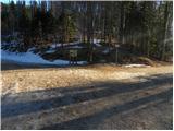
a) From central Slovenia we first drive to Logatec, from where we continue towards Idrija. At Kalce we turn left towards Col and continue driving along the winding road. At Col we turn right and after 100 meters left in the direction of Predmeja. From here we drive along an occasionally somewhat narrower and winding road to Predmeja. At the end of the settlement we turn right towards Lokve (left downhill leads to Ajdovščina), and we follow the main road on the plateau first past the turn-off for Golake and then past the turn-off for Čaven. When the road starts descending towards Mala Lazna, we turn right. We drive along the forest road to Preval Strgarija, which we recognize by the information and mountain signs. We park in a suitable place by the road.
b) From the Razdrto–Nova Gorica motorway we head to the Ajdovščina exit and continue towards the village of Lokavec. We can reach Lokavec through the center of Ajdovščina or via the old Ajdovščina–Nova Gorica road, where we turn right in the settlement of Cesta. From Lokavec we continue along the ascending winding road towards Predmeja. When the road levels out, we reach a junction where the road from Col joins from the right. We continue straight and follow the main road first past the turn-off for Golake and then past the turn-off for Čaven. When the road starts descending towards Mala Lazna, we turn right. We drive along the forest road to Preval Strgarija, which we recognize by the information and mountain signs. We park in a suitable place by the road.
Route description:
From Preval Strgarija we head onto the footpath towards Iztokova koča. The path immediately enters the forest, through which it moderately ascends and brings us to the hut in five minutes of walking.
We bypass the hut on the right side and continue the ascent towards Mali Golak, which is still about 40 minutes of walking away. The trail ascends through the forest, then at a junction by an information board and a small shrine (chapel) it splits in two directions. We can continue straight on the steep path or left on the gentler one. Both variants merge again after about 10 minutes. The path then turns slightly to the right and ascends steeply. After this short, steep section we reach a forested ridge, where the path from Predmeja joins from the right. We continue straight and follow the moderately steep path to a small saddle west of the main summit. Here we turn right; the path quickly leads us out of the forest into an area of dwarf pines, through which we ascend to the summit of Mali Golak in a few minutes.

The trip can be extended to the following destinations: Srednji Golak
Photos:
 1
1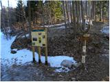 2
2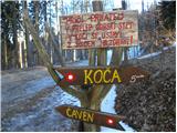 3
3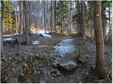 4
4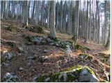 5
5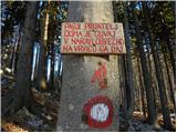 6
6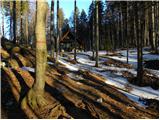 7
7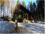 8
8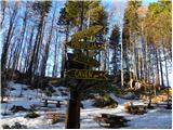 9
9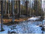 10
10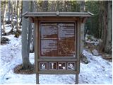 11
11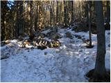 12
12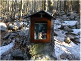 13
13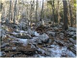 14
14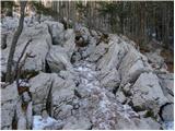 15
15 16
16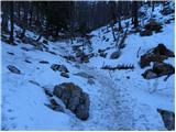 17
17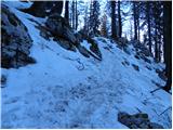 18
18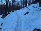 19
19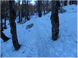 20
20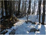 21
21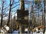 22
22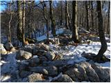 23
23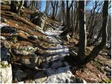 24
24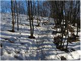 25
25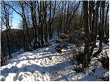 26
26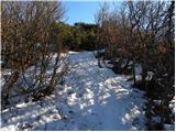 27
27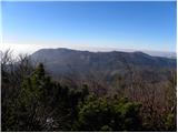 28
28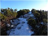 29
29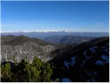 30
30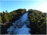 31
31 32
32
Discussion about the trip Preval Strgarija - Mali Golak
|
| Ajda_Zitnik22. 01. 2012 |
I walked the path last weekend, precisely 15.1.2012. It is well marked. But some caution against slipping is needed.
|
|
|
|
| Jonny_23. 01. 2012 |
True as written in the description - the view is really awesome! Not a high hill, but the view is over the whole country. Pictures: CLICK
|
|
|
|
| Ruzowski16. 03. 2014 |
After several weekends and Y ascents spent on Zelenica, it was time to visit some more of our parts.
So today start from the tunnels, via srednječavenski to malo gora, kucelj, čaven(hut), iztokova koča, Mali golak, predmeja, tunnels......Very nice tour, unique transition from late spring to snowy idyll. Bellflowers on čaven, Snow! on the golaks.
|
|
|
|
| valerija11216. 03. 2014 |
Hello Ruzowski! Nice tour, yes. I'm interested in how much storm damage from ice is still on this path. Thanks for the reply.
|
|
|
|
| Ruzowski16. 03. 2014 |
The path from malo gora to čaven has been rerouted for some time (fallen trees due to last year's storm). The old path to kucelj from malo gora is also impossible.
Mali golak also didn't see ice damage, or I didn't notice it. The path is without special features. 
So go ahead (while there's still snow on the golaks and spring on čaven)
|
|
|
To post a comment you must log in:
If you do not yet have a username, you must first
register.