Pri Žagi (Javorniški Rovt) - Planina Stamare (behind Boncla)
Starting point: Pri Žagi (Javorniški Rovt) (885 m)
| Latitude/Longitude: | 46,45390°N 14,09750°E |
| |
Route name: behind Boncla
Walking time: 1 h 45 min
Difficulty: partly demanding unmarked way
Elevation gain: 515 m
Elevation difference along the route: 515 m
Map: Karavanke - osrednji del 1:50.000
Recommended equipment (summer):
Recommended equipment (winter): crampons, lamp
Views: 2.838
 | 3 people like this post |
Access to starting point:
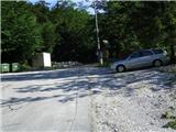
From the highway Ljubljana - Jesenice, take the exit Lipce (Jesenice east), where we turn right towards Jesenice. At the first traffic-light intersection (settlement Slovenski Javornik), we turn right (direction Lj.) towards Koroška Bela; at the next intersection with traffic lights, turn left, and soon once again left towards Javorniški Rovt (right Koroška Bela). When after a few kilometers of uphill driving we arrive in the mentioned village, in the second sharp left turn we encounter the right turn-off of the macadam road towards the Dom Trilobit (sign). Right before that spot on the right there is a smaller parking lot - our starting point.
Route description:
From the starting point, we continue a few meters on macadam, then we notice marked direction signposts with inscriptions Valvazor and Gajškova pot. Here we turn right, but do not continue following the marks (right over the bridge), instead straight uphill on the cart track. Soon we reach the next bridge, where we cross the stream, and the path (cart track) turns left uphill. For the next 15 minutes of walking, we follow the main cart track, which means we ignore all turn-offs. On the left side of the path, we will be able to notice the sign "Dom Trilobit" twice.
Then, when the path ascends somewhat more steeply, we encounter a fork in the cart track, where we go right (left path "za Kraševcem" to Planina Stamare). The cart track now turns increasingly right, first ascending more steeply, then flattening briefly, and ascending slightly once more towards the gentler section (saddle) between both Bonclas. Here we continue on the cart track past the indistinct eastern ridge of Mala Boncla, located on our right. The path winds slightly and simultaneously ascends again quite quickly, first gently and then more steeply. We walk on or right beside the steep cart track. Higher up, the path leads us to a fork in the cart track, where we continue straight ahead, i.e., left (right Velika Boncla). When the path brings us through a small valley, the steepness eases. At the end of the flat section, we do not continue straight as indicated, but turn left onto the relatively steep forest slope in a north to north-east direction. On the slope where the path fades, we keep slightly right; for orientation, a smaller moss-covered boulder (about midway up the slope) can serve. Soon after the steepness eases, we cross a flat section of forest to a small saddle located beside a partly rocky slope on our right. At the foot of this slope, with some attention, we notice the path and step onto it. The ascending path first crosses left, slightly later directing steeply straight up the slope towards the summit. Here we may need to use our hands as well. Then the path, after a gentle and short crossing to the right, ascends straight again over rocky and partly scree terrain upwards. When the steepness eases, we immediately turn left to the edge of the slope, where we notice a red mark on a small spruce, and continue in the indicated direction slightly left. Soon after, we encounter a cart track leading through the forest, onto which we step and turn left. Then, when it turns right, the cart track ascends the slope and subsequently makes a left turn. Here beautiful views begin to open up, and in a few minutes of further walking we finally step onto Planina Stamare from its western side.

Photos:
 1
1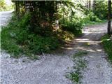 2
2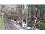 3
3 4
4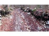 5
5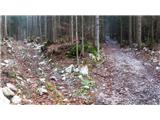 6
6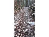 7
7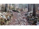 8
8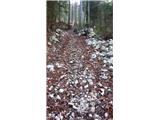 9
9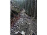 10
10 11
11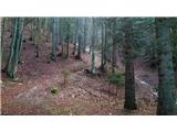 12
12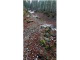 13
13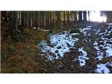 14
14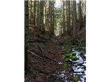 15
15 16
16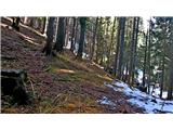 17
17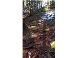 18
18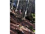 19
19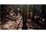 20
20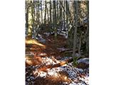 21
21 22
22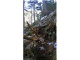 23
23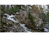 24
24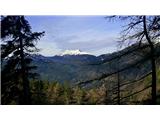 25
25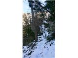 26
26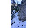 27
27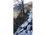 28
28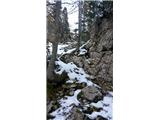 29
29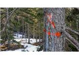 30
30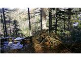 31
31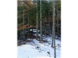 32
32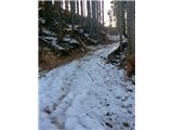 33
33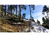 34
34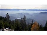 35
35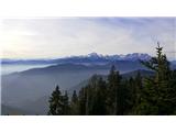 36
36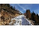 37
37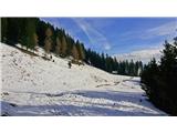 38
38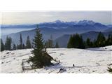 39
39
Discussion about the trip Pri Žagi (Javorniški Rovt) - Planina Stamare (behind Boncla)
|
| Majdag19. 04. 2020 |
Heinz, you have to know well where the path runs. Yesterday it was full of leaves, no trails anywhere and I preferred to turn back. And also from planina Stamare, it's not easy to follow, Pavel our guide told me. 
|
|
|
|
| heinz25. 04. 2020 |
The path is not marked. This is one of two variants of the hunting path between V. Bonclo and Stamarami. Hunting paths characteristically require quite a bit of orientation and perhaps a touch of exploratory spirit. I deliberately did not describe the other mentioned variant, as this one is probably already too much. Occasionally I regret submitting some path description. I consider the above one quite accurate.
|
|
|
|
| Majdag25. 04. 2020 |
Heinz, I know the path is not marked, as all hunting paths are like that, hard to follow. Maybe if there wasn't so much foliage it would work out. No problem, one experience more. Keep describing, everyone knows if they can make it or turn back..
|
|
|
|
| heinz26. 04. 2020 |
No need to continue particularly with the descriptions, as I think some might even be too much. I'm mainly thinking of the influx of various hikers bringing unrest into the living space of forest inhabitants. Hunting paths should be erased according to my new realization, since the name itself indicates they are not intended for mountaineers. About the culture of modern "mountaineers," I wouldn't waste words at all.
|
|
|
|
| andi226. 04. 2020 |
I agree with protecting and respecting forest inhabitants. It's a shame that it came to this. Your knowledge and descriptions of little-known areas within the Karavanke are at least for me irreplaceable in accessible literature. I have them saved for special occasions. lp
|
|
|
|
| Janez Seliškar4. 06. 2023 09:55:05 |
Along logging roads and skid trails we ascended to Planina Stamare via Mala and Velika Boncla. On the eastern side of Velika Boncla the terrain becomes quite steep, but unfortunately the skid trails also climb higher and higher, which does ease the ascent. The terrain becomes too steep even for the skidder, so you have to push along the path that brings you back to the skid trail coming down from Planina Stamare. Then only gentle walking to the planina. The path Za Kraševcem is well marked with yellow blazes.
|
|
|
|
| Jusk6. 06. 2023 21:05:59 |
I'm wondering what heinz means by not walking on hunting trails because it disturbs the forest inhabitants? We meet those forest inhabitants on marked trails too, but they know they're near a marked trail and don't need to be afraid? Flood of hikers on hunting trails?? Come on Moreover, from your posts it's clear you also like unmarked trails and even with a dog, surely you didn't disturb any roe deer, right? Oh and I'm also curious about modern hikers Moreover, from your posts it's clear you also like unmarked trails and even with a dog, surely you didn't disturb any roe deer, right? Oh and I'm also curious about modern hikers
|
|
|
To post a comment you must log in:
If you do not yet have a username, you must first
register.