Prtovč - Kosmati vrh (Ratitovec) (via razor)
Starting point: Prtovč (1011 m)
| Latitude/Longitude: | 46,22750°N 14,11350°E |
| |
Route name: via razor
Walking time: 1 h 40 min
Difficulty: easy marked way
Elevation gain: 632 m
Elevation difference along the route: 632 m
Map: Škofjeloško in Cerkljansko hribovje 1:50.000
Recommended equipment (summer):
Recommended equipment (winter): ice axe, crampons
Views: 14.720
 | 4 people like this post |
Access to starting point:
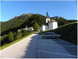
First, we drive to Železniki, where a signpost for the village Prtovč directs us onto a side road. After a few kilometers of driving, the road brings us to a crossroads, where we continue left in the direction of Ratitovec and the village Prtovč. Further ahead, the road brings us to the church in the village, where there is a parking lot on which we park.
Route description:
From the parking lot, we continue on the asphalt road upwards. After a few meters of walking, we come to a crossroad, where the road branches off to the right towards the hunting cottage. We continue left to the next crossroad where there are signposts. We go to the right road in the direction of Ratitovec via Razor (left Ratitovec via Povden). The road leads us past the last houses in the village to the spot where the road ends.
Further, we continue on a cart track which starts ascending through the forest. After a good 15 minutes of walking the footpath a few times avoids the cart track but ascends in its vicinity. A little higher we cross the forest road and continue on a wide cart track. At the spot where the path from the hunting cottage joins us, the cart track turns into a footpath. After a short crossing of a somewhat steeper slope, the path brings us into a valley (cirque) named Razor. The forest is becoming thinner, so on the right side we notice a few cliffs of Kosmati vrh. After a short ascent, the path brings us to a smaller plain, where there is a junction.
Here we go right in the direction of the mountain pasture Klom (left Krekova koča mountain hut on Ratitovec). The path steeply ascends for a short time and brings us over a grazing fence (electric fence) to a poorly visible junction, which is situated only a few meters behind the fence. Here we leave the nicely beaten footpath and go sharply right onto an otherwise marked but very poorly visible footpath. The path ahead runs along the edge of the cliffs along the grazing fence. Because the path is poorly visible we must carefully follow the blazes, which are sparsely placed. A little further ahead the path turns left and ascends on grassy slopes to the summit of Kosmati vrh.
PP: Orientation in the last part of the path is difficult, in fog I advise against the ascent to the summit.

Photos:
 1
1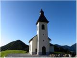 2
2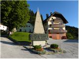 3
3 4
4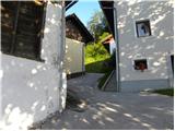 5
5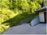 6
6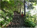 7
7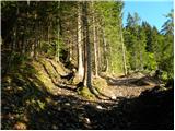 8
8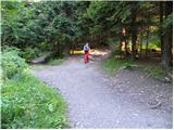 9
9 10
10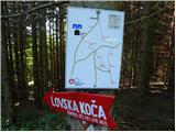 11
11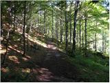 12
12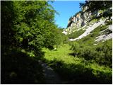 13
13 14
14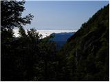 15
15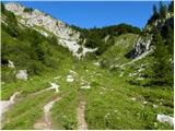 16
16 17
17 18
18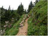 19
19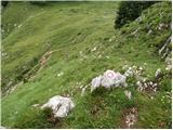 20
20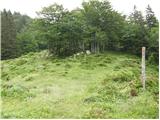 21
21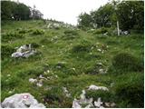 22
22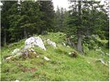 23
23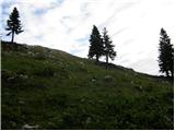 24
24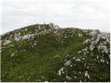 25
25 26
26
Discussion about the trip Prtovč - Kosmati vrh (Ratitovec) (via razor)
|
| vesnica30. 04. 2008 |
We'd like to go to Kosmati vrh but we've never been in this area. Can someone describe the path what it's like and if there's still any snow.
|
|
|
|
| lajbkis1. 05. 2008 |
Hello
Starting point is Prtovč. The usual path leads through Razor towards Gladki vrh and Krekova koča. For Kosmati vrh, at the signpost in Razor, branch off to the right. Keep right all the time and you'll reach Kosmati vrh in less than half an hour. There is still snow on the path.
The other path (road) leads from Prtovč past the hunting hut always along the eastern side of Kosmati vrh. After about two kilometres of more or less snowy road you reach the memorial plaque. A few metres behind this plaque turn left onto the marked path and at the top of the ascent turn left again. Follow the markers and you can't go wrong. This path is also snowy towards the summit. I also recommend visiting Krekova koča on Gladki vrh.
Best regards
Rado
|
|
|
|
| vesnica1. 05. 2008 |
Thank you very much for the detailed information about the path. We've decided to wait until the snow is gone and then head up. Best regards
|
|
|
|
| darh12. 06. 2010 |
Last Sunday we followed exactly the described path to Kosmati vrh, and continued the trip via Gladki vrh to Altemaverja. We descended to the valley via Povdna. Flowering meadows at this time of year really enchant. More about our impressions here.
|
|
|
|
| Majdag21. 03. 2011 |
Yesterday we thought of Ratitovec, but just before the last steep part we changed our minds and turned right towards Kosmati vrh. We didn't regret it. Views are unique, mountains and hills everywhere you look, balm for the soul and eyes. Unfortunately, there was a strong wind blowing and we didn't continue towards the hut and Gladki vrh, and others, hello Majda.. 
|
|
|
|
| cebelca21. 03. 2011 |
Majdag, how much snow is there still up there or on the path?
|
|
|
|
| Majdag21. 03. 2011 |
cebelca...most of the path from Prtovč to the junction for Kosmati vrh was icy. As for snow, hard to say, about 20-30 cm, almost none on top. But it's nice, good luck 
|
|
|
|
| Kokta28. 09. 2011 |
Today I was on Ratitovec and Kosmati vrh for the first time. Personally, I like Kosmati vrh better ..fantastic view and peace...honestly recommend a visit.
|
|
|
|
| GregorC20. 05. 2012 |
Today there was incredible crowding at Ratitovec near the hut, but I made a detour and at Razor turned towards Kosmati vrh. Then I descended back to Vratca and continued to planina Pečana, from there over Gladki vrh back to Prtovč. Unlike the area around the hut and Gladki vrh, there are very few visitors here (today I didn't meet anyone) and consequently very peaceful. And the views from the summit were fantastic today.
The parking lot at Prtovč was packed full upon my return at 10 a.m.
|
|
|
To post a comment you must log in:
If you do not yet have a username, you must first
register.