Prtovč - Planina Klom (via Razor)
Starting point: Prtovč (1011 m)
| Latitude/Longitude: | 46,22750°N 14,11350°E |
| |
Route name: via Razor
Walking time: 1 h 35 min
Difficulty: easy marked way
Elevation gain: 489 m
Elevation difference along the route: 525 m
Map: Škofjeloško in cerkljansko hribovje 1:50.00
Recommended equipment (summer):
Recommended equipment (winter): ice axe, crampons
Views: 2.610
 | 1 person like this post |
Access to starting point:
A) First, we drive to Škofja Loka, and then we continue driving towards Železniki. When we arrive in Železniki, first at the intersection where the road towards Kropa, Dražgoše and Rudno branches off to the right, we continue straight ahead, then a little after the Mercator store, or opposite the company Niko d.o.o., we continue right in the direction of Podlonk and Prtovč. We continue on the mentioned road, which starts to ascend more steeply, and we follow the asphalt road entirely to the parking lot on Prtovč, which is located near the church of Marija Pomočnica.
B) From Cerkno, Podbrdo or Sorica we drive to Zali Log, and then we continue driving towards Škofja Loka. When we arrive in Železniki we leave the main road and continue driving left in the direction of Podlonk and Prtovč. We continue on the mentioned road, which starts to ascend more steeply, and we follow the asphalt road entirely to the parking lot on Prtovč, which is located near the church of Marija Pomočnica.
Route description:
From the parking lot, we walk to the beginning of the village, where at the intersection by the NOB monument we continue left, then at the next intersection slightly right in the direction of Ratitovec (path via Razor). We continue among houses, then the path leads us onto a cart track, on which we ascend diagonally towards the right. Higher up, the path from the hunting cottage Na Toli joins from the right, and at the junctions we follow the direction of Ratitovec. Further on, we ascend diagonally towards the right again, and the path temporarily leads us onto a newer forest road, which we leave a little higher and continue the ascent on the marked footpath. A little higher the traces of the new road or cart track end, and in a moderate ascent we arrive out of the forest into the cirque Razor, where there is a marked junction.
From the cirque we continue on the right path in the direction of Kosmati vrh, mountain pasture Klom and Krekova koča via Vratca (left the usual path to Krekova koča on Ratitovec), on which we ascend more steeply for a short time and with nice views quickly reach the saddle Vratca, where the signposts direct us slightly right in the direction of mountain pasture Klom (left Gladki vrh and Krekova koča, straight Planina Pečana, sharply right Kosmati vrh). The path ahead leads us past a bunker from the time of the Rapallo border, then through a belt of forest we reach the next newer road, which we reach right at the grazing fence that crosses the road. We follow the road to the left, along which we quickly arrive at the next marked junction, where to the right another path branches off leading towards Kosmati vrh (the mentioned path is not drawn on most maps), and we continue left on the marked footpath or cart track in the direction of mountain pasture Klom. For a short time we continue on the cart track, then the blazes direct us left onto the footpath, on which in a gentle, later moderate descent, we descend to the shepherd's hut on mountain pasture Klom.
Description and pictures refer to the condition in the year 2016 (July).

Photos:
 1
1 2
2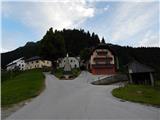 3
3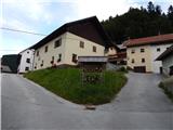 4
4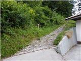 5
5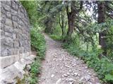 6
6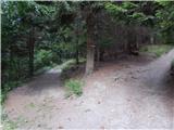 7
7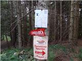 8
8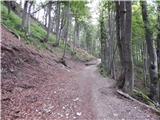 9
9 10
10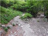 11
11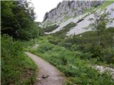 12
12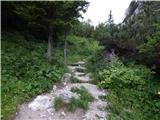 13
13 14
14 15
15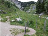 16
16 17
17 18
18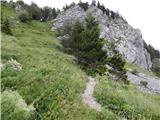 19
19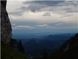 20
20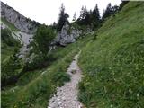 21
21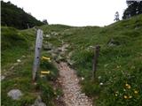 22
22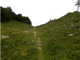 23
23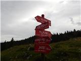 24
24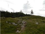 25
25 26
26 27
27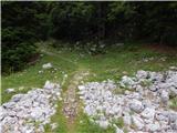 28
28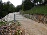 29
29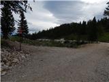 30
30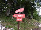 31
31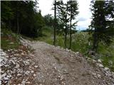 32
32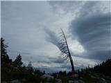 33
33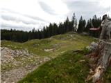 34
34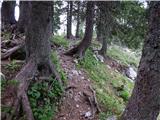 35
35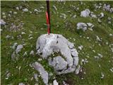 36
36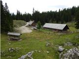 37
37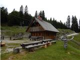 38
38
Discussion about the trip Prtovč - Planina Klom (via Razor)
To post a comment you must log in:
If you do not yet have a username, you must first
register.