Raabtal - Steinkarspitz/Monte Antola
Starting point: Raabtal (1500 m)
| Latitude/Longitude: | 46,67450°N 12,67590°E |
| |
Walking time: 2 h 45 min
Difficulty: partly demanding marked way
Elevation gain: 1024 m
Elevation difference along the route: 1024 m
Map:
Recommended equipment (summer):
Recommended equipment (winter): ice axe, crampons
Views: 3.522
 | 2 people like this post |
Access to starting point:
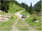
Through the border crossing Korensko sedlo we descend into Austria, where at the first larger intersection we continue left in the direction of the village Podklošter/Arnoldstein. In the mentioned village we come to a roundabout, where we continue right in the direction of "Hermagor". Further we drive on a wide road which leads us through the Gailtal valley. At the settlement Mauthen we continue left in the direction of the mountain pass Plöckenpass, then after a few 100 m right in the direction of the Lesachtal valley. Further we drive on a narrower and quite winding road, which we follow to the village Untertilliach. A little after the mentioned village (at the second bus stop) to the left downwards branches off an initially still asphalted road. The road then crosses a bridge, after which from the left side a wide macadam road joins. We continue straight for approximately 50 m, then we come to the next unmarked intersection, where we continue left on a somewhat worse forest road, which we then follow to the sharp right turn by which there is a sign prohibiting further driving.
Route description:
At the turn we leave the road and continue left on at first well-visible gently sloping marked mountain path. The path goes already after a few minutes into a sparse belt of forest, where in a relatively short time it bypasses three hunting observatories. After the third observatory the path turns slightly to the right and starts to disappear among high grasses. Only a little further the path crosses a mountain stream, after which it passes into the most overgrown part of the path. The path ahead pushes through a belt of very high grass, then continues on an old and quite overgrown mule track. This moderately steep path, along which in summer we notice numerous blueberries, we follow all the way to the bivouac Mitterkarhütte.
From the bivouac we continue straight (right Hochspitz) on at first poorly visible little path, which gently ascends along the left edge of a high-alpine cirque. After a few minutes of walking the path turns slightly to the left and starts to ascend transversely across increasingly steep grassy slopes. A little higher the path turns even more to the left and for a short time ascends very steeply. Higher the path levels out, and it brings us to a poorly marked junction. We continue on the right path, which first ascends gently, then passes onto increasingly steep grassy slopes. The ascent over the mentioned grassy slopes we perform in a transverse ascent, which ends on the main ridge of the Carnic Alps. When we step onto the main ridge a wonderful view opens towards the south, where somewhat to the left we notice the mighty Monte Peralbo.
We continue left (right Hochspitz) on the ridge path (Karnischer Höhenweg), which continues towards the east. The path ahead continues on and along the panoramic ridge, which borders between Austria and Italy. After a few minutes of walking the path withdraws from the ridge to the Italian side, where it crosses relatively steep slopes (danger of slipping). This panoramic path, which for the most part ascends transversely, we follow to the marked junction, which is located only a few meters below the summit Steinkarspitz. At the marked junction we leave the marked path (continue left) and via easier pathless terrain in 3 minutes ascend to the mentioned summit (the marked path can be left already some 10 m before the junction, as it leads right below the summit).

Photos:
 1
1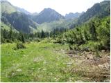 2
2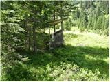 3
3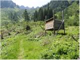 4
4 5
5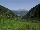 6
6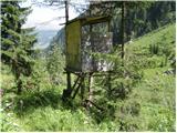 7
7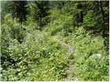 8
8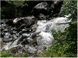 9
9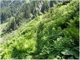 10
10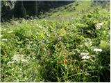 11
11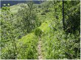 12
12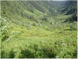 13
13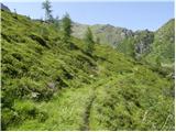 14
14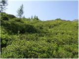 15
15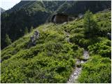 16
16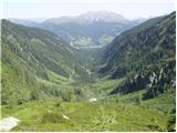 17
17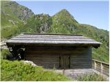 18
18 19
19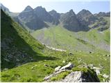 20
20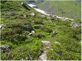 21
21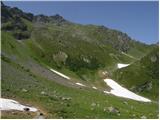 22
22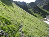 23
23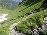 24
24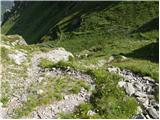 25
25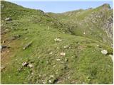 26
26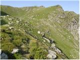 27
27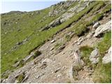 28
28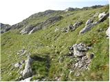 29
29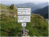 30
30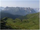 31
31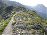 32
32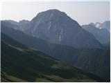 33
33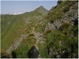 34
34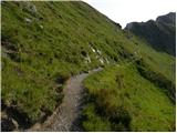 35
35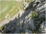 36
36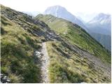 37
37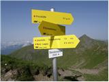 38
38 39
39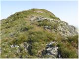 40
40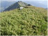 41
41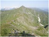 42
42
Discussion about the trip Raabtal - Steinkarspitz/Monte Antola
To post a comment you must log in:
If you do not yet have a username, you must first
register.