Ravenska Kočna - Kranjska Rinka (Slovenska pot)
Starting point: Ravenska Kočna (1000 m)
| Latitude/Longitude: | 46,38500°N 14,53640°E |
| |
Route name: Slovenska pot
Walking time: 4 h 35 min
Difficulty: very difficult marked way
Elevation gain: 1453 m
Elevation difference along the route: 1500 m
Map: Kamniške in Savinjske Alpe 1:50.000
Recommended equipment (summer): helmet, self belay set
Recommended equipment (winter): helmet, self belay set, ice axe, crampons
Views: 21.710
 | 1 person like this post |
Access to starting point:
From the Ljubljana - Jesenice highway, take the exit Kranj - east and follow the road ahead towards Jezersko. In Zgornje Jezersko, just a little after the gas station, we will notice a road that branches off to the right from the main road (direction Planšarsko jezero). The road then leads us past the mentioned lake and behind it steeply ascends for a short time. Higher up, the road flattens and at the beginning of a large meadow loses its asphalt surface. We then follow the macadam road to a marked larger parking lot.
Route description:
From the parking lot, we continue on the macadam road following the signs »Češka koča, Ledine« and after approximately 15 minutes of walking, we come to a cargo cableway.
From the former parking lot at the cargo cableway, we head onto the path that goes between both cableways (the lower station of the cargo cableway to Kranjska koča burned down in June 2015) and then slightly upwards. The path soon leaves the forest and continues through dwarf pines. After some time, the path brings us to a gully named Žrelo. Here we are at a junction, where we continue left (straight ahead the path through Žrelo), and the path then immediately becomes climbing. The path is well secured, but caution is still needed due to wet rocks. The path over the shorter wall is in places quite exposed, but full of nice views. When we climb this section, the path returns to dwarf pines, through which we then ascend on a well-made path. We continue quite steeply upwards and soon the path through Žrelo joins from the right. From here to Kranjska koča, we have only a few dozen steps of easy walking.
From the hut, we continue left towards the east in the direction of Ledinski vrh, Mrzla gora, and Babe. The path, which is initially quite gentle, brings us in a few minutes to a junction, where we take the right path (left climbing path to Babe). The path ahead becomes only slightly steeper and brings us to a somewhat more difficult passage over a rocky section. Here a steel cable assists us, but the passage when dry is not difficult. The path then brings us to the wide slopes below Ledinski vrh, from which there is a nice view towards the glacier below Skuta, which we can see on the right side. The path ahead ascends moderately and brings us just a few dozen meters before Jezersko sedlo to the next marked junction, where we continue right in the direction of Koroška Rinka or Križ (left Ledinski vrh, Velika Baba, Mrzla gora).
The path ahead ascends moderately over a less steep scree, then joins the path from Logarska dolina.
The path ahead ascends past a natural window and then turns slightly to the right and crosses the steep western slopes in ascent. The path then turns to the left and steeply ascends along the steel cable. Soon we reach the northern slopes of the mountain and some easy climbing follows on rugged rock without fixed protection. We reach the western slopes again, where the path once more steeply ascends along the steel cable. From here there is also a very nice view of the precipitous walls of Skuta. A quite exposed traverse follows on the western side of the mountain, then the path turns left again and ascends almost vertically along the steel cable. We reach the northern slopes of the mountain again and a shorter ascent along the steel cable follows to the summit of Koroška Rinka.
From Križ or Koroška Rinka, we descend to the other side on the path that steeply descends towards the valley between Kranjska and Koroška Rinka. The path ahead first runs through a crumbly gully, then transitions to scree, where we quickly reach a junction, where we continue right (left Turski žleb and Kamniška Bistrica). The path ahead crosses the slopes of Koroška Rinka, then turns slightly left, where it steeply ascends. A short very steep ascent follows, then the path brings us to the main ridge, along which we ascend to the summit of Kranjska Rinka in a few steps.
Ravenska Kočna - Ledine 2:00, Ledine - Koroška Rinka 2:15, Koroška Rinka - Kranjska Rinka 20 minutes.

Photos:
 1
1 2
2 3
3 4
4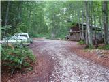 5
5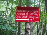 6
6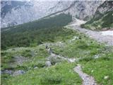 7
7 8
8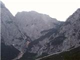 9
9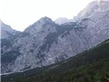 10
10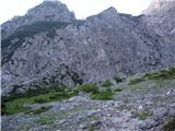 11
11 12
12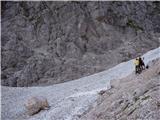 13
13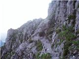 14
14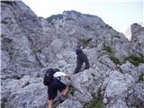 15
15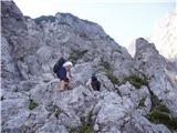 16
16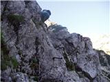 17
17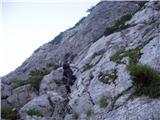 18
18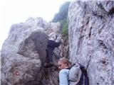 19
19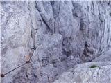 20
20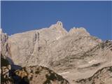 21
21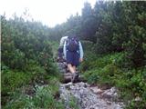 22
22 23
23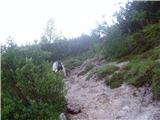 24
24 25
25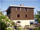 26
26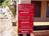 27
27 28
28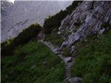 29
29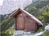 30
30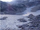 31
31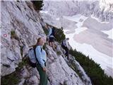 32
32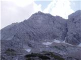 33
33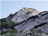 34
34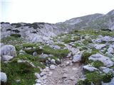 35
35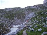 36
36 37
37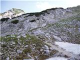 38
38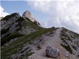 39
39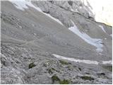 40
40 41
41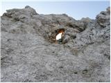 42
42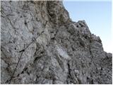 43
43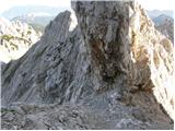 44
44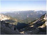 45
45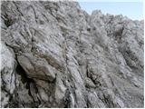 46
46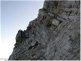 47
47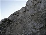 48
48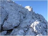 49
49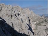 50
50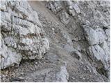 51
51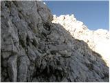 52
52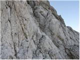 53
53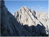 54
54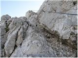 55
55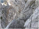 56
56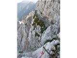 57
57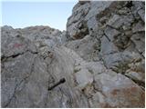 58
58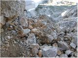 59
59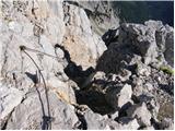 60
60 61
61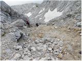 62
62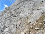 63
63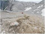 64
64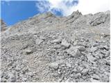 65
65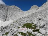 66
66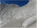 67
67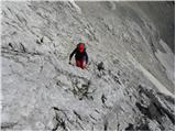 68
68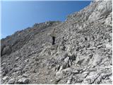 69
69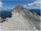 70
70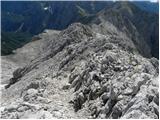 71
71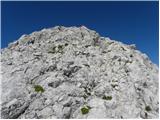 72
72 73
73
Discussion about the trip Ravenska Kočna - Kranjska Rinka (Slovenska pot)
|
| MRobin19. 08. 2011 |
Today on the path Ravenska Kočna - Slovenska pot - Kranjska koča na Ledinah, I lost keys to VW Polo with a small silver key attached. If anyone finds them, please report to 040-860-494.
LP
|
|
|
|
| soncyka14. 08. 2012 |
Nice trail. I went through Žrelo to Kranjska koča na Ledinah, then to Koroška and Kranjska Rinka. From Koroška Rinka to Kranjska the trail is a bit more demanding, a bit less marked, because there's a scree in between, but still excellent. On the way back I went the same way, stopped also at Ledinski vrh, and then via Slovenska pot from Kranjska koča to the valley. Nice tour!
|
|
|
|
| malimiha26. 06. 2016 |
hi, does anyone know what the conditions are like? thanks and best regards
|
|
|
|
| redbull29. 06. 2016 |
28.06.16
From Okrešelj via Križ (dry secured trail).
Continuing required only at the start 3m of snow to the first cable. Further there's still some snow on the trail but no need to walk on it. No crampons needed for the trail, ice axe recommended at least for those 3m snow crossing.
Good luck
|
|
|
|
| redbull29. 06. 2016 |
Don't look at what's written above, I misread a bit. I described the conditions for the ascent to Koroška Rinka.
|
|
|
|
| Batistuta23. 08. 2018 |
The path from the glacier below Skuta onwards is indeed very demanding, one of the most difficult hiking paths in Slovenia (I'm an experienced mountaineer). As previous posts mention, the markers are very worn, so I constantly lost time with orientation. The wire ropes are torn out in three places, one of them very dangerous. The wire ropes are also damaged and frayed; I scratched myself bloody on my right palm, forearm, and left elbow. The pegs are several times too far apart, requiring some free climbing. In some places it's impossible to walk without dislodging stones.
The path from Koroška to Kranjska Rinka is actually scree, on which you slip and dislodge stones.
So I recommend the path only for very experienced mountaineers using protective gloves and helmet.
The window along the path (below Koroška Rinka) is easily accessible and a must-stop, as the view through to the other side of the mountains is fantastic. 5 minutes further from the window I saw a herd of 6 chamois. Beautiful!
At the summit the weather changed in 15 minutes and the descent was a nightmare, as it was raining, thundering, and I was slipping desperately. I arrived at Ledine completely exhausted. Don't go up unless the forecast is completely clear all day (which in Slovenia never is anyway  ). ).
Happy trails!
|
|
|
To post a comment you must log in:
If you do not yet have a username, you must first
register.