Ravenska Kočna - Mrzla gora (hunting path)
Starting point: Ravenska Kočna (1000 m)
| Latitude/Longitude: | 46,38500°N 14,53640°E |
| |
Route name: hunting path
Walking time: 6 h
Difficulty: very difficult marked way
Elevation gain: 1203 m
Elevation difference along the route: 1500 m
Map: Kamniške in Savinjske Alpe 1:50.000
Recommended equipment (summer): helmet
Recommended equipment (winter): helmet, ice axe, crampons
Views: 3.620
 | 1 person like this post |
Access to starting point:
From the Ljubljana–Jesenice highway, take the Kranj–east exit and follow the road ahead in the direction of Jezersko. In Zgornje Jezersko, just a little behind the gas station, we will notice a road which branches off from the main road to the right (direction Planšarsko jezero). The road then leads us past the mentioned lake and behind it steeply ascends for a short time. Higher up, the road flattens and at the beginning of a large meadow loses its asphalt covering. We then follow the macadam road to a larger marked parking lot.
Route description:
From the parking lot, we continue on the macadam road following the signs »Češka koča, Ledine« and after approximately 15 minutes of walking, we come to a cargo cableway.
From the former parking lot, we go on the path which runs on the left side of the cableway to Ledine (the bottom station of the mentioned cableway burned down in June 2015). The path ahead first runs through the forest, but soon transitions into dwarf pines, where it gently ascends along the edge of a mighty torrent. The path follows this torrent all the way to the beginning of the steeper part of the path. The path then steeply ascends, aided by some steel cables, with the help of which we climb one level higher (in wet, danger of slipping). The difficulties then ease, and the path continues to steeply ascend, mostly on the northern slopes. After an hour and a half of walking, we come to a pleasant resting place, where a bench and table delight us. Near the resting place, which is also a nice viewpoint, there is a memorial plaque in memory of the victims of the crashed helicopter. From here to the hut, which we reach after a good 20 minutes of further walking, there are no more technically demanding sections.
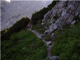
From the hut, we continue left towards the east in the direction of Ledinski vrh, Mrzla gora and Rinke. The path, which is initially quite gentle, brings us in a few minutes to a junction, where we take the right path (left is the climbing path to Babe). The path ahead becomes only slightly steeper and brings us to a somewhat more difficult passage over a rocky section. Here a steel cable assists us, but the passage is not difficult when dry. The path then brings us to the wide slopes below Ledinski vrh, from which there is a nice view of the glacier below Skuta, which we can see on the right side. The path then brings us in a moderate ascent to Jezersko sedlo, which borders neighboring Austria. From Jezersko sedlo, we continue right in the direction of Savinjsko sedlo, which we reach after approximately 15 minutes of traversing. From this saddle, we descend towards Okrešelj. After a few minutes of descent, we come to a small emergency bivouac, where we sign the logbook (bivouac pod Mrzlim vrhom). We continue descending and soon come to a junction, where the climbing path to Koroška Rinka branches off to the right upwards over scree, while we continue downwards. Soon, at 1700 m altitude, the path to Mrzla gora branches off to the left. The path first ascends through sparse dwarf pines and then brings us to a traverse across a rocky slab. Here we put on helmets, as the path ahead is very crumbly and exposed to falling rocks. From the traverse, the path brings us into a gully, which we only cross. Now we enter the climbing section of the path. The path is well protected at the beginning, but the protections soon run out. This is followed by an unprotected ascent on a pyramidal slope. Since this part of the path is very steep, watch for falling rocks. Before stepping onto the top of the pyramid, we have the feeling that this is the summit. But when we step on the "summit," we see that it is not. This is followed by a highly exposed traverse of a narrow ledge without protections. At the end of this ledge, the path turns left up a moderately steep wall straight upwards (without protections). Then we walk along the ridge, which is quite exposed in places. The path then turns slightly right and brings us to the summit in 30 minutes over fairly steep terrain.
The path is very demanding and poorly protected. Helmet is mandatory.
Ravenska Kočna - Kranjska koča 2:15, Kranjska koča - Savinjsko sedlo 1:15, Savinjsko sedlo - Mrzla gora 2:30.

Photos:
 1
1 2
2 3
3 4
4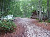 5
5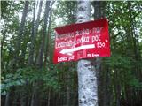 6
6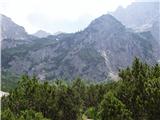 7
7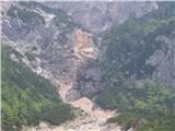 8
8 9
9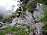 10
10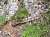 11
11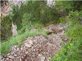 12
12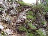 13
13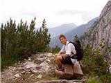 14
14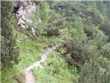 15
15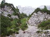 16
16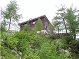 17
17 18
18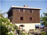 19
19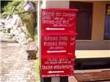 20
2021
 22
22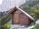 23
23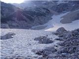 24
24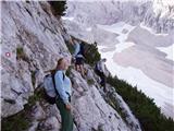 25
25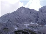 26
26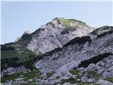 27
27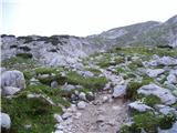 28
28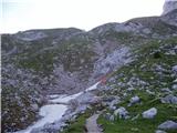 29
29 30
30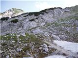 31
31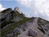 32
32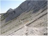 33
33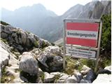 34
34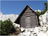 35
35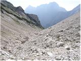 36
36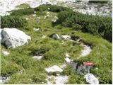 37
37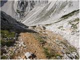 38
38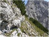 39
39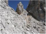 40
40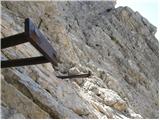 41
41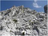 42
42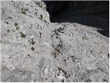 43
43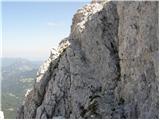 44
44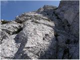 45
45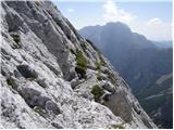 46
46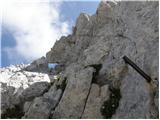 47
47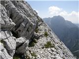 48
48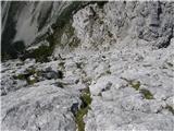 49
49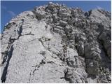 50
50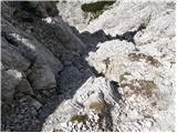 51
51 52
52 53
53
Discussion about the trip Ravenska Kočna - Mrzla gora (hunting path)
|
| darinka46. 09. 2019 |
On 4. 9. we hiked this tour. And exactly 6 hours we needed to the top of Mrzla gora. We had a nice day. Very few hikers. Well, maybe three we met in the wall. Yes, helmet is definitely recommended. When you descend from Savinjsko sedlo, that bivouac that was sometimes along the path is no longer there. And really careful in the wall, because there aren't many fixed protections. Only in the lower part there are some pegs and slings. Tour in nice weather and views, when the rock is dry it's great.
|
|
|
To post a comment you must log in:
If you do not yet have a username, you must first
register.