Ravenska Kočna - Vellacher Turm/Storžek (Slovenska pot)
Starting point: Ravenska Kočna (1000 m)
| Latitude/Longitude: | 46,38500°N 14,53640°E |
| |
Route name: Slovenska pot
Walking time: 4 h
Difficulty: very difficult marked way
Elevation gain: 1110 m
Elevation difference along the route: 1225 m
Map: Kamniške in Savinjske Alpe 1:50.000
Recommended equipment (summer): helmet, self belay set
Recommended equipment (winter): helmet, self belay set, ice axe, crampons
Views: 6.440
 | 1 person like this post |
Access to starting point:
From the Ljubljana - Jesenice highway, we take the Kranj - East exit and follow the road ahead towards Jezersko. In Zgornje Jezersko, just a little after the gas station, we will notice a road which branches off to the right from the main road (direction Planšarsko jezero). The road then leads us past the mentioned lake and behind it steeply ascends for a short time. Higher up, the road flattens and at the beginning of a large meadow loses the asphalt surface. We then follow the macadam road to the marked larger parking lot.
Route description:
From the parking lot, we continue on the macadam road following the signs »Češka koča, Ledine« and after approximately 15 minutes of walking, we come to a cargo cableway.
From the former parking lot at the cargo cableway, we head onto the path that goes between both cableways (the lower station of the cargo cableway to Kranjska koča burned down in June 2015) and then slightly uphill. The path soon leaves the forest and continues through dwarf pines. After some time, the path brings us to a gully named Žrelo. Here we are at a junction, where we continue left (straight is the path through Žrelo), and the path then immediately becomes climbing. The path is well secured, but caution is still needed due to wet rocks. The path over the shorter wall is quite exposed in places, but full of nice views. When we climb this section, the path returns to the dwarf pines, through which we then ascend on a well-made path. We continue quite steeply uphill and soon the path through Žrelo joins from the right. From here to Kranjska koča hut, we have only a few dozen steps of easy walking.
From the hut, we continue left towards the east in the direction of Ledinski vrh, Mrzla gora and Rinke. The path, which is initially quite gentle, brings us to a junction in a few minutes, where we take the right path (left is the climbing path to Babe). The path ahead becomes only slightly steeper and brings us to a somewhat more difficult passage over a rocky section. Here a steel cable assists us, but the passage is not difficult when dry. The path then brings us to wide slopes below Ledinski vrh, from which there is a nice view towards the glacier below Skuta, which we can see on the right side. The path then brings us in a moderate ascent to Jezersko sedlo, which borders neighbouring Austria.
From Jezersko sedlo, we continue right in the direction of Savinjsko sedlo, which we reach after approximately 15 minutes of traversing.
From Savinjsko sedlo, we continue sharply left (right to Okrešelj and Mrzla gora) on the path which starts to descend towards the valley of Belska Kočna. After a few minutes of descent, we will notice a large inscription on the rock “Klettersteig” on the left side of the path. Here we leave the path towards the valley of Belska Kočna and head left uphill on a somewhat less trodden trail. The path, which is further marked with red dots, soon brings us to the start of the climbing section. The climbing path initially crosses the steep eastern slope of the mountain towards the north with the aid of a steel cable and pegs. The path then turns left and steeply ascends alongside the steel cable. Later, the path brings us to a steep partly grassy slope, where caution is needed as the path is often slippery. In the last section of the path, we turn left and follow a short ascent on the unsecured slope towards the summit.
Ravenska Kočna - Kranjska koča 2:00, Kranjska koča - Storžek 2:00.

Photos:
 1
1 2
2 3
3 4
4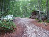 5
5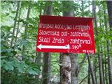 6
6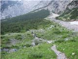 7
7 8
8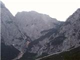 9
9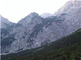 10
10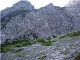 11
11 12
12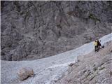 13
13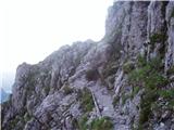 14
14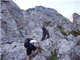 15
15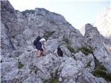 16
16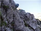 17
17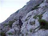 18
18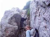 19
19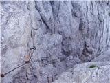 20
20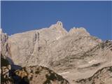 21
21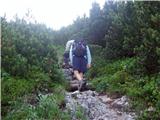 22
22 23
23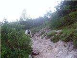 24
24 25
25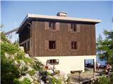 26
26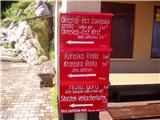 27
27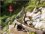 28
28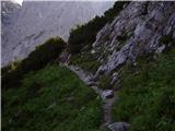 29
29 30
30 31
31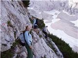 32
32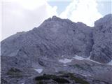 33
33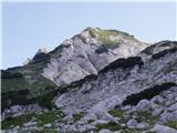 34
34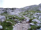 35
35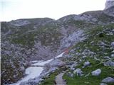 36
36 37
37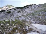 38
38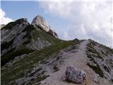 39
39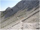 40
40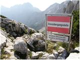 41
41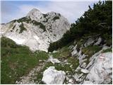 42
42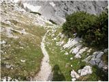 43
43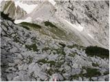 44
44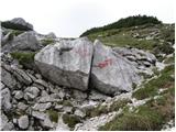 45
45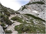 46
46 47
47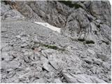 48
48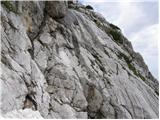 49
49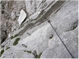 50
50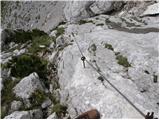 51
51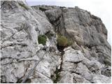 52
52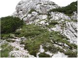 53
53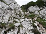 54
54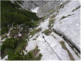 55
55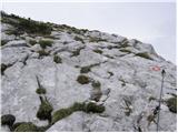 56
56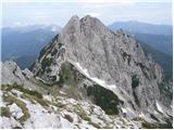 57
57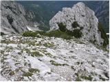 58
58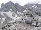 59
59
Discussion about the trip Ravenska Kočna - Vellacher Turm/Storžek (Slovenska pot)
|
| smatjaz6. 08. 2017 |
The first part of the cable on photo 51 is pulled out, but not broken. Carefully..... if more go one by one between the still holding pegs.
|
|
|
|
| PlaRinka30. 07. 2019 |
Today I did this tour: currently all pegs in pictures 50 and 51 are pulled out, except the one next to the mark on picture 50 and the very top one on picture 51 - the cable is thus completely loose and helps more with the feeling of safety when clipping in and less with maneuvering on the brackets.
Similarly, the cable pegs in picture 54 are pulled out at numerous points, but nothing critical.
Definitely a wonderful trip that offers excellent views at the end!
|
|
|
|
| garmont30. 07. 2019 |
Unfortunately, the condition of the cables and pegs has been like this for several years. I fear the neighbors have forgotten about this beautiful path. 
|
|
|
|
| dprapr31. 07. 2019 |
They probably don't worry too much about those worn-out cables and pegs, because there is a nice, natural approach on the upper side.
|
|
|
To post a comment you must log in:
If you do not yet have a username, you must first
register.