Ravne - Črna prst (via Orožnova koča)
Starting point: Ravne (735 m)
| Latitude/Longitude: | 46,25860°N 13,95920°E |
| |
Route name: via Orožnova koča
Walking time: 3 h 5 min
Difficulty: easy marked way
Elevation gain: 1109 m
Elevation difference along the route: 1150 m
Map: TNP 1:50.000
Recommended equipment (summer):
Recommended equipment (winter): ice axe, crampons
Views: 138.959
 | 9 people like this post |
Access to starting point:
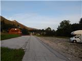
From the Ljubljana - Jesenice highway, take the Lesce exit and follow the road towards Bled and further towards Bohinjska Bistrica. From Bohinjska Bistrica, continue left in the direction of Tolmin and Soriška planina. Soon we will notice along the road the mountain trail markers for Črna prst, which point to the right, but we continue straight. Only a little later we come to a crossroads, where a signpost directs us slightly to the right towards the village Ravne. Further we drive past a large parking lot by the ski slope Kobla, while we follow the asphalt road, which begins to ascend steeply, to Ravne, where the road flattens. Here we continue driving all the way to the spot where the asphalt ends. At the spot where the asphalt ends there is a larger parking lot by the inn Janez, where we park on the right side of the parking lot (the parking lot on the left side of the road is intended for guests of the inn Janez).
Route description:
From the parking lot at the inn Janez we continue in the direction of Črna prst and mountain hut Orožnova koča, where at first we walk on a macadam road, from which a beautiful view opens up towards Triglav. The road after the initial ascent passes into the forest and turns a little to the left, where we quickly arrive at a marked junction.
From the junction we continue left in the direction of Črna prst, mountain pasture Planina za Črno goro and mountain hut Orožnova koča (straight Bohinjska Bistrica and old path towards Orožnova koča). The path ahead on the right side bypasses a private house (formerly mountain hut Planinski dom dr. Janeza Mencingerja), then a little further it joins a cart track, on which we continue the ascent. A little higher, at the junction we continue right, then the path continues through the forest. A little further the path leads past a log cabin and a cross, then we already arrive at a marked junction, where we continue right in the direction of Orožnova koča (left mountain pasture Planina za Črno goro).
The path ahead crosses slopes a little towards the right, meanwhile it also descends noticeably. When the descent ends, an old path joins us from the right, which is a little shorter but officially no longer marked. This is followed by walking on a forest path, where we cross a few cart tracks; at the marked junction we continue on the right path. A few minutes higher we reach a forest road, which we only cross (right Orožnova koča via log slide).
This is followed by a relatively steep ascent through the forest, higher a somewhat longer path via log slide joins us from the right.
We continue left and in a few minutes arrive at the mountain hut Orožnova koča on mountain pasture Planina za Liscem.
From the hut we continue left into the forest moderately upwards. The path ahead slowly transitions from the forest to the slopes below Črna prst. The steepness of the path begins to increase, as does the slope we are walking on, which becomes steeper and steeper. The already quite steep path brings us below the walls of Črna prst. Next we ascend alongside the wall upwards, then turn left and cross a gully. Further in a moderate ascent we cross the slopes towards the east. Only a few meters before the saddle the path from mountain pasture Planina za Črno goro joins us. At the saddle we turn right and in ten minutes of panoramic walking arrive at the hut on Črna prst. For the ascent to the summit we need to take a few more steps.
Ravne - Orožnova koča 1:45, Orožnova koča - Čez Suho 1:05, Čez Suho - Črna prst 15 minutes.
Description and pictures refer to the condition in 2017 (August).

Photos:
 1
1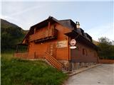 2
2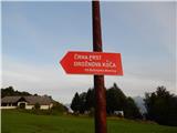 3
3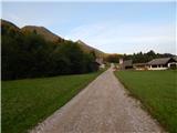 4
4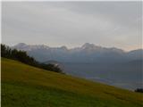 5
5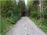 6
6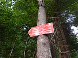 7
7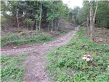 8
8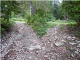 9
9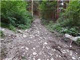 10
10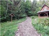 11
11 12
12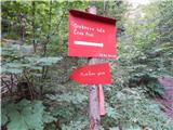 13
13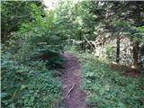 14
14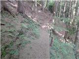 15
15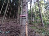 16
16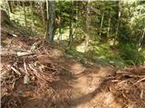 17
17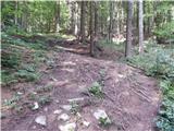 18
18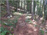 19
19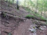 20
20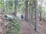 21
21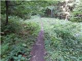 22
22 23
23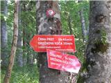 24
24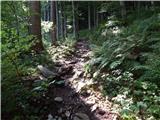 25
25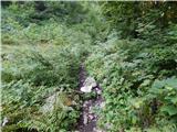 26
26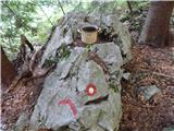 27
27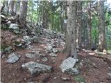 28
28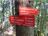 29
29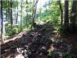 30
30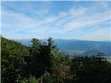 31
31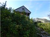 32
32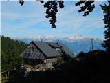 33
33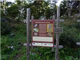 34
34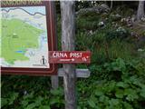 35
35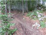 36
36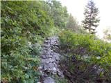 37
37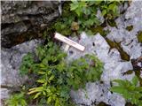 38
38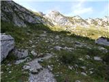 39
39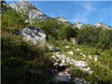 40
40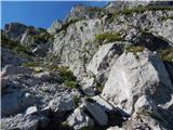 41
41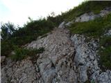 42
42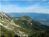 43
43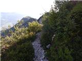 44
44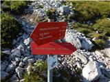 45
45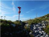 46
46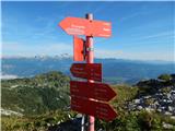 47
47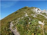 48
48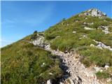 49
49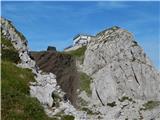 50
50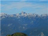 51
51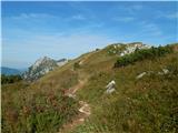 52
52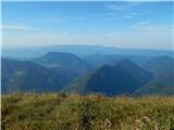 53
53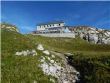 54
54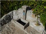 55
55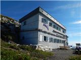 56
56 57
57 58
58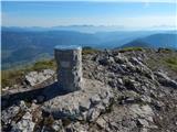 59
59 60
60
Discussion about the trip Ravne - Črna prst (via Orožnova koča)
Show older messages
|
| ROBERT22. 08. 2006 |
Very nice winter hut. At the top a lake awaits us that freezes in winter and you can play hockey.
|
|
|
|
| Gost26. 08. 2006 |
If you two were great experts on Črna prst in winter, you could see that the lake or puddle is inflated with snow. It's a small hill, I hope it won't be too steep for you for sledding.
|
|
|
|
| Gost13. 09. 2006 |
whoever had the privilege these days to be in Garah, no matter how demanding the tour, calls it torture... I have no words. The only torment and unpleasantness is the shouting and crowds rolling along the paths leading to Triglav. For Črna prst I claim that the path itself and that view are pure pleasure.
|
|
|
|
| Gost7. 10. 2006 |
I like reading comments where friendliness is emphasized. Sniping is unbecoming for a mountaineer.
Ju hu, autumn is here, larches yellowing and like golden mountains praying to the sky.
Best regards to all from mountaineer Irma, who is lounging a bit in the valley. Write pleasant moments for my amusement.
|
|
|
|
| bazo16. 07. 2007 |
the view of Triglav and Lake Bohinj is pure poetry
|
|
|
|
| Parkeljc22. 05. 2010 |
I set off for Črna prst on 20.5.2010. Orožnova hut.
It took me somehow less than an hour to Orožnova. From there the path on the slope is to some extent snow-free. I crossed only 9-10 shorter snow fields, then after a few meters of descent I reached a basin, and in front of me appeared a huge snow field, about 200 m long, above which loomed the sheer north face of Črna prst. Since I had taken less than an hour to Orožnova hut, from there on everything turned upside down. After a short orientation and searching for the direction, I spotted a nice mark in front of me and it really relieved me, the next one I saw only right under the vertical face, which gave me new will to continue. The snow field narrowed towards the top, at the end it was about 5 meters wide and the ascent already quite enviable 45%!!! and given the still quite hard snow, I had great trouble crossing it. Not to mention the smaller rocks that were already lying in the snow below, and two stones, if not already rocks (size of a good fist) flew past me, my gaze more and more frequently searched when something would hit me. The path to the ridge is still quite snowy. From the saddle over Suho to the Z. Jelinčič hut the path was a piece of cake, I crossed only a huge snow field, I really don't know where it came from, as it starts on the ridge and falls down the grassy slope on the sunny side, about 30 m long, 10 wide and with a snow cover of a good meter!
I have to admit that the snow field under the north face really exhausted me, as at the beginning it was quite southern snow and it was mushy, higher up the steepness increased, the snow became harder and more dangerous for slipping. Therefore crampons are still useful, of course helmet. But on the saddle of the ridge it was blowing so hard that I had to drop to my knees twice so it wouldn't throw me to the ground. From Orožnova to the top I took 1.15 hours, total good 2 hours.
The weather at the top was nice, partly clear..
I advise against the ascent for those inexperienced with snow or still unprepared..
|
|
|
|
| Kozorog22. 05. 2010 |
Parkeljc, too bad you didn't write this under current conditions, then probably more climbers would read you... It must be known that the ascent to Črna prst in winter conditions is among the more demanding ascents. As long as there is snow and that in such quantity there still is, full winter gear is needed and due to fragility also helmet. A day before you I was also on Črna prst via the same path. I must say that what bothered me most was that for safety when crossing the snow field it was necessary to put on and take off crampons several times, until you reach the vast snow field under Črna prst. The ascent is of course dangerous at this time for all who set out without the necessary equipment and of course at least minimal knowledge!
|
|
|
|
| heinz28. 01. 2011 |
Does anyone know what the conditions are like at the moment?
|
|
|
|
| Enka3. 07. 2011 |
Nice path leading past two extremely pleasant and friendly huts.
|
|
|
|
| sodnick26. 12. 2011 |
Today my colleague and I went on this path. Beginning snow-free, snow from 1200 onwards. Path to Orožnova koča is snowy, snow is hard and icy. No one had gone ahead of us further. Snow is completely icy and very dangerous for slipping. Crampons and ice axe mandatory, so we turned back as we didn't have everything with us. LP
|
|
|
|
| Lunatic12. 01. 2012 |
I'm tempted for Saturday  Has anyone been recently Has anyone been recently  What are the conditions like past Orožnova and past Osredka What are the conditions like past Orožnova and past Osredka
|
|
|
|
| Lunatic9. 03. 2012 |
Does anyone know what the conditions are like from Orožnova towards Lisec or from Orožnova along the ridge of Črna gora and then to Črna gora
|
|
|
|
| Ajda_Zitnik3. 06. 2012 |
I walked the trail today. In today's conditions extremely wet, and under the wall above Orožnova koča there is still a small snow patch where more cautious steps are needed.
|
|
|
|
| slamca6. 06. 2012 |
Hello. Does anyone perhaps know if the hut is open at the end of the week? Thanks for the answer.
|
|
|
|
| Laščan6. 06. 2012 |
Check here-(Mountaineering Association Bohinjska Bistrica, caretakers Andreja and Slavko Šivec, 041 428 223)-otherwise on PZS pages info-open OSNP
|
|
|
|
| CarpeDiem24724. 06. 2012 |
Today my colleague and I drove by car from Boh. Bistrica past Nemški Rovt and then exactly 3km from Rovt the path to Orožnova koča branches sharply right. We continued following the signs to Orožnova koča and parked at the last possible option for Črna Prst (altimeter showed 1155m). From there it was another good 20 minutes to the hut, later about 1.5 hours to the top of Črna Prst (with quite some photography, lunch etc. in between), anyway this time should not be taken as reference. We didn't see any snow on the path, not even enough to make a single snowball!
|
|
|
|
| GregorC25. 06. 2012 |
CarpeDiem thanks for this info. I often drive from Boh. Bistrica towards Soriska planina and those narrow paths to Orožnova koča always intrigued me. Especially how it's marked further and what the path is like. Now I have to go check it out.
|
|
|
|
| Matjaz_6530. 07. 2012 |
some photos from the circular route to Črna prst ... with ascent via Planina za Lišcem and descent via Planina za Črno goro 
|
|
|
|
| velkavrh12. 03. 2014 |
I'm wondering if anyone has hiked from here to Črna prst in the last few days. Is it trodden?
|
|
|
|
| velkavrh20. 04. 2014 |
No one responded! So I'm asking again! Was Črna prst snow-free those days?
|
|
|
|
| miri20. 04. 2014 |
There is still snow, at least on the southern side.
|
|
|
|
| peter220. 04. 2014 |
The fact that there is still over 2 meters of snow on nearby Vogel already indicates that it's similar on the northern side of Črna prst.
|
|
|
|
| KAZA19. 05. 2014 |
Has anyone been around recently? How is the snow?
|
|
|
|
| Pi_is_exactly_320. 05. 2014 |
Snow starts from Orožnova koča onwards. The top of Lisca is still white too.
|
|
|
|
| roky balboa21. 05. 2014 |
Picture no. 2 says the trail is closed due to avalanche, I don't know how it is in reality, I went via Črna gora.
|
|
|
|
| serift25. 06. 2014 |
The path in picture no. 2 is closed due to disturbed terrain and fallen trees (only between the two roads), a new path to Orožnova koča is rerouted and marked, namely go past Dom dr. J. Mencingerja on the path towards Planina Črna gora, after a few minutes the path branches right and leads to the road where it joins the old path to Orožnova koča. The path is marked and trodden.
|
|
|
|
| Jst_Me26. 06. 2014 |
There is practically no snow left. The problem is that a patch of snow remains on the steepest part of the ascent, somewhere near picture no. 20. We all had some trouble there today. But it will probably melt quickly. Otherwise the path is excellent, the owner of the former Mencingerjev dom is exceptionally friendly. Apart from occasional fog, the weather was almost ideal. No heat.
|
|
|
|
| malimiha4. 05. 2015 |
Hello, I'm interested if anyone has hiked there recently and if the trail is dry. thanks and best regards
|
|
|
|
| Ajda_30. 05. 2016 |
Has anyone recently gone up this trail to Črna prst? What are the conditions like?
|
|
|
|
| Pelca5. 09. 2016 |
Does anyone perhaps know if Orožnova koča is open on weekends in September?
|
|
|
|
| slavkoo25. 09. 2016 |
Today I set off on this path. Steep, extremely slippery, actually dangerous for slipping, especially on the return. Some wire rope a few hundred meters below the saddle would be very welcome. And this too: Orožnova koča should be open according to various internet data, while Jelinčičev dom at Črna prst is closed. Surprisingly, the latter was open, Orožnov dom closed at least from 13:50 onwards.
|
|
|
|
| ločanka26. 09. 2016 |
slavkoo, I never thought that a cable would be needed there. There are countless such places on the trails
|
|
|
|
| slavkoo27. 09. 2016 |
ločanka, in dry weather probably not really, but on an ice rink like it was on Sunday morning the idea of a few-meter cable would probably occur to you. (especially on descent).
|
|
|
|
| PINOKIO27. 06. 2017 |
We have this trail planned with a friend in the coming days. Can someone give some recent information about the trail? I'm mainly interested in:
- is the trail well marked,
- is it passable or is some additional equipment needed... I'll appreciate all information and thank you in advance.
Safe steps to all hikers.
|
|
|
|
| Enka27. 06. 2017 |
The trail is well marked, but it doesn't hurt to have this description with you (I always carry a map personally). Just below the saddle there's a short section (a few steps) on rocks where you might need to use your hands a bit, but in dry conditions really nothing special. A steel cable didn't even occur to me there. In wet conditions it might be a bit harder. Last year there was still snow there (I don't think there could be any this year), had to bypass it on wet rocks and it was a bit tricky. Then at the top I preferred to descend via Planina za Črno goro - also because I didn't know this trail before (it's nice too) and because I like to do loop trails when possible.
|
|
|
|
| UB7728. 06. 2017 |
The trail is excellently marked (praise to PD Bohinjska Bistrica), without features and passable without problems. Only if you start after rain, in the lower part it can be a bit slippery, but nothing serious. Also worth mentioning is the pleasant hut warden at Orožnova koča!Lp
|
|
|
|
| Enka3. 06. 2018 |
Why a new path, does anyone know? Is the old one just unmarked or is there also some passability issue?
|
|
|
|
| goresolepe3. 06. 2018 |
The problem is with safe passability
|
|
|
|
| Enka3. 06. 2018 |
Why, did the path collapse somewhere or what? After two years I'm heading to Črna prst again, and this surprised me a bit.
|
|
|
|
| goresolepe4. 06. 2018 |
You go by the marked path and everything will be fine. If you intend to go via the upper road, I tell you that at Kobla a forestry cableway is set up and from there onwards it's not possible by car. Otherwise call the caretaker of Orožnova koča (051 442 550)
|
|
|
|
| Enka4. 06. 2018 |
Oh, thanks for the info. I planned to start from Ravne, but since I'll be tight on time, those extra 20 minutes are a bit too much this time . .
|
|
|
|
| mpogac28. 10. 2021 12:23:32 |
Hello.
I'm interested in what the conditions are like on this path and if the hut is still open by chance, we would go tomorrow (Friday) or the day after. Thanks
|
|
|
|
| andraja28. 10. 2021 21:08:00 |
The path is good and marked. The hut is open from Thursday to Sunday every weekend.
|
|
|
|
| darinka428. 05. 2022 13:19:17 |
Snow has melted. About time. Yesterday rain spared us. Just humid to Orožnova koča. Then steeply to Lišca. And along ridge to Črna prst. First time on this path. Don't know when last saw viper coiled on path. And ready to strike. Renato watched it. Then viper decided to retreat home. Cooled on Črna prst. Descent to Podbrdo on known path. Nice hike with 1400m ascent and 16km.
|
|
|
|
| nommi4. 07. 2023 07:50:15 |
Hello.
Does anyone know how parking is at Gostilna Janez in Ravne? Is the parking lot paid or not?
Thanks for the answer
|
|
|
|
| nina48. 07. 2023 18:34:05 |
|
|
|
|
| Enka9. 11. 2025 21:27:55 |
The "old" path is marked again.
|
|
|
|
| montena7. 06. 2026 07:54:24 |
Hello, does anyone know when the most flowers can be seen?
|
|
|
|
| miri7. 06. 2026 11:59:07 |
When they bloom.
|
|
|
To post a comment you must log in:
If you do not yet have a username, you must first
register.