Starting point: Ravne (735 m)
| Latitude/Longitude: | 46,25860°N 13,95920°E |
| |
Walking time: 2 h 20 min
Difficulty: easy marked way
Elevation gain: 780 m
Elevation difference along the route: 800 m
Map: Škofjeloško in Cerkljansko hribovje 1:50.000
Recommended equipment (summer):
Recommended equipment (winter): ice axe, crampons
Views: 3.258
 | 1 person like this post |
Access to starting point:
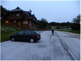
From the highway Ljubljana - Jesenice, we take the exit Lesce and follow the road towards Bled and further towards Bohinjska Bistrica. From Bohinjska Bistrica, we continue left in the direction of Tolmin and Soriška planina. Soon we will notice by the road the mountain markers for Črna prst, which point towards the right, but we continue straight. Only a little later, we come to a crossroads, where a signpost directs us slightly to the right towards the village Ravne. Further, we drive past a large parking lot by the ski slope Kobla, but we follow the asphalt road, which starts ascending steeply, to Ravne, where the road flattens. Here we continue to drive all the way to the spot where the asphalt ends. At the spot where the asphalt ends, there is a larger parking lot by inn Janez, where we park on the right side of the parking lot (the parking lot on the left side of the road is intended for guests of the inn Janez).
Route description:
From the parking lot at the inn Janez we continue in the direction of Črna prst and mountain hut Orožnova koča, where at first we walk on a macadam road, from which a beautiful view opens up towards Triglav. The road after the initial ascent passes into the forest and turns a little to the left, where we quickly arrive at a marked junction.
From the junction we continue left in the direction of Črna prst, mountain pasture Planina za Črno goro and mountain hut Orožnova koča (straight Bohinjska Bistrica and old path towards Orožnova koča). The path ahead on the right side bypasses a private house (formerly mountain hut Planinski dom dr. Janeza Mencingerja), then a little further it joins a cart track, on which we continue the ascent. A little higher, at the junction we continue right, then the path continues through the forest. A little further the path leads past a log cabin and a cross, then we already arrive at a marked junction, where we continue left (right Orožnova koča).
Further, the cart track changes into a footpath, which a little higher brings us to a forest road, which we follow to the right. We walk a few steps along the road, then the markers for Črna prst direct us left onto a steep path. We continue the ascent on an initially relatively steep path, which further leads past man-made channels intended for water drainage (the channel was built to prevent water intrusion into the Bohinj tunnel). Higher, the path temporarily flattens completely, then moderately ascends to the mountain pasture Za Črno goro.
When we step onto the mountain pasture, the marked path turns to the left, then semicircularly bypasses the mountain pasture along the channel. On the other side of the mountain pasture we continue left and begin to moderately ascend through initially sparse forest. After a few minutes of further walking the path passes into the forest and brings us to a marked junction, where we continue straight in the direction of Porezen (sharply right Črna prst).
The path ahead moderately ascends for a few more minutes, then brings us to a small saddle Na Kalu.
Here an unmarked shepherd path branches off to the right, which crosses the southern slopes of the lower Bohinj mountains, while we continue slightly to the left and ascend to the edge of the ski slope Kobla. When we reach the edge of the ski slope we continue right, then ascend right below the summit of Krevl. Right below the summit the marked path turns to the left, and on the right side we look for a poorly trodden path, on which in a few steps we ascend to the panoramic summit.

The trip can be extended to the following destinations: Črna prst
Photos:
 1
1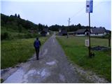 2
2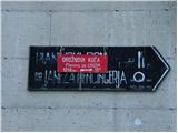 3
3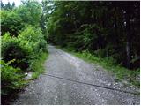 4
4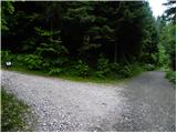 5
5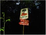 6
6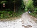 7
7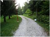 8
8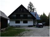 9
9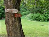 10
10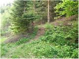 11
11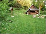 12
12 13
13 14
14 15
15 16
16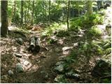 17
17 18
18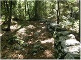 19
19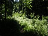 20
20 21
21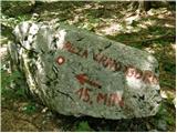 22
22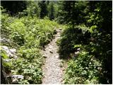 23
23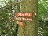 24
24 25
25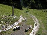 26
26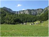 27
27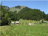 28
28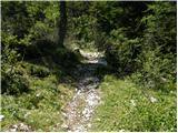 29
29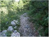 30
30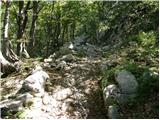 31
31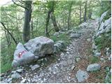 32
32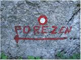 33
33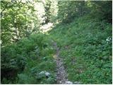 34
34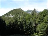 35
35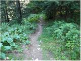 36
36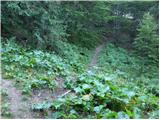 37
37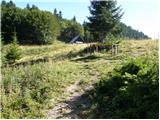 38
38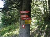 39
39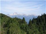 40
40 41
41 42
42 43
43
Discussion about the trip Ravne - Krevl
To post a comment you must log in:
If you do not yet have a username, you must first
register.