Ravne na Koroškem - Pokeržnikov vrh (via Šteharski vrh)
Starting point: Ravne na Koroškem (384 m)
| Latitude/Longitude: | 46,54640°N 14,96400°E |
| |
Route name: via Šteharski vrh
Walking time: 3 h 15 min
Difficulty: easy unmarked way
Elevation gain: 671 m
Elevation difference along the route: 850 m
Map: Koroška 1:50.000
Recommended equipment (summer):
Recommended equipment (winter): crampons
Views: 978
 | 1 person like this post |
Access to starting point:
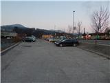
A) From the road Slovenj Gradec - Dravograd, from the larger roundabout take the exit in the direction of Ravne na Koroškem, then drive towards the mentioned place. When we arrive in Ravne na Koroškem, behind the Petrol gas station, at the intersection where the Spar store is situated on the right, turn left onto the marked free parking lot, where we park by the river Meža.
B) From Črna na Koroškem or through the border crossing Holmec drive to Prevalje, from where we continue driving towards Dravograd. When we arrive in Ravne na Koroškem, at the Spar store, which we notice on the left side, turn right onto the asphalted parking lot, which is located between the main road and the river Meža.
Route description:
From the parking lot first at the pedestrian crossing carefully cross the quite busy main road, then continue on the sidewalk in the direction towards Dravograd. Behind the Petrol gas station continue left onto the road, where at the underpass under the railway track we notice the first signs for Šteharski vrh. After the underpass continue right in the direction of Malgajeva pot and steeply ascend the stairs. The stairs end quickly, and when at the hayrack we reach the macadam road we follow it right to the nearby residential house, where signs direct us left under the high-voltage power line route. Follows a quite panoramic walk under the power line, then the path splits.
We continue left (right Malgajeva pot), then on the right side bypass the nearby house and farm building, behind which we cross a macadam road. Follows an ascent through the forest, where at junctions we follow the quite frequent blazes. Higher the path brings us to a panoramic grassy slope, from which a nice view opens towards Uršlja gora and Peca. Somewhat above the nearby chapel the path from the tourist farm Spodnji Lečnik joins from the right, after the junction we also bypass the homestead on the right side.
Follows a short ascent on the asphalt road, then signs for Šteharski vrh direct us left into the forest. Through the forest we ascend more steeply for some time, then reach the macadam road, along which we continue to the farm Šteharnik, which we bypass on the left side. We continue on the cart track, initially with nice views on the Koroška hills, then the path enters the forest. Follows a few more minutes of moderate ascent and the mostly forest path brings us to Šteharski, or Šteharnikov vrh.
From the top we return a few steps back, then continue right on the unmarked cart track, along which we begin to descend towards the west to northwest. After a few minutes of descent we reach the junction of macadam roads, we continue on the slightly left road (sharply left Ravne na Koroškem, slightly right we can arrive in Libeliče, sharply right church of St. Cross). Follows a gentle ascent on the macadam road, which leads us past two shrines, then with nice views we arrive at the junction, where slightly right branches the path to the hamlet Šteknija, we continue slightly left on the lower road, which for some time still leads us with nice views on the Koroška mountains, then the road enters the forest, when the forest temporarily thins we reach the hunting cottage Strojna.
Behind the cottage the road returns to the forest and initially still crosses the slopes of Šteknetov vrh, then the slopes of Trotov vrh. Follows some successive junctions, where we continue straight, then past Trotov križ (triangular chapel with saints depicted on frescoes) we arrive at the next junction at the NOB monument, where we continue slightly left towards Strojna (slightly right Libeliče).
The path further brings us out of the forest and continues to lead with nice views on Uršlja gora and other surrounding peaks. Higher we also pass the farm Požeg or the estate Kupnik, after a few more minutes of walking we arrive at the farm Janež, which is an exceptional example of vernacular architecture from the 17th century.
At the farm, where a well-preserved black kitchen is preserved, continue slightly right onto the cart track, which ascends transversely above the road (straight along the road church of St. Urh). Higher the path leads us through a strip of forest, when the forest ends we quickly walk to the nearby Pokeržnikov vrh, from which a nice view opens.
Ravne na Koroškem - Šteharski vrh 1:45, Šteharski vrh - Pokeržnikov vrh 1:30.
Description and pictures refer to the condition in the year 2018 (March) and 2019 (February).

Photos:
 1
1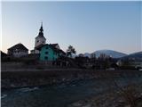 2
2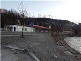 3
3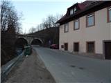 4
4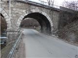 5
5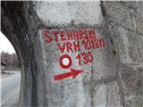 6
6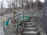 7
7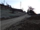 8
8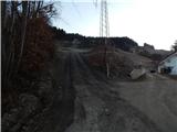 9
9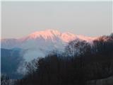 10
10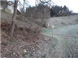 11
11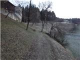 12
12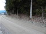 13
13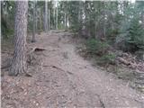 14
14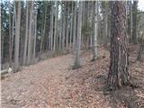 15
15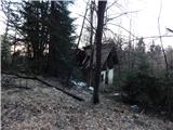 16
16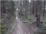 17
17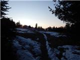 18
18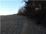 19
19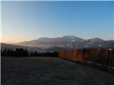 20
20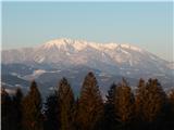 21
21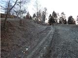 22
22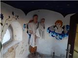 23
23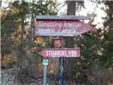 24
24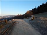 25
25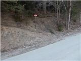 26
26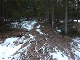 27
27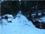 28
28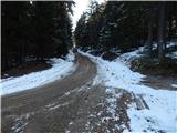 29
29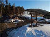 30
30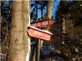 31
31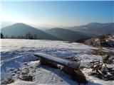 32
32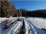 33
33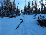 34
34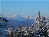 35
35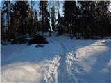 36
36 37
37 38
38 39
39 40
40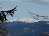 41
41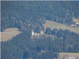 42
42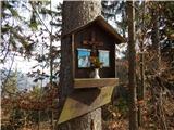 43
43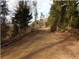 44
44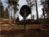 45
45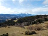 46
46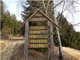 47
47 48
48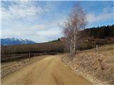 49
49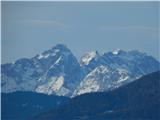 50
50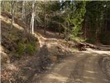 51
51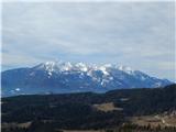 52
52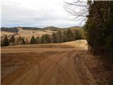 53
53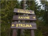 54
54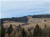 55
55 56
56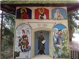 57
57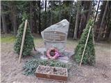 58
58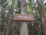 59
59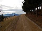 60
60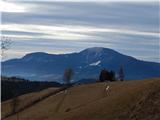 61
61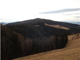 62
62 63
63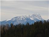 64
64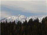 65
65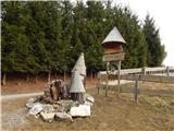 66
66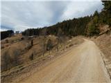 67
67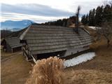 68
68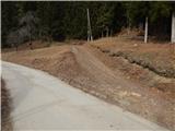 69
69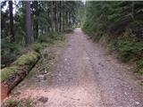 70
70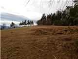 71
71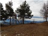 72
72 73
73 74
74
Discussion about the trip Ravne na Koroškem - Pokeržnikov vrh (via Šteharski vrh)
To post a comment you must log in:
If you do not yet have a username, you must first
register.