Ravne - Orožnova koča na planini za Liscem
Starting point: Ravne (735 m)
| Latitude/Longitude: | 46,25860°N 13,95920°E |
| |
Walking time: 1 h 45 min
Difficulty: easy marked way
Elevation gain: 611 m
Elevation difference along the route: 633 m
Map: TNP 1:50.000
Recommended equipment (summer):
Recommended equipment (winter): ice axe, crampons
Views: 71.486
 | 3 people like this post |
Access to starting point:
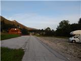
From the highway Ljubljana - Jesenice we take the exit Lesce and follow the road towards Bled and further towards Bohinjska Bistrica. From Bohinjska Bistrica we continue left in the direction of Tolmin and Soriška planina. Soon we will notice by the road the mountain signposts for Črna prst, which point to the right, but we continue straight. Only a little later we come to a crossroads, where a signpost directs us slightly to the right towards the village Ravne. Further we drive past a large parking lot by the ski slope Kobla, but we follow the asphalt road which starts to ascend steeply to Ravne, where the road flattens. Here we continue to drive all the way to the spot where the asphalt ends. At the spot where the asphalt ends there is a larger parking lot by the inn Janez, where we park on the right side of the parking lot (the parking lot on the left side of the road is intended for guests of the inn Janez).
Route description:
From the parking lot at the inn Janez we continue in the direction of Črna prst and Orožnova koča, where at first we walk on a macadam road, from which a beautiful view opens up towards Triglav. The road after the initial ascent passes into the forest and turns a little to the left, where we quickly arrive at a marked junction.
From the junction we continue left in the direction of Črna prst, Planina za Črno goro and Orožnova koča (straight Bohinjska Bistrica and old path towards Orožnova koča). The path ahead on the right side bypasses a private house (formerly Planinski dom dr. Janeza Mencingerja), then a little further it joins a cart track, on which we continue the ascent. A little higher, at the junction we continue right, then the path continues through the forest. A little further the path leads past a log cabin and a cross, then we already arrive at a marked junction, where we continue right in the direction of Orožnova koča (left Planina za Črno goro).
The path then crosses slopes a little to the right, meanwhile it also descends noticeably. When the descent ends, from the right an old path joins us, which is a little shorter, but officially no longer marked. Next follows walking on a forest path, where we cross a few cart tracks, at the marked junction we continue on the right path. A few minutes higher we reach a forest road, which we only cross (right Orožnova koča via drči).
A relatively steep ascent through the forest follows, higher from the right a somewhat longer path via drči joins us.
We continue left and in a few minutes we arrive at Orožnova koča on Planina za Liscem.
Description and pictures refer to the condition in the year 2017 (August).

Photos:
 1
1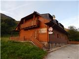 2
2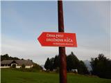 3
3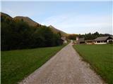 4
4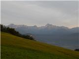 5
5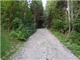 6
6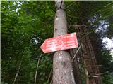 7
7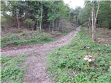 8
8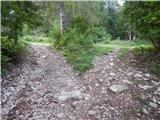 9
9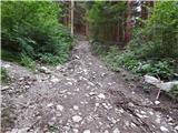 10
10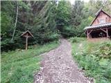 11
11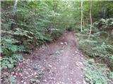 12
12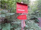 13
13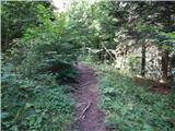 14
14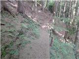 15
15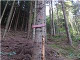 16
16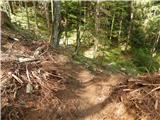 17
17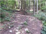 18
18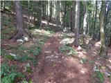 19
19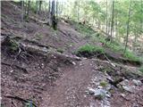 20
20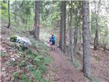 21
21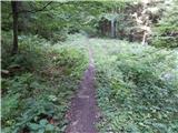 22
22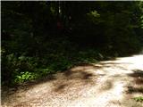 23
23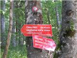 24
24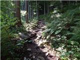 25
25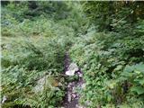 26
26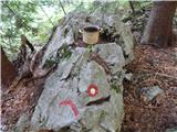 27
27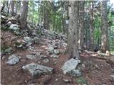 28
28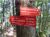 29
29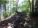 30
30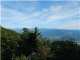 31
31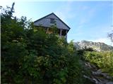 32
32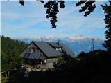 33
33
Discussion about the trip Ravne - Orožnova koča na planini za Liscem
|
| Gost26. 10. 2007 |
The trip is superb, I recommend extending it to Črna prst. J. Mencinger's hut is a private house. Dejo Dejo
|
|
|
|
| Gost27. 10. 2007 |
It's also nice to know that the first SDP hut stood at the same place, built by Orožen himself (I think he was a vicar) with his friends. All other huts of that time were under Austrian command. If it was different, please correct me, or add something useful
Lp Matej
|
|
|
|
| Slavc5110. 01. 2010 |
INVITATION - TRIP TO OROŽNOVA HUT
I would like to introduce you to the hut, which is suitable for day or two-day trips. Since this is our first Slovenian hut, I think young people should get to know it. The hut was completely burned down and rebuilt four years ago. Given that it is quite new, it offers comfortable and friendly accommodation both in the dining-day rooms and on the nicely arranged common bunks. The hut can accommodate 26 people, who are also well served upon prior arrangement, as the hut has cooking and serving facilities in the lower room.
Orožnova hut is located in the Julian Alps at an altitude of 1338m and offers magnificent views of the entire chain of Pokljuka and Triglav mountains.
A well-marked trail takes you, after parking at the middle station of the Kobla ski resort in Bohinjska Bistrica, through the forest in 1 hour and 30 minutes to the hut. From here, further hikes are possible to Črna prst-1832m (1 hour 15 min), planina Osredki-1400m (1 hour), planina za Črno prstjo-1340m (1 hour 30 min) and Lisec peak (1 hour).
If you decide to visit in somewhat later spring days, you can view a small alpine arboretum of native plants, including the unique Alpine pasqueflower.
I invite you to see other attractions on the website www.hribi.net (Orožnova koča) or call me on GSM 041 479190 or 051 422550 Andreja Šivec
I will be happy for every call and visit from you.
Andreja Šivec
|
|
|
|
| nisa11. 01. 2010 |
Does this invitation to visit Orožnova hut mean that the hut is open also in winter time, e.g. on Saturdays and Sundays, or only by prior arrangement.
Greetings to all hikers and safe steps this year.
|
|
|
|
| Slavc5125. 01. 2010 |
I inform all hikers that the path from Ravne-middle station of the Kobla cable car to Orožnova koča is very well trodden and a nice snow trench has been made, so access to the hut is unproblematic.
|
|
|
|
| Slavc5125. 01. 2010 |
The hut is generally open on nice weekends-this Saturday 30.1 it will definitely be open (not on Sunday-but also the next weekend all three days including the holiday so 6.2.,7.2 and 8.2. I suggest you call 041 479190 or 051 422550. I recommend a visit.
|
|
|
|
| peter225. 01. 2010 |
Of the hikes you mention, planina za Črno prstjo (1.30 min) is also listed. You probably meant planina za Črno goro. Otherwise, Orožnova koča is not exactly the starting point for that planina, it's easier to head there already from the upper road or take it as a return from Črne prsti.
The alpine pasqueflower does not bloom in the spring months yet. We find it in the most beautiful colors in the last days of July and in August.
Nice and commendable that the hut will be open on nice winter weekends. See you!
|
|
|
|
| Slavc5127. 01. 2010 |
I'm glad you follow the comments. I'm really glad that you correct my mistakes and I apologize for them. As you know, a person learns throughout life.
See you at the hut.
Andreja
|
|
|
|
| dogna28. 01. 2010 |
I'm very glad that the hut keeper informs us about her hut like this. This way you really see that you are welcome in the hut. It is really nice and everyone is very friendly. For winter conditions, for us who don't like ice and danger, the path to the hut behind Lisec is just super. See you. It would be great if other hut keepers also make an effort and inform us in this way about the situation in the huts. Best regards.
|
|
|
|
| peter28. 02. 2010 |
A promise is a debt, so today we visited Orožnova koča and met the new friendly caretakers. Since the path to the hut runs in the shade, it's nice to enter the warm hut. It's also possible to get something to eat.
Below the hut there was fog, above it a nice sunny day. Snow depth around 70 cm and quite wind-blown.
With snowshoes we went only about 100 vertical meters higher, where on a sunny clearing we enjoyed the virgin snow whiteness. Due to the fresh and unsettled snow, we advise against visiting nearby peaks!!
A few photos here: http://www.petersfoto.si
|
|
|
|
| Mihc809. 02. 2010 |
Hi everyone. 
My girlfriend and I also headed towards Orožnova koča on Saturday 6.2. We were staying in Bohinjska Bistrica, but since the weather wasn't suitable for skiing, we went a bit into the hills. The intention was just to stretch our legs a bit, but since it was possible to walk nicely on the packed trail (slightly covered with a few centimeters of new snow), we went all the way to the hut. There, to our surprise, we found open doors, a warm room, even warmer tea and a very pleasant atmosphere chatting with Slavc and (I think) Andreja . The hut is really nicely finished, so spending a weekend in it or its surroundings is a real experience.
The trip is unique, the trail (even in snow) is not too difficult, because the caretakers "take care" of the first track on Fridays (at least it was like that for us).
With crampons and poles it's a nice trip, and if you have snowshoes as well, they save some energy before the hut.
Best regards,
Miha
|
|
|
|
| savka11. 02. 2010 |
Our group also spent half a day in the hut - yes, half a day, because the caretakers are so pleasant that time flies. We were nicely served, the hostess made an extraordinary effort! It was pleasant to talk to them, because they are not just caretakers - innkeepers, but real mountaineers who gave us a lot of advice about our further "adventures". They have walked everything lengthwise and crosswise - it's worth asking them for advice. The atmosphere is really homely, pleasant, they took care of the path - made the track, they really make an effort - all praise! Hope to see you again soon
|
|
|
|
| Slavc5113. 02. 2010 |
Today the path from Ravne to the hut is newly trampled, at the hut the sun awaits you already at 11. We will definitely be at the hut this and next weekend. We look forward to you.
Andreja Hey, thanks for all the encouraging praise.
Andreja
|
|
|
|
| Slavc5113. 03. 2010 |
Today freshly walked the path from the valley all the way to the hut. Otherwise about 1.5 meters of snow, sun, so what are you waiting for.......
|
|
|
|
| Slavc5127. 04. 2010 |
The hut will also be open on 1st and 2nd May.
|
|
|
|
| olđi3. 05. 2010 |
On 24th and 25th April we had a great time at Andreja and Slavc, the new caretakers of Orožnova koča. We were a group of 16 people and they served us divine buckwheat žganci with all meat and vegetable side dishes. We also drank well. Otherwise, we had to be careful as there was still quite a bit of snow on the way to the top and it was sinking in well. Up top ... uff sun, some clouds, black soil like on the palm of your hand. We slept over and the beds were really good, quite luxurious for a hut. The next day was great. So, the path is well trodden, the snow will probably melt quickly. Worth it
|
|
|
|
| maremw22. 05. 2010 |
today we went past the hut (and inside of course) to Črna prst. snow towards the top in some places. no need to use crampons. we returned via another path past Črna gora. beautiful trip, weather great for hiking
|
|
|
|
| Kriška23. 05. 2010 |
I don't understand anything . On 20.5. Parkeljc went on this path (see the trip comment below), and he described the current conditions completely differently. . On 20.5. Parkeljc went on this path (see the trip comment below), and he described the current conditions completely differently. 
|
|
|
|
| Kozorog23. 05. 2010 |
Kriška, check the forum current conditions under "Črna prst" post by GITE from 19.5.2010, there are pictures too... maybe that's the best.. but it's like this, if the morning is cooler the snow is always hard and sometimes icy... and then there's another entry but without pictures... they are further down so you don't see them on the first page.. lp
|
|
|
|
| Kriška23. 05. 2010 |
Yes, well... Of course I saw Gite's description too, which matches pretty well with what Parkeljc wrote. This one I commented on differs quite a bit from both.
|
|
|
|
| Kozorog23. 05. 2010 |
maybe the snow miraculously disappeared....
|
|
|
|
| Slavc516. 12. 2010 |
After a long time reporting again: it's winter and around the hut more than 1m snow. A fairly solid track leads to the hut, so ascent is possible even in such conditions. Definitely call the GSM before ascending to check if the hut is open. It was open this weekend, and on New Year's Day 1.1.2011 too.
|
|
|
|
| Pohodnica565. 03. 2011 |
Today in beautiful weather I went up. Traces of footsteps are still there, but there's quite a bit of new snow. The path is still clearly visible. Met only one hiker who overtook me, well, younger with more stamina. Hut closed. Based on the posts, I would expect it to be open, otherwise they also said in Ravne that it's closed almost all winter.
On the window by the entrance door stands a small bottle of homemade brandy, a pleasant surprise, to "tie the soul". Further towards Črna prst nothing is trodden, no one has gone that way in recent days. But the day was beautiful, no crowds and above all lots of peace.
|
|
|
|
| velkavrh16. 06. 2011 |
Today in the morning I passed by this hut on the way to Črna prst. About ten years ago I passed by here for the last time and I really remember the modest shepherd's hut under the hut, which is still unchanged today. The hut was rebuilt in 2004, it burned down in 1944. Nice that they built it again, because it was the first hut of the Slovenian Alpine Association built before 1900. Today it was not open, but it should open tomorrow. The biggest attraction is the arboretum of native alpine plants, emphasis on roses. The arboretum is arranged along the path to Črna prst about twenty minutes further. You will find individual plaques with plant names from monkshood to marsh marigold. They are mostly blooming. Monkshood blooms later, we recognize it by its large leaves. For botany enthusiasts, this is a wonderful thing. Such an arboretum can also be found only at Veliko polje under Vodnikova koča.
|
|
|
|
| jprim17. 06. 2011 |
You mean the one above the hut, a bit higher, if that's what you mean..., there are only remnants of faded signs left, in short last year when I climbed a bit over this garden, there was nothing to see.
Best regards!
|
|
|
|
| peter217. 06. 2011 |
One botanical trail is in the valley, on the hill Goričica by the Danica camp, the second under Črna prst along the path from Orožnova koča, the third is planned on Veliko polje, but I don't know if it has been set up yet.
|
|
|
|
| jprim17. 06. 2011 |
This botanical garden above the hut, where a TV show was also filmed, I watched it too, it's not long, at least that's what the hostess of Vodnikov dom said, but last year they no longer maintained it.
|
|
|
|
| velkavrh17. 06. 2011 |
The condition in the natural arboretum is completely fine. An example of a flower with a plaque is on the forum under Julijci-Črna prst. All plaques are clearly visible. It didn't seem neglected to me at all.
When I was at Vodnikova koča last year, there was a panel in front of the hut inviting to view the arboretum. In about a week I will also head to Vodnikova koča and will definitely check it out.
|
|
|
|
| lučo22. 08. 2011 |
Mountain hut worth visiting; tidiness, friendly staff, location, offer,...
|
|
|
|
| andrejcica26. 04. 2012 |
I inform all hikers that the hut will be open from 27.4.2012 to 2.5.2012 inclusive.
Visit us, you might not regret it.
Andreja and Slavc
|
|
|
|
| Irina26. 04. 2012 |
Thanks for the invitation.
|
|
|
|
| peter21. 05. 2012 |
Today we responded to the invitation to Orožnova koča. But we chose a somewhat unusual  approach from planina Za Črno goro, over the saddle at Homah, towards planina Za Liscem. Apparently an old path used to lead there, which we followed only a few meters on the western side in the forest. Otherwise, it's steep pathless terrain. approach from planina Za Črno goro, over the saddle at Homah, towards planina Za Liscem. Apparently an old path used to lead there, which we followed only a few meters on the western side in the forest. Otherwise, it's steep pathless terrain.
In the hut, it was as usual very pleasant.
A few pictures: http://www.petersfoto.si
|
|
|
|
| velkavrh24. 04. 2014 |
Yesterday I went to Planina Za Liscem. The path is closed at Mencigerjevi dom, at least that's the notice. Why it's like that you can read on the Forum under Miscellaneous-Slovenian mountains in all seasons. Current conditions on the path are also described there. On the planina, in the forest before the planina and on Črni prsti itself there are still full winter conditions.
|
|
|
|
| mmcajna30. 04. 2014 |
Velkavrh, can you tell me what the conditions are like from Podbrd via Črno prst to Orožnova koča? I'd like to go there tomorrow. I'm just afraid of avalanches on the north side. Thanks for the answer Majda.
|
|
|
|
| otiv30. 04. 2014 |
Majda, you probably don't follow all of Velkavrh's posts, that's why you're asking about the condition of the path to Črno prst from Podbrd. He himself went from Bohinjska Bistrica to Orožnova koča, where he turned back due to snow. From his photo, you can see that the north side is still well covered with snow and certainly requires winter gear. On the south side, in my opinion, there can't be much snow left. Maybe someone from Bača dolina, who can see Črno prst from the window, will report. 
|
|
|
|
| mpp14. 06. 2015 |
The hut looks very nice from afar...
...until you notice the WHITE PLASTIC WINDOWS!
Where was their sense!?
|
|
|
|
| edoo14. 06. 2015 |
The world has really become complicated. What all people stumble over. Horrible where this leads.
|
|
|
|
| Orožnova koča20. 06. 2015 |
The world is perfect, only people can be, well you know yourselves.
Only brave and curious people know where paths lead. Tina and Lojze, caretakers of Orožnova koča (the hut will be open daily from June 20 to end of August) invite all who boldly walk the paths to the hut or past it, to stop, refresh if needed or overnight, perhaps stay a few days. Believe us, although we are halfway on the path from Bohinjska Bistrica to the top of Črna prst, the location of Orožnova koča offers plenty of very nice and interesting hikes. The most beautiful is the botanical trail that starts right at our hut.
Come, you won't regret it!
For any information we are available at tel. 051 442 550 or klem.lojze@gmail.com,
you can also follow us on Facebook: https://www.facebook.com/OroznovaKocaNaPlaniniZaLiscem
For all interested in more about the first Slovenian hut, officially opened on June 15, 1894, burned in 1944 and newly built in 2006, a nice RTV SLO report.
http://www.rtvslo.si/kultura/razglednice-preteklosti/odpira-prva-koca-se-planinska-raduje-vsa-dolina-se-bohinjska/287467
and
http://www.gore-ljudje.net/novosti/6852/
Come,
Tina and Lojze
|
|
|
|
| iUnknown22. 07. 2019 |
This week I'd go to that hut and leave the car at the mentioned parking. On Google it's Ravne v Bohinju 23a Parking.
Does anyone know if they have a parking meter there or charge parking fee and how much approx. Asking because recently at the other end of Bohinj I paid with 20 EUR bill and meter didn't give change. Usually no cash as I always pay by card.
|
|
|
|
| Enka22. 07. 2019 |
Here, you've given Bohinj folks a good idea.
|
|
|
|
| peter222. 07. 2019 |
No worries, parking there is free.
|
|
|
|
| Murka BB10. 06. 2020 |
The hut is probably open now on weekends. What hot dish to eat with a spoon do you recommend in this hut?
Are the northern slopes of Črne prsti still in snow, I mean there in the gully.
The primroses around the hut and higher up are probably blooming too.
|
|
|
To post a comment you must log in:
If you do not yet have a username, you must first
register.