Ravne - Rodica (via Črna prst)
Starting point: Ravne (735 m)
| Latitude/Longitude: | 46,25860°N 13,95920°E |
| |
Route name: via Črna prst
Walking time: 6 h 5 min
Difficulty: difficult marked way
Elevation gain: 1231 m
Elevation difference along the route: 1665 m
Map: TNP 1:50.000
Recommended equipment (summer):
Recommended equipment (winter): ice axe, crampons
Views: 39.293
 | 3 people like this post |
Access to starting point:
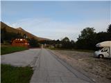
A) From the Ljubljana-Jesenice highway, we take the Lesce exit and follow the road towards Bled and further towards Bohinjska Bistrica. From Bohinjska Bistrica, we continue left in the direction of Tolmin and Soriška planina. Soon we will notice by the road the mountain signposts for Črna prst, which point to the right, but we continue straight. Only a little later, we come to a crossroads, where a signpost directs us slightly to the right towards the village of Ravne. Further, we drive past a large parking lot by the former ski slope Kobla, and we follow the asphalt road, which starts to ascend steeply, to Ravne, where the road flattens. Here we continue driving all the way to the spot where the asphalt ends. At the spot where the asphalt ends, there is a larger parking lot by the inn Janez, where we park on the right side of the parking lot (the parking lot on the left side of the road is intended for guests of the inn Janez).
B) From Železniki or Petrovo Brdo, we drive to Bohinjska Bistrica, where before the center of the settlement we turn left in the direction of the settlement Ravne. We follow the road, which starts to ascend steeply, to Ravne, where the road flattens. Here we continue driving all the way to the spot where the asphalt ends. At the spot where the asphalt ends, there is a larger parking lot by the inn Janez, where we park on the right side of the parking lot (the parking lot on the left side of the road is intended for guests of the inn Janez).
Route description:
From the parking lot at the inn Janez we continue in the direction of Črna prst and mountain hut Orožnova koča, where at first we walk on a macadam road, from which a beautiful view opens up towards Triglav. The road after the initial ascent passes into the forest and turns a little to the left, where we quickly arrive at a marked junction.
From the junction, we continue left in the direction of Črna prst, mountain pasture Planina za Črno goro and mountain hut Orožnova koča (straight Bohinjska Bistrica and old path towards Orožnova koča). The path ahead on the right side bypasses a private house (formerly mountain hut Planinski dom dr. Janeza Mencingerja), then a little further ahead it joins a cart track, on which we continue the ascent. A little higher, at the junction we continue right, then the path continues through the forest. A little further ahead, the path leads past a log cabin and a cross, then we already arrive at a marked junction, where we continue right in the direction of Orožnova koča (left mountain pasture Planina za Črno goro).
The path ahead crosses the slopes somewhat to the right, meanwhile it also descends noticeably. When the descent ends, an old path joins us from the right, which is somewhat shorter but officially no longer marked. This is followed by walking on a forest path, where we cross a few cart tracks, at the marked junction we continue on the right path. A few minutes higher we reach the forest road, which we only cross (right Orožnova koča on timber slide).
This is followed by a relatively steep ascent through the forest, higher up a somewhat longer path on the timber slide joins from the right.
We continue left and in a few minutes we arrive at the mountain hut Orožnova koča on mountain pasture Planina za Liscem.
From the hut we continue left into the forest moderately upwards. The path ahead slowly transitions from the forest to the slopes below Črna prst. The steepness of the path begins to increase, as does the slope we are walking on, which becomes steeper and steeper. The already quite steep path brings us below the walls of Črna prst. Next we ascend beside the wall upwards, then turn left and cross a gully. Further in a moderate ascent we cross the slopes towards the east. Just a few meters before the saddle, the path from mountain pasture Planina za Črno goro joins us. At the saddle we turn right and in ten minutes of panoramic walking we reach the hut on Črna prst. For the ascent to the summit, we still need to take a few steps.
From Črna prst we continue westwards in the direction of Rodica, to which we still have three hours of walking. The path first leads along a wide grassy ridge, which quickly narrows and the path begins to descend more steeply. After a few minutes of descent, the path from mountain pasture Osredki joins from the right, and we continue on the left (Primorska) side of the ridge in the direction of Vogel.
The path ahead becomes more demanding as, with the aid of steel cables, mostly without them, it crosses very steep grassy slopes that are dangerous for slipping. The path then levels out somewhat and brings us to saddle Vrata (1721m). The path then again withdraws to the left of the ridge and subsequently ascends across the next steep slope. A memorial plaque warns us that the path is not entirely easy. The steepness of the slopes then gradually eases and the path approaches the main ridge again (here we can ascend to Četrt in 15 minutes - easy pathless terrain).
We continue along the panoramic, mostly grassy ridge (towards the west), which gently ascends towards Konjski vrh, which the path bypasses on the left side. After that the path descends slightly and brings us to an indistinct saddle between Konjski vrh and Poljanski vrh. The path, which again begins to ascend gently, also bypasses the latter on the left side and then brings us to the foot of Matajurski vrh, which we will notice on the left side. Further ahead the path crosses to the Gorenjska side of the ridge, where it crosses steep mostly rocky slopes (possibility of snowfields). On the other side the path ascends through a belt of dwarf pines, after which follows crossing the southern slopes of Raskovec. Somewhat higher the path brings us to a nice small plateau-like area, where across grassy slopes we again cross to the northern side of the ridge. Further we cross the northern slopes of Suha Rodica (in early summer possibility of snowfields), after which we step onto the main ridge again.
Further the path continues along the southern side of the ridge or along it itself. During the crossing, which mostly takes place in a gentle to moderate ascent, we cross some very steep slopes that are dangerous for slipping. This increasingly panoramic path then quickly brings us to the summit of Rodica.
The path for the greater part from Črna prst to Rodica follows the ridge, so set out on the path only in good weather. The path also crosses some very steep grassy slopes, which when wet are very dangerous for slipping, and even when dry great caution is needed.
Ravne - Orožnova koča 1:45, Orožnova koča - Čez Suho 1:05, Čez Suho - Črna prst 15 minutes, Črna prst - Rodica 3:00.

Photos:
 1
1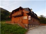 2
2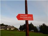 3
3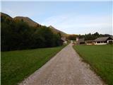 4
4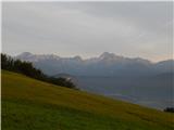 5
5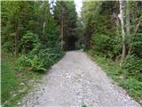 6
6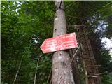 7
7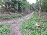 8
8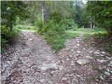 9
9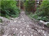 10
10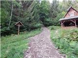 11
11 12
12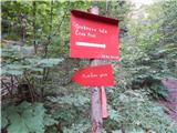 13
13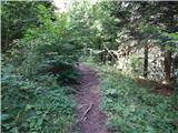 14
14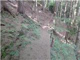 15
15 16
16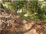 17
17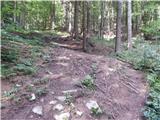 18
18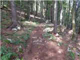 19
19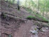 20
20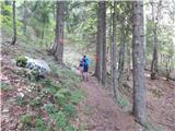 21
21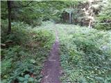 22
22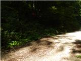 23
23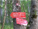 24
24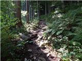 25
25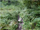 26
26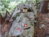 27
27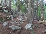 28
28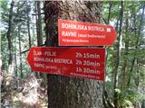 29
29 30
30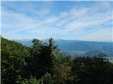 31
31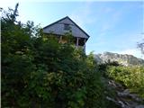 32
32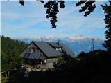 33
33 34
34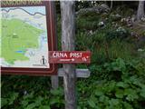 35
35 36
36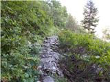 37
37 38
38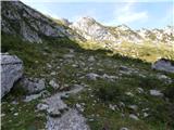 39
39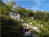 40
40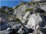 41
41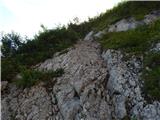 42
42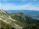 43
43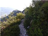 44
44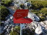 45
45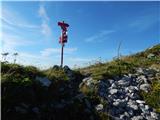 46
46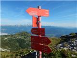 47
47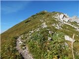 48
48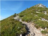 49
49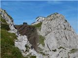 50
50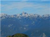 51
51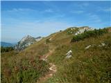 52
52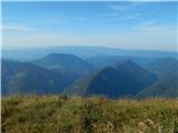 53
53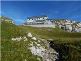 54
54 55
55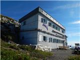 56
56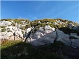 57
57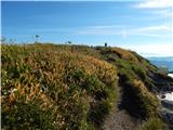 58
58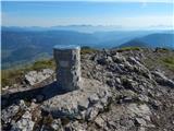 59
59 60
60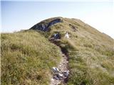 61
61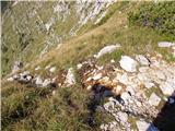 62
62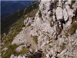 63
63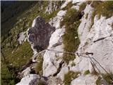 64
64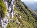 65
65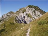 66
66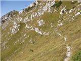 67
67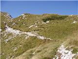 68
68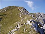 69
69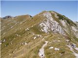 70
70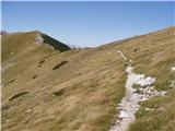 71
71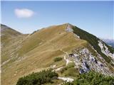 72
72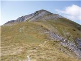 73
73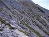 74
74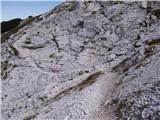 75
75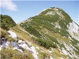 76
76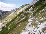 77
77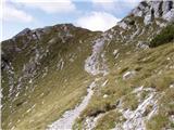 78
78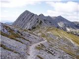 79
79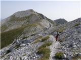 80
80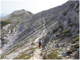 81
81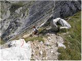 82
82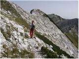 83
83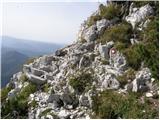 84
84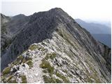 85
85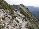 86
86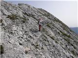 87
87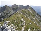 88
88 89
89
Discussion about the trip Ravne - Rodica (via Črna prst)
|
| Tadej19. 09. 2008 |
Beautiful ridge path with very nice views reaching all the way from Triglav to the Adriatic Sea. It should be noted however that the grassy slopes especially on the descent from Črna prst are very steep.
|
|
|
|
| zorzak26. 08. 2009 |
Does anyone perhaps know how long the tour Ski hotel Vogel - Rodica - Črna prst - Porezen - Podbrdo would take. We plan to overnight at Črna prst... Thanks in advance 
|
|
|
|
| smidov david11. 10. 2009 |
From Ski hotel to Rodica it's marked 3 hours, but we got there in 2 hours, as my buddy and I rushed, but without stops with moderate pace.
From Rodica to Črna prst it's also marked 3 hours, we walked 2 hours 10 minutes without stops.
We have average fitness.
From Črna prst we descended to Bohinjska Bistrica so I can't tell you further to Porezen.
|
|
|
|
| rečan11. 10. 2009 |
from Črna prst to Porezen you still have about 5 hours of walking
at least that's what I saw written at the top of Črna prst at the hut
best regards borut
|
|
|
|
| borovnicka12. 06. 2012 |
I'm wondering if anyone has done the circular path from the former home of Dr. Janez Mencinger on Črna prst, along the ridge to Rodica and back to the start. Especially interested in the last part of the path - what is the connection from Rodica to the start. Is there a marked path and approximately how long does that part take?
|
|
|
|
| jana196613. 06. 2012 |
About 5 years ago I continued the path from Rodica further to Pl. Suha towards the valley, then at the first gravel road right towards Bareči valley or the abandoned planina, where the road winds at the same altitude endlessly towards Mencin koča. There you really eat gravel, but I won't forget that at the top of Rodica at 14h I said I'd sit in the car at 18h and it was spot on, even for a completely unknown path for me, I don't know how it's marked today. So 4h of moderate walking from Rodica to the ski resort Kobla-good luck!
|
|
|
|
| borovnicka15. 06. 2012 |
Jana, many thanks for the reply. This tour will definitely happen tomorrow, even though that macadam section doesn't appeal to me much (but the rest of the path is apparently beautiful, so it outweighs that inconvenience )
|
|
|
|
| jana196616. 06. 2012 |
I'm really curious about the comment and whether there was enough liquid in the backpack, which I forgot to warn about for today!
|
|
|
|
| borovnicka17. 06. 2012 |
We had enough liquids with us, during the path we also stopped for tea at Orožnova koča and at the hut on Črna prst, which they opened for this season just on Friday. The path is really beautiful, views are unique, and the warnings are not superfluous that you need to be mostly very careful on the path between Črna prst and Rodica. Everything super until we reached that macadam - you were right, it's really one torment, when after eight hours of quite strenuous walking, another two hours of endless turns on compacted macadam await you and your legs barely carry you anymore, all the time hoping that your car will appear around the next bend, but it doesn't and doesn't... Definitely a better option is the one described today by Sabina1967, to have organized transport with more cars. But I'm sure we met the group of cheerfully disposed hikers that Sabina was with on Rodica and they overtook us on the way back when they went via the path through Lepa Suha, while we went around the longer path through planina Suha, because we didn't know the other existed (it's not marked).
Despite everything, the tour was unforgettable. Jana, thanks for the path description that we followed and reached the goal without problems.
|
|
|
|
| bo_zl17. 06. 2012 |
to all who plan to do the circular route Orožnova koča, Črna prst and Rodica in the future, I suggest the following.
Leave the car in Bohinjska Bistrica at the blocks near Zoissova graščina, then continue on foot along the path all the way to Rodica, then continue to Ski hotel Vogel. From here on, it's your decision whether by cable car or on foot to the lake. Another car can wait for you here (if there are more of you), which you brought in the morning, or you can take the bus back to Bistrica. In any case, in the last 20 to 25 years we have somewhat forgotten that public transport exists. But it does and it works. Verified last September.
|
|
|
|
| frenk4529. 08. 2012 |
I'm interested in the path from Mencingerjeva koča towards Črna prst and further towards Voglu, Planina Razor, Krnu, Krnskim jezerima mimo Doma na Komni. I have vacation and would like to do such a tour also with overnight stays, it doesn't have to be circular though, if anyone has experience with such a tour please help with advice. lp
|
|
|
|
| otiv29. 08. 2012 |
@frenk45 just boldly on the path, to Krn is a wonderful end of our country, only if the weather suits.
|
|
|
|
| frenk4530. 08. 2012 |
frenk45
29.8.2012 I'm interested in the trail from Mencingerjeva koča towards Črna prst and further towards Vogl, Planina Razor, Krn, Krnska jezera past Doma na Komni. I have vacation and would like to do such a hike also with overnight stay it doesn't have to be circular, if someone has experience with such a hike please help with advice. lp
|
|
|
|
| smatjaz26. 06. 2013 |
Started with my son from the village Polje through the village
Žlan to Črna prst, then to Rodica (warning again - the path is already dangerous when dry, when wet goodbye brains, partly secured with cables - mostly not!!!), then through planina Suha to Ribčev Laz, where on Sunday bears walk more often than the BUS drives, and after 2.8 km walk along the main road back to Polje - Fantastic. Otherwise, below planina Suha there is also a gravel road branching off towards Polje. 
|
|
|
|
| fackoo26. 07. 2013 |
Tomorrow I plan from Petrovo brdo via Črna prst to Rodica, so I'm interested if anyone knows how much it's normed, condition is no issue......
Thanks in advance
|
|
|
|
| smatjaz27. 07. 2013 |
Fackoo, otherwise if fitness is not a problem for you, still go slowly and carefully from Črna prst towards Rodica, the path is poorly secured, not overly dangerous, but the inattentive and hasty can slip (as proof, quite a few memorial plaques along the path), and take plenty of fluids with you - it will burn.
|
|
|
|
| smatjaz27. 07. 2013 |
Sorry for standard times - 2:50 and even faster from Črna prst to Rodica, Petrovo Brdo - Črna prst approx 4:30, and approx 3:00 Rodica - Ribčev laz
|
|
|
|
| fackoo27. 07. 2013 |
Well, I safely arrived there and back, for this trail from Petrovo brdo to Rodica and back I used 8:25 hours. Petrovo brdo - Črna prst 2:20, Črna prst Rodica 2:10, Rodica Črna prst 1:25 and back to the valley because I was a bit tired 2:30. And lots of water!!!!
|
|
|
|
| Laščan3. 08. 2013 |
What is your opinion about this hike tomorrow, given the weather (heat-ridge-thunderstorms)?
Thanks!!
|
|
|
|
| fackoo5. 08. 2013 |
Given that I noticed too late, you probably did this tour.
It was very nice for me, not too strenuous, nicely along the ridge up and down, beautiful views.
There were probably no thunderstorms, I was on Škrlatica at that time. The day before Vrata, Stenar, Križ to Pogačnik and to Pihavec. Pihavec has an exceptionally beautiful view. I recommend.....
|
|
|
|
| Laščan6. 08. 2013 |
It's true, the tour is done. As for the weather, you know. Views zero, heat on the ridge not too bad, in the valley a cauldron.
|
|
|
|
| dija20. 06. 2014 |
Has anyone recently walked the ridge from Rodica to Črna prst? Is the path dry?
LP
|
|
|
|
| Merymery22. 06. 2014 |
Information on the condition of the path Črna prst - Rodica - Šija - Merjasec would also be useful to me. Has anyone done the path recently, please provide info
lp
|
|
|
|
| peter223. 06. 2014 |
I haven't walked the mentioned paths in recent days. But yesterday on Črna prst, after talking to the hut warden in the hut, I learned that the path to Vogla should be snow-free except perhaps for some small snow tongue.
On the path to Č.p from the pasture behind Liscem (Orožnova koča), when you reach the vertical rocks below Č.P there is still snow to cross, but it is soft and good steps can be made.
Lp
http://www.petersfoto.si
|
|
|
|
| Merymery23. 06. 2014 |
peter2 Thanks for the info, we plan to walk this path 27.6 to Č.p. 28.06. then further to Merjasec and the info on path condition is very welcome
lp Merymery
|
|
|
|
| dija23. 06. 2014 |
Merymery let me know how it is.. I'm going a week later
|
|
|
|
| Merymery29. 06. 2014 |
Well, we managed to conquer the path from B. Bistrica past Orožnova to Č.p. and further over Rodica - Šija Vogel - Merjasec - then gondola. The path is passable, some snow patches that are quite passable, of course caution is not superfluous just like everywhere in the mountains. Orožnova hut was closed, nowhere was it written if it's open, but a VERY friendly caretaker welcomed us at Č.p.
Best regards and safe steps to all
|
|
|
|
| janez.novak29. 06. 2014 |
Merymery - how long did it take you for this path? Did you start in BB at Mercator - if so, is the path marked between the houses to Mencingerjeva hut? Is there any ambiguity when crossing from ČP to Šija, I mean markings, signposts? Thanks for the answer, as I want to hike this path in the near future.
|
|
|
|
| velkavrh29. 06. 2014 |
The best is to park at the large parking lot at the end of Ravne. Then walk along the gravel road to Mencigerjev dom. Above the hut, on the left side, the marked path to Črna prst starts. This junction is poorly marked - no sign. Only on a rock next to it says - Črna prst. Two months ago this path was still officially closed due to a landslide - about twenty minutes from the start, but it was possible to proceed. I don't know how it is with this landslide now. But I'll probably do this path in a week. Then just follow the signs for Orožnova koča or for Črna prst, which safely lead to planina Za Liscem and further along the Botanical path to Črna prst. The crossing itself is nice. I did it about a year ago and will do it again within a month this year. The time here is quite accurately measured. To shorten it by one hour - no more. So round trip will surely take eleven to thirteen hours - including breaks. But you need good weather.
|
|
|
|
| janez.novak29. 06. 2014 |
velkavrh - you're probably going to Rodica and back the same way, but I plan to do the following route: parking in BB - Orožnova koča - Črna prst - Rodica - Šija - Vogel - gondola and bus to BB.
|
|
|
|
| Merymery29. 06. 2014 |
Yes, we also did this route by leaving the car a bit below Mencigarjevi koči and one at Mercator. The path to Orožnova is still closed so we went towards Planina Črna gora to the road then it's nicely marked ahead so no problem finding it. At the top of ČP you just go along the ridge and follow Vogel it's also hard to miss we took our time and enjoyed the flowers so we hiked to ČP with stops 4 hours the next day also to the gondola 8 hours then bus to BB and pick up the car up to Ravne.
|
|
|
|
| ssimonss11. 02. 2017 |
I plan to do an ultra trail from Kranj to Tolmin.
Up to Dražgoše I have the route studied, further on there are many options, but I hardly know the hills except Ratitovec.
Does anyone have more info? I want to go along the ridge from Lajnar past Črna prst and further towards Raskovec and then descent towards Tolmin. Since I'll be very tired on that part, I'm interested in how to get to Tolmin most safely, i.e. with as few strenuous crossings or steep descents, chimneys etc. as possible.
I'll be very grateful for all comments, suggestions and help!
|
|
|
|
| GregorC12. 02. 2017 |
From Dražgoše, if you're already in the village, go towards Bohinjska Bistrica so you don't have to descend to Rudno. From there towards Ledine and on to Ratitovec. From there nicely over Altemaver, Kremant to Soriška planina. Further on you can avoid Lajnar, if not, climb up to it and then go over Slatnik past the barracks, before Možic turn left down towards Črna prst, where the path past Šavnik takes you to the saddle Vrh Bače. From there along the marked path to Črna prst (there is some ascent and descent) and then crossing the ridge to Rodica. Here some care is needed, but actually nothing difficult. The whole trail has no really difficult part, except that it's long, always going a bit up and down. But no really long descent, like descending to the valley and then back up. The trail is fully marked. From Rodica onwards maybe someone else can tell how and what.
|
|
|
|
| B212. 02. 2017 |
To Rodica, as described by GregorC. From Rodica onwards you have two options. The first is along SPP to Vogel and further to planina Razor (hut), the second is descent along the mulattiera to the transverse road above village Grant. When we reach the road we go right. This road is marked (path E7) and fairly flat all the way to planina Razor. Some two kilometers before planina Razor we have two options again. The first is to continue to the hut on planina Razor and from there descend to Tolminske Ravne (two variants along mulattiera or on hiking path, both marked) and further to Tolmin (also marked). The second option is to go along the road to planina Lom and on marked hiking path to Zatolmin, or almost entirely on the road (very long path). If we go from Rodica along SPP we have a slightly bigger descent only a bit further from the ski slope Šija), followed by immediate ascent to Vogel, which is not that bad, and the rest of the path is pure descent all the way to Tolmin. If we choose the path Rodica - planina Razor or planina Lom - Tolmin, then the entire path is descent. The path is technically not demanding at all (no variant), but very long...
|
|
|
|
| GregorC12. 02. 2017 |
A bit of text is missing at the beginning. From Dražgoš you go in the direction of Bohinjska Bistrica to Rastovke, where the signposts direct you towards Ratitovcu.
|
|
|
|
| SauberM19. 06. 2019 |
I'm wondering if there is any snow on this path.
Thanks.
|
|
|
|
| KARM196420. 06. 2019 |
I was there yesterday. No more snow on the path.
|
|
|
|
| MarjetkaP24. 08. 2020 |
The path is beautiful, scenic, moderately demanding in terms of fitness. But I really don't recommend it if you're afraid of heights. The section Črna prst - Rodica was really stressful for me.
|
|
|
|
| cofka25. 08. 2020 |
Stressful? Caution is needed at a few places, just like everywhere on the paths.
|
|
|
|
| Spelcarocket16. 06. 2021 06:02:55 |
Does anyone know what the condition of the path up here is like?
|
|
|
|
| bongo16. 06. 2021 08:43:11 |
To Orožnova koča via Snežna konta there are a few avalanche debris, a bit tricky due to branches etc. Below Črna prst there are some snow patches, the one from the slope towards Črna gora you cross with some caution, the one uphill towards the wall can be partially bypassed, partially you go over the southern snow, the same applies to the ascent to the saddle Čez suho. Winter gear is recommended. The ridge is more or less bare, huts already permanently open. Good luck.
|
|
|
To post a comment you must log in:
If you do not yet have a username, you must first
register.