Starting point: Razdrto (575 m)
| Latitude/Longitude: | 45,75910°N 14,06190°E |
| |
Walking time: 2 h 5 min
Difficulty: easy unmarked way
Elevation gain: 634 m
Elevation difference along the route: 634 m
Map: Nanos 1:50.000
Recommended equipment (summer):
Recommended equipment (winter): ice axe, crampons
Views: 14.093
 | 1 person like this post |
Access to starting point:
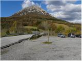
From the highway Ljubljana - Koper or Ljubljana - Nova Gorica, we head to the Razdrto exit. We follow the road ahead into the village Razdrto and then in the center of the village continue in the direction of the villages Strane and Veliko Ubeljsko. Only a little above the village, we will arrive at a large parking lot where we park.
Route description:
From the parking lot, we cross the bridge over the highway, then at the junction we continue left in the direction of Vojkova koča and Abram. After a few tens of steps of walking on the macadam road, the Nanos signs direct us right onto a moderately steep footpath, which starts ascending over a panoramic grassy slope. After a short ascent, the path passes into a belt of shrubbery, which higher up turns into forest. The path then turns somewhat to the left and brings us to a marked junction, where we continue left or straight in the direction of sv. Hieronim and the gentle path towards Vojkova koča (to the right leads the steep path to Vojkova koča).
The path a little further leads us across a panoramic meadow, from which a nice view of the surroundings opens up to us, then it returns to the forest, through which it continues to ascend transversely to the left. The gentle path mostly leads us towards the northwest, higher up it brings us from the forest onto more grassy slopes, where it becomes somewhat steeper. With nice views of the hilly landscape we then reach the edge of the Nanos plateau, where paths from Lozice and Podnanos join us from the left.
We continue right in the direction of Vojkova koča (left the church sv. Hieronim, 3 minutes) on the path, which just a few steps further brings us to a less noticeable junction, where the unmarked path to Grmada branches off to the left.
We head onto the mentioned, initially less visible path, which ascends more steeply and soon brings us to a forest road, which we merely cross. We continue the ascent on a relatively steep path that ascends over an increasingly panoramic grassy slope. Higher up, the path levels out slightly, turns right and gradually transitions onto an indistinct ridge, along which in a few more minutes of walking we ascend to the summit of Grmada.

Along the route: Žingarca (729m), Rob nanoške planote (1057m)
Photos:
 1
1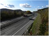 2
2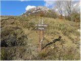 3
3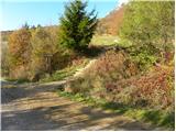 4
4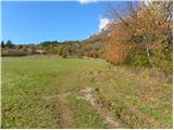 5
5 6
6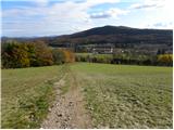 7
7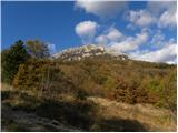 8
8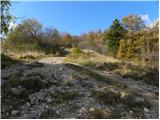 9
9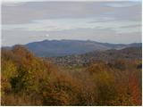 10
10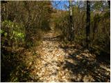 11
11 12
12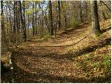 13
13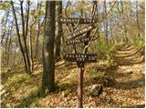 14
14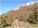 15
15 16
16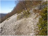 17
17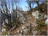 18
18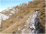 19
19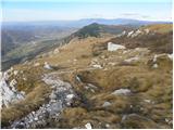 20
20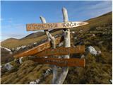 21
21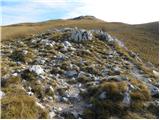 22
22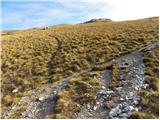 23
23 24
24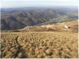 25
25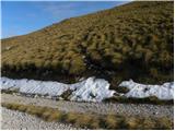 26
26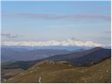 27
27 28
28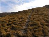 29
29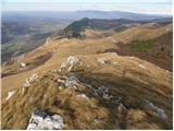 30
30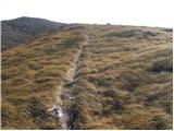 31
31 32
32
Discussion about the trip Razdrto - Grmada (Nanos)
|
| Hribolazec8117. 05. 2018 |
Can you visit Vojkov dom on Nanos first and then continue to Grmada?
|
|
|
|
| darinka417. 05. 2018 |
Grmada is also an easy peak. I usually go straight over Grmada, and then to the little church and along the flat path to Razdrto.
|
|
|
To post a comment you must log in:
If you do not yet have a username, you must first
register.