Razdrto - Suhi vrh (Nanos) (gentle path)
Starting point: Razdrto (575 m)
| Latitude/Longitude: | 45,75910°N 14,06190°E |
| |
Route name: gentle path
Walking time: 4 h
Difficulty: easy marked way
Elevation gain: 738 m
Elevation difference along the route: 950 m
Map: Nanos 1:50.000
Recommended equipment (summer):
Recommended equipment (winter): ice axe, crampons
Views: 11.578
 | 1 person like this post |
Access to starting point:
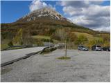
We leave the Primorska motorway at the Razdrto exit; upon reaching the regional (old) road we follow the signs for Razdrto. A little further, after the bus station we turn right towards the centre of the settlement; at the junction there are also signs for Nova Gorica (straight ahead on the old road towards Koper). In Razdrto we turn right again, this time towards Stran and Veliki Ubeljski; before crossing the motorway we park in the large gravel car park.
Route description:
From the car park we cross the bridge over the motorway, then at the junction continue left towards Vojkova koča and Abram. After a few dozen steps on the gravel road, signs for Nanos direct us right onto a moderately steep footpath that begins to ascend across a scenic grassy slope. After a short climb the path enters a belt of shrubs that higher up turns into forest. The path then turns slightly left and brings us to a marked junction where we continue left or straight towards St. Jerome and the gentle path to Vojkova koča (right leads the steep path to Vojkova koča).
A little further the path leads across a scenic meadow offering a fine view of the surroundings, then returns to the forest through which it continues to ascend transversely to the left. The gentle path mostly leads northwest; higher up it brings us out of the forest onto more grassy slopes where it becomes somewhat steeper. With beautiful views of the hilly landscape we reach the edge of the Nanos plateau, where paths from Lozice and Podnanos join from the left.
We continue right towards Vojkova koča (left the church of St. Jerome, 3 minutes) along the path that a few steps further brings us to a less noticeable junction where an unmarked path to Grmada branches left. We continue slightly right on the marked path that for some time ascends parallel to the road. The path then moves a little further right away from the road and reaches the scenic north-western rim of Nanos. Here the so-called Janezova pot joins almost imperceptibly from the right; we continue straight on the wide path leading towards the transmitters on Nanos. Just before the transmitters the path turns left, descends into a belt of forest and then, passing the monument to Janko Premrl - Vojko, brings us to Vojkova koča on Nanos.
From the hut we continue on the marked path towards Suhi vrh and Stran; across a meadow with a few trees we enter the forest where we ascend briefly. A stretch of easy walking with a few short descents and ascents brings us to a scenic grassy slope. After the scenic section we return to the forest and begin a steeper descent. After a few minutes of descent we reach a marked junction where we turn left following the signs for Suhi vrh (straight down to Strane).
A few minutes further we reach a forest road and follow it right downhill following the markings (even if we continue left on the road we can reach Suhi vrh, as the paths rejoin later). At the point where we join the path from Stran we turn left onto the footpath that ascends through the forest and returns to the road. We follow the road once more to the right and continue along it to the nearby hunting hut.
We continue on the road from which a steep path soon branches right. We go straight to the junction where we turn right towards Suhi vrh. The road begins to descend a little further on; then we notice a marked footpath that turns sharply right from the road. We take it and after a few minutes of somewhat steeper ascent reach Suhi vrh.
Razdrto - Žingarca 0:25, Žingarca - rob nanoške planote 1:15, rob nanoške planote - Vojkova koča 0:35, Vojkova koča - Bukova dolina 0:35, Bukova dolina - razpotje Boljunov vrh 0:15, razpotje Boljunov vrh - razcep pod Suhim vrhom 0:25, razcep pod Suhim vrhom - Suhi vrh 0:30.

Photos:
 1
1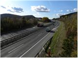 2
2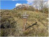 3
3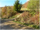 4
4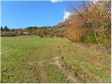 5
5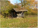 6
6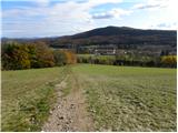 7
7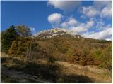 8
8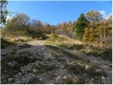 9
9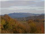 10
10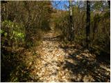 11
11 12
12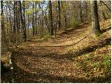 13
13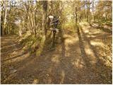 14
14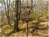 15
15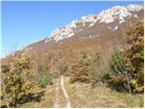 16
16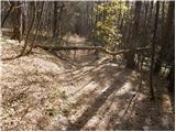 17
17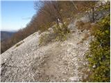 18
18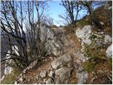 19
19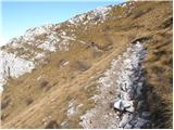 20
20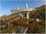 21
21 22
22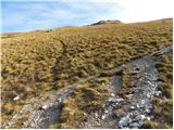 23
23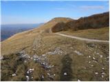 24
24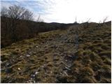 25
25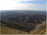 26
26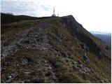 27
27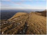 28
28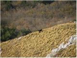 29
29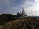 30
30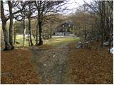 31
31 32
32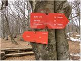 33
33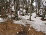 34
34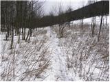 35
35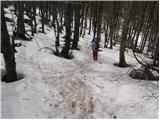 36
36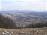 37
37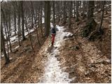 38
38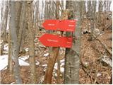 39
39 40
40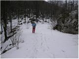 41
41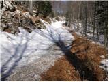 42
42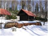 43
43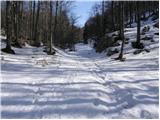 44
44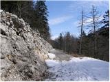 45
45 46
46 47
47 48
48 49
49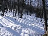 50
50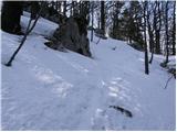 51
51 52
52
Discussion about the trip Razdrto - Suhi vrh (Nanos) (gentle path)
To post a comment you must log in:
If you do not yet have a username, you must first
register.