Razglednik - Planina Pečana
Starting point: Razglednik (1205 m)
| Latitude/Longitude: | 46,25230°N 14,00460°E |
| |
Walking time: 2 h 30 min
Difficulty: easy marked way
Elevation gain: 267 m
Elevation difference along the route: 365 m
Map: Škofjeloško in Cerkljansko hribovje 1:50.000
Recommended equipment (summer):
Recommended equipment (winter):
Views: 3.170
 | 2 people like this post |
Access to starting point:
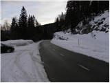
A) From the motorway Ljubljana - Jesenice we take the exit Lesce and follow the road towards Bled and further towards Bohinjska Bistrica. From Bohinjska Bistrica we continue left in the direction of Tolmin and Soriška planina. Above the village Nemški Rovt we arrive at a marked intersection, where we continue right in the direction of Soriška planina (slightly left Škofja Loka and Železniki). On the road towards Soriška planina we drive past the turn-off of the path (road) towards Orožnova koča (the turn-off for Orožnova koča is marked, and it branches off to the right from the main road), from where we drive on the main road for approximately 1 km, where on the right side we notice a smaller parking lot, and on the left side we notice a road which branches off sharply to the left and continues towards the mountain pasture Pečana. At the intersection we can also notice the first blazes and the mountain signpost for Ratitovec.
B) From Železniki or Podbrdo we first drive to Soriška planina, then we continue the drive towards Bohinjska Bistrica. From the parking lot on Soriška planina we drive for approximately 1 km, then we notice the turn-off of the forest road to the right, which leads towards the mountain pasture Pečana. We park at the intersection on the left side of the road on a smaller parking lot.
Route description:
From the starting point we first carefully cross the road, then we head onto the macadam road in the direction of Ratitovec. The road quickly enters the forest, through which it begins to ascend moderately. Higher up, the road flattens and brings us to a smaller marked intersection.
We continue slightly left (right is the road leading to the nearby Črni vrh 1486 m) and continue the path on the road, which further on ascends and descends slightly a few times. From the road, which continues through the forest all the time, we rarely get glimpses of the western Karawanks and central Julian Alps. After approximately an hour and a half of walking, the road descends more noticeably and brings us to an intersection, where the road from Bitenjska planina joins from the left.
We continue slightly right and begin to ascend slightly, first still through the forest, then we cross a shorter panoramic slope. Quickly we return to the forest, then we arrive at the next intersection, where we continue right in the direction of Ratitovec (straight Rovtarica). The path ahead leads us along the road, which continues along a small valley, and from the left just some 10 meters further another marked path from Bitenjska planina joins us. The road along which we walk soon ends and brings us to the parking lot and turning point below planina Pečana.
From the parking lot we continue on a wide cart track, which begins to ascend relatively steeply through the forest. After approximately 10 minutes of walking the cart track flattens, then shortly afterwards it brings us to the huts on planina Pečana.

Photos:
 1
1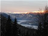 2
2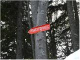 3
3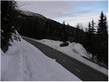 4
4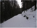 5
5 6
6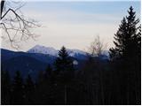 7
7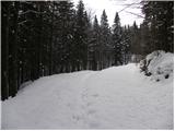 8
8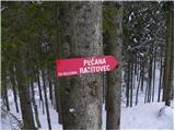 9
9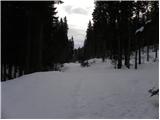 10
10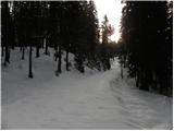 11
11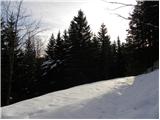 12
12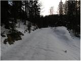 13
13 14
14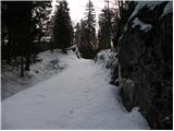 15
15 16
16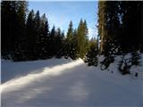 17
17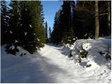 18
18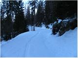 19
19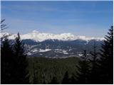 20
20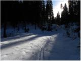 21
21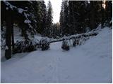 22
22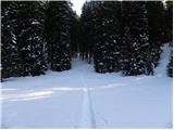 23
23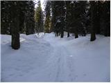 24
24 25
25 26
26 27
27
Discussion about the trip Razglednik - Planina Pečana
To post a comment you must log in:
If you do not yet have a username, you must first
register.