Razpotje Vragovec - Hochstuhl/Stol (via Zabreška planina)
Starting point: Razpotje Vragovec (1125 m)
| Latitude/Longitude: | 46,41420°N 14,17130°E |
| |
Route name: via Zabreška planina
Walking time: 3 h
Difficulty: easy marked way
Elevation gain: 1111 m
Elevation difference along the route: 1135 m
Map: Karavanke - osrednji del 1:50.000
Recommended equipment (summer):
Recommended equipment (winter): ice axe, crampons
Views: 16.800
 | 1 person like this post |
Access to starting point:
A) From the Ljubljana - Jesenice highway, take the Lesce exit, then from the roundabout continue in the direction of Žirovnica and Vrba. Further on, drive along the main road towards Jesenice, which first leads past Vrba, then past Žirovnica. After the bridge over Završnica, at the first crossroads continue sharply right (the turn-off is not marked) towards Moste. At the next crossroads about 50 m further on, go left in the direction of Završnica. Along the Završnica valley, drive to the marked crossroads located some tens of metres before Završniško jezero, then go left in the direction of Valvasorjev dom pod Stolom mountain hut. Further on, drive along the ascending (mostly) macadam road, following it for approximately 4 km to the marked crossroads, where you go right in the direction of Zabreška planina and Doslovška planina (straight ahead to Valvasorjev dom, Potoška planina...). From the crossroads onwards, continue driving along the road which ascends transversely to the right; at the Y-shaped (ipsilon) crossroads, continue left onto the steeper road, which you then follow to a smaller crossroads where several logs are usually stacked. Park near the crossroads in such a way as not to obstruct any possible forestry work.
B) First drive to Bled, from where continue towards Lesce and the highway. From the roundabout directly next to the highway, take the exit towards Vrba and Žirovnica. Further on, drive along the main road towards Jesenice, which first leads past Vrba, then past Žirovnica. After the bridge over Završnica, at the first crossroads continue sharply right (the turn-off is not marked) towards Moste. At the next crossroads about 50 m further on, go left in the direction of Završnica. Along the Završnica valley, drive to the marked crossroads located some tens of metres before Završniško jezero, then go left in the direction of Valvasorjev dom pod Stolom mountain hut. Further on, drive along the ascending (mostly) macadam road, following it for approximately 4 km to the marked crossroads, where you go right in the direction of Zabreška planina and Doslovška planina (straight ahead to Valvasorjev dom, Potoška planina...). From the crossroads onwards, continue driving along the road which ascends transversely to the right; at the Y-shaped (ipsilon) crossroads, continue left onto the steeper road, which you then follow to a smaller crossroads where several logs are usually stacked. Park near the crossroads in such a way as not to obstruct any possible forestry work.
C) From Jesenice, along the old road drive towards Lesce. At the 4 km road marker, also notice the sign indicating the start of the Žirovnica municipality; at the first crossroads after the mentioned sign, continue slightly left towards Moste (the turn-off from the main road is not marked). At the next crossroads about 50 m further on, go left in the direction of Završnica. Along the Završnica valley, drive to the marked crossroads located some tens of metres before Završniško jezero, then go left in the direction of Valvasorjev dom pod Stolom mountain hut. Further on, drive along the ascending (mostly) macadam road, following it for approximately 4 km to the marked crossroads, where you go right in the direction of Zabreška planina and Doslovška planina (straight ahead to Valvasorjev dom, Potoška planina...). From the crossroads onwards, continue driving along the road which ascends transversely to the right; at the Y-shaped (ipsilon) crossroads, continue left onto the steeper road, which you then follow to a smaller crossroads where several logs are usually stacked. Park near the crossroads in such a way as not to obstruct any possible forestry work.
Route description:
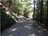
From the starting point, continue along the left road (right to Doslovška planina), which leads through the forest for a few more minutes, then past a clearing with a wooden hut quickly brings you to the turning area by the road barrier (gate).
Behind the fence, step out of the forest and the path takes you onto the expansive Zabreška planina, across which you quickly walk with fine views to the shepherd hut on the said pasture.
From the shepherd hut, continue right towards Stol on the path that ascends past a water trough. A few steps higher, the path also passes a water intake, then ascends transversely to the right. After a few minutes, upon reaching Stara planina, the signs for Stol direct you left, where after a somewhat steeper ascent you quickly reach the marked Zabreška pot leading from Valvasorjev dom to Prešernova koča.
Follow the said path to the right, ascending transversely to the right along it, first still above Stara planina, then through the forest. When the path in the forest temporarily turns slightly left, a noticeable but unmarked path joins from the right from the hunting hut above Doslovška planina. A few minutes higher, the path turns left, then quickly ascends to a larger clearing, at the edge of which stands Betonska bajta (1606 m).
Beyond the hut, the signs for Stol direct you right into the forest, where you immediately notice a sign asking you to carry a log to Prešernova koča. Continue briefly through the forest, then past the pleasant bench "počitek pri Janezu" arrive at a left-hand bend, where just a few steps before the bend an even less trodden unmarked pathlet joins from the right from Tinčkova koča. From the bend onwards, ascend transversely through the dwarf pine belt on an increasingly scenic path from which fine views open towards Gorenjska and the Julian Alps. Higher up, the path turns right again, then past Finžgarjeva skala takes you to a grassy plateau, where the marked path turns left and passes onto the summit southeast slope of Mali Stol. Continue ascending along the path from which truly splendid views open to the east, and with vistas reaching the Julian Alps, in about 30 minutes of further ascent reach Prešernova koča.
From the hut, continue towards Stol, first ascending to Mali Stol in one minute.
From Mali Stol follows a descent into the little valley between the two summits of Stol, from there continue straight ahead (right to Ljubelj, Celovška koča...) again towards Stol. Follows a further approximately 10-minute ascent and the path brings you to the highest peak of the Karawanks without major technical difficulties.
Starting point - Zabreška planina 20 minutes, Zabreška planina - Prešernova koča 2:25, Zabreška planina - Stol 15 minutes.
Description and pictures refer to the condition in 2015 (September).

Photos:
 1
1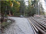 2
2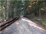 3
3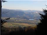 4
4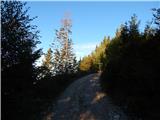 5
5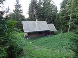 6
6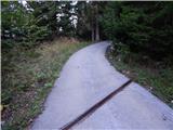 7
7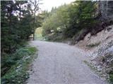 8
8 9
9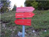 10
10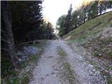 11
11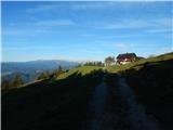 12
12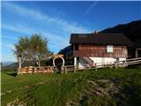 13
13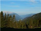 14
14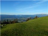 15
15 16
16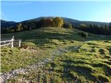 17
17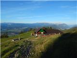 18
18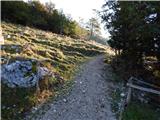 19
19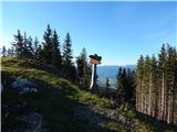 20
20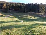 21
21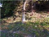 22
22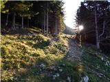 23
23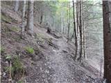 24
24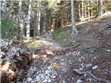 25
25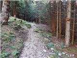 26
26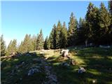 27
27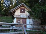 28
28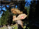 29
29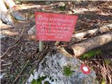 30
30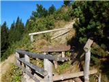 31
31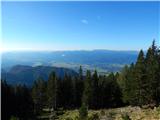 32
32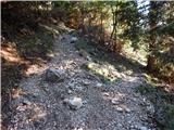 33
33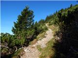 34
34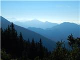 35
35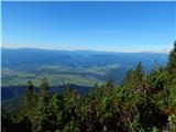 36
36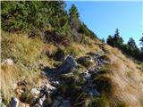 37
37 38
38 39
39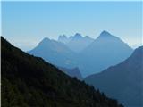 40
40 41
41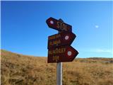 42
42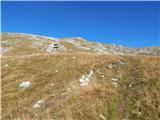 43
43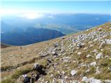 44
44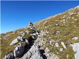 45
45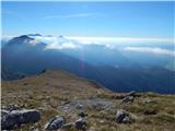 46
46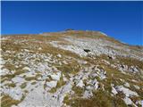 47
47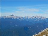 48
48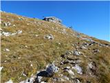 49
49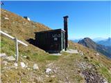 50
50 51
51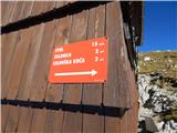 52
52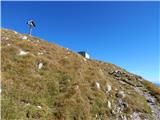 53
53 54
54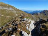 55
55 56
56 57
57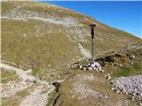 58
58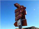 59
59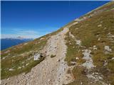 60
60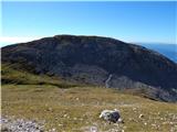 61
61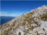 62
62 63
63 64
64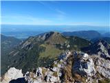 65
65 66
66
Discussion about the trip Razpotje Vragovec - Hochstuhl/Stol (via Zabreška planina)
|
| mornar9. 06. 2021 06:36:18 |
Has anyone walked this trail recently? I'm interested in what the road to the starting point is like. Thanks and best regards.
|
|
|
|
| sAleska10. 06. 2021 13:01:48 |
Was there yesterday 9.6. The road is very good.
|
|
|
|
| mornar10. 06. 2021 13:56:52 |
sAleska, many thanks for the information. Best regards.
|
|
|
|
| ovi25. 06. 2023 21:35:22 |
just home - from Stol;
ATTENTION!
road to your described "starting point Vragovec" closed in the valley (barrier); parking before barrier prohibited - use parking lot before the paid barrier for Valvazorja - hourly payment or 10EUR - full-day ticket and drive to Valvazorja:
Don't hold it against me, path managers - paths to Stol summit or Prešeren hut are miserably marked No signposts where the trodden paths lead.
Shame!
|
|
|
|
| ovi26. 06. 2023 15:58:03 |
Stol (both Zabreška and Žirovniška routes) is suitable for visits with four-legged friends mainly in spring and early autumn months; from July to the end of August, you need to choose very early starting hours for the hike (either from Valvazorja or from Zabreška) - especially in the last part of the path and on the return, there will be great stress for your dog (in sunny weather) without natural (water) refreshment and consequently the possibility of heatstroke in the dog! Take enough water for the dog (cooling paws, drinking). Suitable only for hardy dog breeds!
|
|
|
|
| turbo26. 06. 2023 16:22:00 |
Don't worry, those of us who have had and have dogs know very well ourselves how and what. There are no hardy dog breeds, where did you get that idea, there are only dogs with appropriate fitness, accustomed to hills and mountains, and dogs accustomed to city parks and the like. Check the forums a bit, quite a bit has already been written on the topic of dogs and mountains. What nonsense, either that or children over ten years 
|
|
|
|
| ovi26. 06. 2023 18:09:49 |
question to the moderator: why is the weather forecast on Hribi.net 7+ days old - for "mortals :::-)))
thanks for the answer, Turbo ...
|
|
|
|
| Jusk26. 06. 2023 22:51:58 |
hey..Hribi.net is for trip descriptions, information etc..for weather forecast you have hundreds of websites and apps and even if you have some super weather app, the best weather forecast is say every 5-10 minutes look up and watch the weather with your own eyes and even if you have some super weather app, the best weather forecast is say every 5-10 minutes look up and watch the weather with your own eyes and even if it looks like the weather is worsening and you turn back because of that and in the end nothing happens, better than getting caught by a thunderstorm high up somewhere and even if it looks like the weather is worsening and you turn back because of that and in the end nothing happens, better than getting caught by a thunderstorm high up somewhere
|
|
|
|
| ovi27. 06. 2023 15:46:10 |
@Jusk - I agree; looking at the sky is definitely the best recipe (if you know the local weather - expected development...); given that not all of us (except in the Maribor area - from where we are (dog included) would - expect (what happened - miraculously - and the weather forecast was updated - and - what does it mean that "uncle Google pops it first" on the browser?
Money. Indeed, most people today don't read forum comments - I (and some others) do.
I would title this post somewhere else (small ads maybe?)- but I can write this post on my home computer- because I don't have a phone...
Moderator, please forward the reply to "Turbu" - that's what you're paid for
BY
|
|
|
|
| Jusk27. 06. 2023 18:12:08 |
I write from my phone, but that doesn't matter the moderator, as far as I know, doesn't get paid for this forum, it's his good will that keeps this forum running at all. And why are you so fired up about Turbu that you mention him nonstop
|
|
|
To post a comment you must log in:
If you do not yet have a username, you must first
register.