Repna dolina - Javornik (above Črni Vrh)
Starting point: Repna dolina (877 m)
| Latitude/Longitude: | 45,86250°N 14,09920°E |
| |
Walking time: 1 h 45 min
Difficulty: easy marked way
Elevation gain: 363 m
Elevation difference along the route: 370 m
Map: Nanos 1:50.000
Recommended equipment (summer):
Recommended equipment (winter):
Views: 11.593
 | 1 person like this post |
Access to starting point:
From Logatec we drive towards Idrija. Only a little after the village of Kalce we will notice a road that turns left in the direction of the villages Podkraj and Col. We turn onto this quite winding road and follow it to the inn Stara pošta (by the inn there is an archaeological site Ad Pirum, Hrušica) and a little further to a crossroads, where a road towards Javornik branches off to the right (the turn-off is marked). The road soon loses its asphalt surface, and we park in a suitable spot near the sign "Gozdna cesta - uporaba na lastno odgovornost".
From Primorska we first drive to Col, and then we continue driving in the direction of the village Podkraj. A few kilometers after the village Podkraj, but still before the inn Stara pošta, we will notice a road that turns sharply to the left (direction Javornik). We then follow the above description.
Route description:
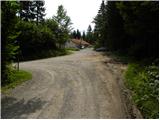
From the starting point, we head onto the macadam road, along which we notice signs for Javornik. The road first ascends gently to moderately on the left side of Repna dolina, then temporarily ascends somewhat more steeply and higher turns quite to the left, where it completely flattens, or occasionally even descends slightly. After a short descent we come to a marked crossroads, where a path from the village Podkraj joins from the left, and we continue straight towards Javornik. The road continues ascending through the forest for some time, then flattens and brings us to a panoramic slope. The path then crosses a short stretch of forest and brings us to a smaller crossroads, where to the right branches the road towards Smučarska koča Javornik. Here we continue on the left lower road, along which we quickly arrive at an abandoned house. Just before the house, the mountain signs direct us to the right onto a footpath, along which we ascend to Pirnatova koča na Javorniku in a few minutes.
From the hut we walk to the nearby directional signs, then head onto the path towards Javornik and the tower. After several tens of meters of walking the path enters the forest, where it ascends moderately. When we emerge from the forest we cross a shorter panoramic slope, then just a little below the summit the path enters the forest again. A gentle ascent through the forest follows and the path brings us to the summit where we notice the lookout tower. If we wish for a view, we ascend on our own responsibility to the top of the tower as well, from which a nice view opens up.

Photos:
 1
1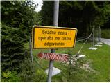 2
2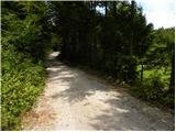 3
3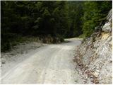 4
4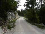 5
5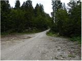 6
6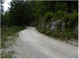 7
7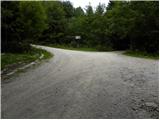 8
8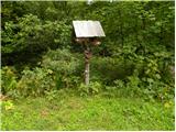 9
9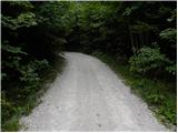 10
10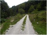 11
11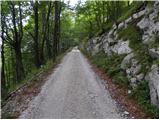 12
12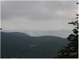 13
13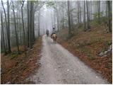 14
14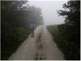 15
15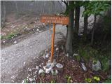 16
16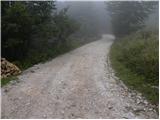 17
17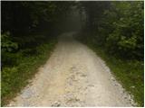 18
18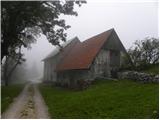 19
19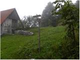 20
20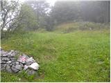 21
21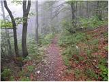 22
22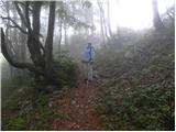 23
23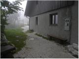 24
24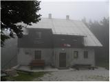 25
25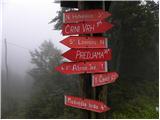 26
26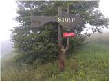 27
27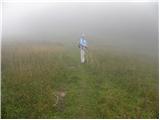 28
28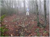 29
29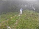 30
30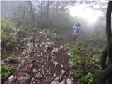 31
31 32
32
Discussion about the trip Repna dolina - Javornik (above Črni Vrh)
|
| D0men13. 09. 2022 12:33:11 |
The tower at the summit is no longer intact and is closed.
A new structure is needed. 
|
|
|
To post a comment you must log in:
If you do not yet have a username, you must first
register.