Rifugio Nordio - Achomitzer Berg (Zahomec) (via Sella Pleccia)
Starting point: Rifugio Nordio (1210 m)
Route name: via Sella Pleccia
Walking time: 1 h 30 min
Difficulty: easy unmarked way
Elevation gain: 603 m
Elevation difference along the route: 603 m
Map: Julijske Alpe - zahodni del 1:50.000
Recommended equipment (summer):
Recommended equipment (winter): ice axe, crampons
Views: 5.499
 | 1 person like this post |
Access to starting point:
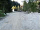
We drive to Tarvisio/Trbiž, which is just a few kilometers behind the state border on the Italian side of the Rateče border crossing. We can also reach Tarvisio/Trbiž from Austria, where we first drive to Villach/Beljak and then across the Thori-Coccau border crossing to Tarvisio/Trbiž. In Tarvisio/Trbiž, we follow the signs for Udine/Videm along the old road (not the motorway). Shortly after Tarvisio/Trbiž, we arrive in the village of Ugovizza/Ukve, where we turn right into the village center. In the middle of the village, we reach a stream, where an asphalted mountain road branches off upwards along the stream. We drive along this road to a junction, where we go straight ahead (right); immediately after this junction, we reach the next one, where we turn left. We follow this mostly asphalted road to the Rifugio Nordio hut, where we park in the parking lot next to the hut.
Route description:
A little below the Nordio hut, a poorer gravel road branches off to the right, ascending along the left side of the right stream. After just a few steps of walking, a cart track branches off to the left from the road, then ascending parallel to the road. After five minutes of walking, the cart track enters the forest and turns into a footpath.
The path begins to climb steeply, taking us past an abandoned shack to a spring. A little further, we reach a small meadow where an old shepherd's hut stands.
Ahead, the gradient eases slightly, and the path runs through the forest with a few smaller clearings. Then we cross a gully, and the path quickly emerges from the forest. Only a few minutes of walking remain to the saddle, where we encounter signposts and the end of the forest road coming from Austria.
Here, we turn right onto the path that gently ascends the meadow upwards. The path then crosses to the Austrian side and leads us via cart track to a forest road. We follow this gently ascending road to the meadow where a hut stands.
Just a few meters further, we reach a shepherd's hut, from which a path branches off to the left towards the Forestale Cima Muli hut. We take this path, which ascends moderately and crosses the slopes of Zahomec / Achomitzer Berg. When the path reaches the side ridge of the peak, we leave the marked path and head left upwards on an unmarked trail. This trail brings us to the summit in a few minutes of ascent.
Direct access from the meadow to the summit is also possible.
Rifugio Nordio - Zahomska planina 1:15, Zahomska planina - Zahomec 15 minutes.

Photos:
 1
1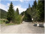 2
2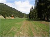 3
3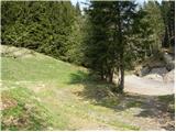 4
4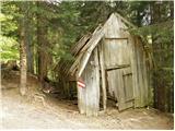 5
5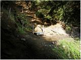 6
6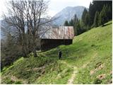 7
7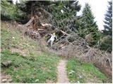 8
8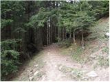 9
9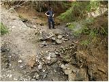 10
10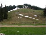 11
11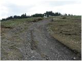 12
12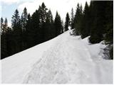 13
13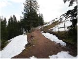 14
14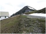 15
15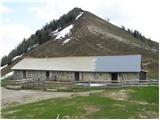 16
16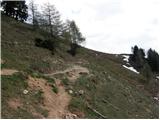 17
17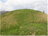 18
18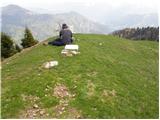 19
19
Discussion about the trip Rifugio Nordio - Achomitzer Berg (Zahomec) (via Sella Pleccia)
To post a comment you must log in:
If you do not yet have a username, you must first
register.