Rifugio Cercena - Cima Montanel
Starting point: Rifugio Cercena (1050 m)
| Latitude/Longitude: | 46,43308°N 12,43504°E |
| |
Walking time: 4 h 40 min
Difficulty: very difficult marked way
Elevation gain: 1411 m
Elevation difference along the route: 1420 m
Map: Tabacco 16 1:25.000
Recommended equipment (summer): helmet
Recommended equipment (winter): helmet, ice axe, crampons
Views: 976
 | 2 people like this post |
Access to starting point:
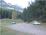
Access from Gorenjska: From Rateče or Predel we cross the border to Trbiž / Tarvisio and then we continue on a highway in the direction of Vidma / Udine to exit Tolmezzo. From Tolmezzo we follow the road in the direction of village Ampezzo and mountain pass Passo della Mauria. The road then descends and it brings us to a crossroad, where we continue left in the direction of the settlement Belluno. The main road, that runs through the valley of river Piave we follow only to the settlement Domegge di Cadore. In the mentioned settlement we turn left downwards and then we follow the signs for mountain hut Rifugio Padova and Rifugio Cercena. The road after descent crosses the river Piave, after that soon starts ascending. The road which leads towards the mentioned huts is quite steep and very narrow. When we come to a crossroad near the mountain hut Rifugio Cercena signposts point us sharply left and to the hut follows only 50 meters of steep ascent. We park on a large parking lot at the mountain hut.
From Primorska: We drive on the highway towards Venice / Venezia. At Portogruaro we leave the highway towards Venice and continue right on the highway towards Pordenone. At the next highway junction near Conegliano, we continue right towards Belluno. Near Belluno the highway ends, and at the next crossroads we continue in the direction of the settlement Auronzo and mountain pass Passo della Mauria. We follow this road to the settlement Domegge di Cadore. In the mentioned settlement we turn right downwards and then we follow the signs for mountain hut Rifugio Padova and Rifugio Cercena. The road after descent crosses the river Piave, after that soon starts ascending. The road which leads towards the mentioned huts is quite steep and very narrow. When we come to a crossroad near the mountain hut Rifugio Cercena signposts point us sharply left and to the hut follows only 50 meters of steep ascent. We park on a large parking lot at the mountain hut.
Route description:
At the end of the parking lot, we go left on a footpath following the signs »Biv. Montanel«. The path quickly brings us into the forest and then in ascent crosses slopes towards the north all the way to a crossing by mountain pasture Dalego.
At the marked crossing we continue sharply right and follow the signs for bivouac Montanel. The path further starts ascending a little steeper towards the southeast. The path here in ascent crosses relatively steep slopes and still runs through the forest. Despite the forest occasionally through the trees nice views open up towards Dolomites. The path then turns to the left and soon brings us to another marked crossing.
Left downwards leads the path towards the mountain hut Rifugio Eremo dei Romiti, and we continue right towards the bivouac Montanel. The path further becomes slightly less steep and out of the forest brings us on somewhat steeper slopes covered with dwarf pines and larches. Here also very beautiful views open up towards the north. The path for a short time still crosses steep slopes and then turns to the right and is for quite some time ascending through the valley Val Moni on the eastern side of the peak Colle dell'Elma. The path at first runs on the right side of the valley below the steep rocky slopes of the mentioned summit. Further the path runs more in the middle of the valley and ascends through dwarf pines and larch forest. Later, the path again turns to the right and brings us to the ridge on the southeastern side of the peak Colle dell'Elma.
Here the path turns to the left and trees are becoming a little rarer so that from the path increasingly beautiful views are opening up on the west side where peaks Civetta, Pelmo and Antelao stand out. Further, the path runs mostly by dwarf pines and by rare larches. Such a path runs all the way to a grassy plain on which there are two bivouacs. The smaller is permanently open, the bigger is locked.
In case we use a map for orientation be careful, because on some maps the bivouac is marked on the wrong location.
At the bivouac where there are also signposts we continue slightly to the left following the signs »Cima Montanel, Cima Herberg«. The path then leads us through a short lane of larch forest and dwarf pines and soon brings us into a valley on the northern side of peaks Crodon di Scodavacca and Cima Herberg. The path here runs on the left side of the valley with a nice view towards precipitous ridge of the mentioned peaks and on ample scree below them. We continue ascending on the left side of the valley and when terrain flattens a little path brings us to a crossing.
To the right leads the path through notch Forcella di Crodon towards the mountain hut Rifugio Padova, and we continue left towards the summit Montanel where also sign on rock points us. From the crossing, the path runs towards the north and brings us on grassy slopes below the summit Montanel. Here the path turns to the right and starts ascending steeply on a panoramic grassy slope. The footpath is on this part poorly visible, but we get help from cairns so that orientation isn't demanding. When we come below the rocky slopes of the peak, the path becomes more demanding. Inscription »cima« points us right on a narrow ledge on which we cross precipitous slope. The path then turns to the left and then follows some easy climbing to a narrow notch. From the notch then a very short more demanding ascent follows, which isn't exposed. The path then turns to the left and to the top follows only some very easy climbing.
We descend on the ascent route or through notch Forcella di Crodon towards the mountain hut Rifugio Padova. In this case, we have from the mountain hut Rifugio Padova to the starting point at the mountain hut Rifugio Cercena a little less than an hour of walking on the road. A considerable part of the path towards the mountain hut Rifugio Padova runs also through overgrown dwarf pines.

Photos:
 1
1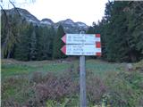 2
2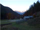 3
3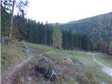 4
4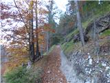 5
5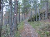 6
6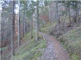 7
7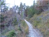 8
8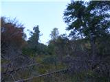 9
9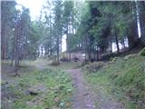 10
10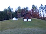 11
11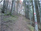 12
12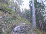 13
13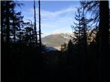 14
14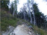 15
15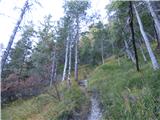 16
16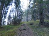 17
17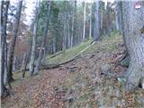 18
18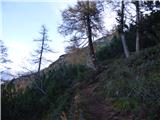 19
19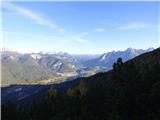 20
20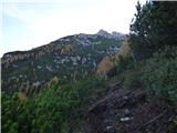 21
21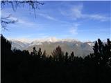 22
22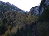 23
23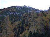 24
24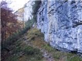 25
25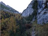 26
26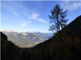 27
27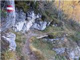 28
28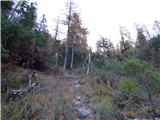 29
29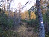 30
30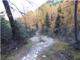 31
31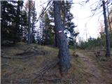 32
32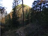 33
33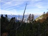 34
34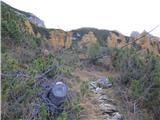 35
35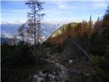 36
36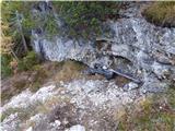 37
37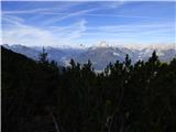 38
38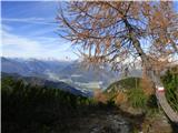 39
39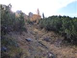 40
40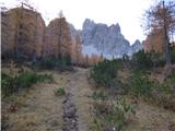 41
41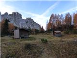 42
42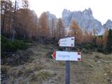 43
43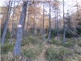 44
44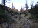 45
45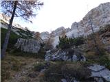 46
46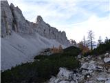 47
47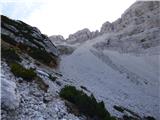 48
48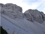 49
49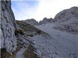 50
50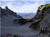 51
51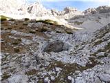 52
52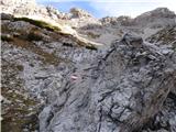 53
53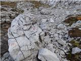 54
54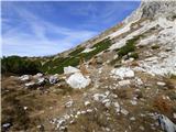 55
55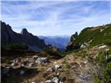 56
56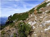 57
57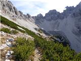 58
58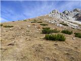 59
59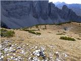 60
60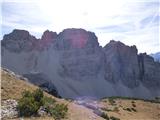 61
61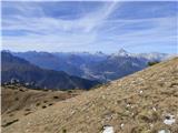 62
62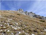 63
63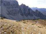 64
64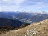 65
65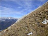 66
66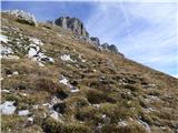 67
67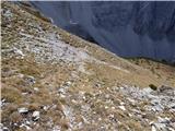 68
68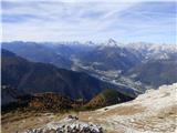 69
69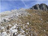 70
70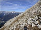 71
71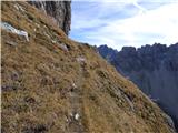 72
72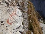 73
73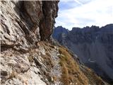 74
74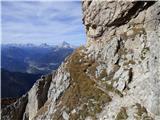 75
75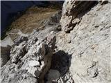 76
76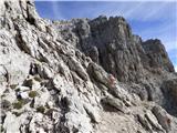 77
77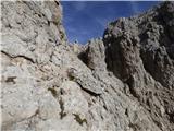 78
78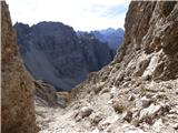 79
79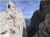 80
80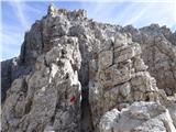 81
81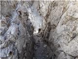 82
82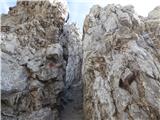 83
83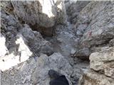 84
84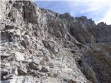 85
85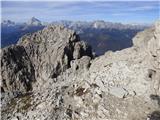 86
86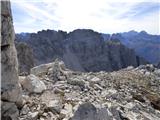 87
87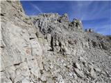 88
88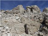 89
89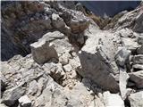 90
90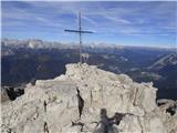 91
91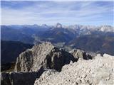 92
92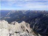 93
93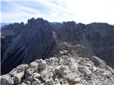 94
94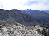 95
95 96
96
Discussion about the trip Rifugio Cercena - Cima Montanel
To post a comment you must log in:
If you do not yet have a username, you must first
register.