Rifugio Gardeccia - Cima Scalieret (via north ridge)
Starting point: Rifugio Gardeccia (1950 m)
| Latitude/Longitude: | 46,43832°N 11,69319°E |
| |
Route name: via north ridge
Walking time: 3 h
Difficulty: partly demanding unmarked way
Elevation gain: 937 m
Elevation difference along the route: 950 m
Map: Tabacco 06 1:25.000
Recommended equipment (summer): helmet
Recommended equipment (winter): helmet, ice axe, crampons
Views: 1.580
 | 2 people like this post |
Access to starting point:
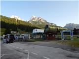
Access from Gorenjska: Through the Karawanks Tunnel, we drive to Austria, and then we continue driving towards Spittal and further towards Lienz (a little after Spittal the highway ends). Further, we drive on a relatively nice and wide road through the Drau Valley, which brings us into Italy. The road further leads past Dobbiaco / Toblach and Brunico / Bruneck. Only a little after the last-mentioned town, past which a bypass leads, we turn left into the Val Badia valley. Further, we drive through the mentioned valley past the settlements La Villa and Corvara. There follows an ascent over the passes Passo Campolongo and Passo Pordoi. From the Passo Pordoi pass we then descend on the west side into the Val di Fassa valley. We continue to the settlement Pera di Fassa where we park on a large parking lot at the bottom station of the chairlift »Pera Vajolet 1«.
From here, transport with a minibus to the mountain hut Rifugio Gardeccia is organized. The price of the return ticket is 10€ (July 2015). The minibus starts at 7:00, and the last ride from the mountain hut Gardeccia is at 19:00. The road to the hut is otherwise closed to public traffic.
From the Primorska side: From Nova Gorica, we drive to Italy and continue on the highway towards Venice / Venezia. At the town Portogruaro we leave the highway towards Venice and continue right on the highway towards Pordenone. At the next highway junction near Conegliano, we continue right towards Belluno. We follow the highway to the exit for Belluno. When we leave the highway we come to a larger roundabout, which we leave at the exit for Belluno and the settlement Feltre. In the smaller roundabout in the town Belluno we then continue right towards the town Agordo. We follow this road all the way to the town Moena in the Val di Fassa valley. In the town Moena we then continue right towards the town Canazei, but only to the town Pera di Fassa where we park on a large parking lot at the bottom station of the chairlift »Pera Vajolet 1«.
From here, transport with a minibus to the mountain hut Rifugio Gardeccia is organized. The price of the return ticket is 10€ (July 2015). The minibus starts at 7:00, and the last ride from the mountain hut Gardeccia is at 19:00. The road to the hut is otherwise closed to public traffic.
Route description:
From the mountain hut Rifugio Gardeccia we head on a macadam road towards the mountain hut Vajolet. The road first leads past the mountain hut Rifugio Stella Alpina and brings us into a thin forest. Here the road ascends somewhat, the thin forest quickly ends, and a view opens towards the mountain hut Rifugio Preuss, which is nicely visible on top of the cliff. Near the mentioned hut is also the mountain hut Rifugio Vajolet. The panoramic road then becomes flatter for a while, then turns left below the slopes of the peak Cima Catinaccio and begins to ascend somewhat more steeply. The road then ascends all the way to the mountain hut Rifugio Vajolet from where there is a very nice view towards the towers Torri del Vajolet.
A little after the hut, the path Sentiero Don Guido branches off to the right towards the peak Cima Scalieret, while we continue on the relatively wide path towards the mountain hut Rifugio Passo Principe. The path soon brings us to another marked junction. This time, the path towards the huts Rifugio Re Alberto and Rifugio Passo Santner branches off to the left upwards. We continue on the fairly flat path 584 towards the mountain hut Rifugio Passo Principe. The path here runs northwards all the time through the Val di Vajolet valley, and an increasingly beautiful view towards the highest peak in the mountain group Catinaccio d'Antermoia (Kesselkogel) begins to open up. At the end of the valley the slope becomes slightly steeper, but the ascent is not difficult. Along the wide path we soon reach the Passo Principe hut, which is located on the eponymous saddle on the western side of the peak Catinaccio d'Antermoia.
From the hut we continue on path 584 towards the Passo di Antermoia saddle. The path from the hut first crosses scree fields below the walls of the peak Catinaccio d'Antermoia and then begins to ascend quite steeply. There is quite a lot of scree on the path here, and otherwise this section of the path is in somewhat poorer condition. When we reach the indistinct saddle on the south side of the peak, the steepness eases somewhat, and we then cross the slopes in a gentle ascent towards the Passo di Antermoia saddle. A little before the saddle, the path brings us to an unmarked junction.
Here we leave the marked path towards the Passo di Antermoia saddle and head right onto the unmarked path. The path from the junction first crosses a fairly steep slope, slightly descending in the process. The slope then becomes less steep, the path turns slightly right, and there follows a short somewhat steeper ascent to the Passo Scalieret saddle. On the saddle we continue right, and after a short crossing of the steep slope it brings us to the gentler slopes on the eastern side of the ridge. The path then ascends gently and later brings us onto the ridge. The path along the ridge is initially still easy, but a few tens of metres below the summit the ridge becomes quite steep. Here the path moves away from the ridge to the right side and crosses the steep slope. The slope is quite steep here, and there is also some scree on the path. Considerable caution is therefore needed during the crossing. The more demanding crossing is relatively short, and we soon return to the ridge, along which we reach the summit without difficulty.
We descend along the ascent path or along the path named Sentiero Don Guido, which runs along the southwestern slopes of the mountain over the Passo Pope saddle.

Photos:
 1
1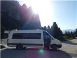 2
2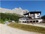 3
3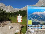 4
4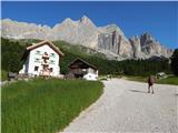 5
5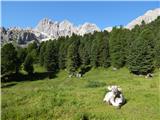 6
6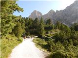 7
7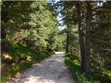 8
8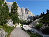 9
9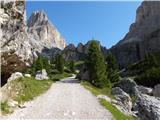 10
10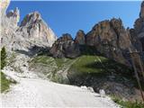 11
11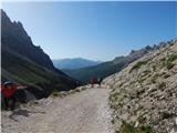 12
12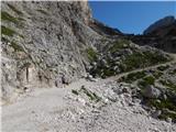 13
13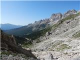 14
14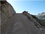 15
15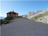 16
16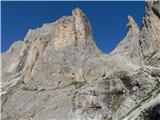 17
17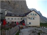 18
18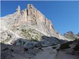 19
19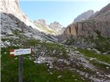 20
20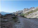 21
21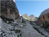 22
22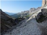 23
23 24
24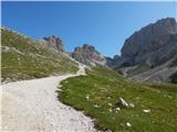 25
25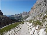 26
26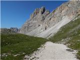 27
27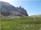 28
28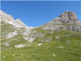 29
29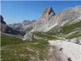 30
30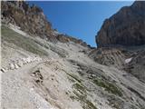 31
31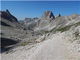 32
32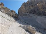 33
33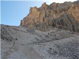 34
34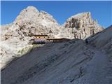 35
35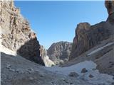 36
36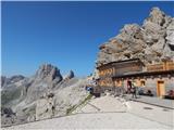 37
37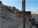 38
38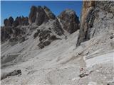 39
39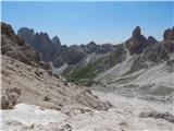 40
40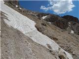 41
41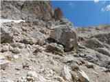 42
42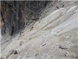 43
43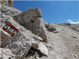 44
44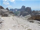 45
45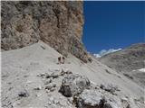 46
46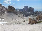 47
47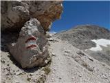 48
48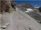 49
49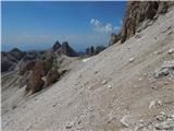 50
50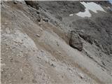 51
51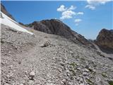 52
52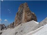 53
53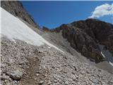 54
54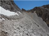 55
55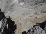 56
56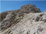 57
57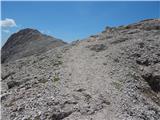 58
58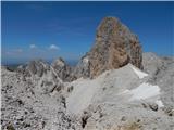 59
59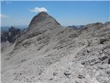 60
60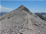 61
61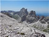 62
62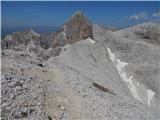 63
63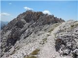 64
64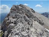 65
65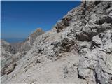 66
66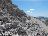 67
67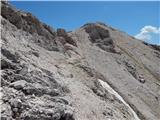 68
68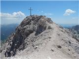 69
69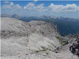 70
70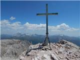 71
71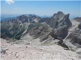 72
72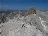 73
73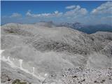 74
74
Discussion about the trip Rifugio Gardeccia - Cima Scalieret (via north ridge)
|
| Borut129. 07. 2021 21:57:10 |
The minibus from the lower cable car station (as written in the access description to the starting point) has not been running for several years. Instead of this transport, you can buy a ticket for the cable car to the second station (return ticket for an adult costs 13 Eur). The last ride down the valley is at 18:00. From the second cable car station to the Gardeccia hut there is still 40 minutes of walking on a wide and gentle path.
|
|
|
To post a comment you must log in:
If you do not yet have a username, you must first
register.