Rifugio Nordio - Maria Schnee below Gozman (via Lom)
Starting point: Rifugio Nordio (1210 m)
| Latitude/Longitude: | 46,55060°N 13,48240°E |
| |
Route name: via Lom
Walking time: 1 h 40 min
Difficulty: easy marked way
Elevation gain: 540 m
Elevation difference along the route: 540 m
Map: Julijske Alpe - zahodni del 1:50.000
Recommended equipment (summer):
Recommended equipment (winter): ice axe, crampons
Views: 3.034
 | 1 person like this post |
Access to starting point:
We drive to Tarvisio / Trbiž, which is just a few kilometers past the state border on the Italian side of the Rateče border crossing. We can also reach Tarvisio / Trbiž from Austria by first driving to Villach / Beljak and then crossing the Thori-Coccau border crossing to Tarvisio / Trbiž. In Tarvisio / Trbiž, we follow the signs for Udine / Videm on the old road (not the highway). Soon after Tarvisio / Trbiž, we arrive in the village of Ugovizza / Ukve, where we turn right into the village center. In the middle of the village, we reach a stream, where an asphalt mountain road branches off uphill along the stream. We follow this road to a junction, where we go straight ahead (right), and immediately after this junction we reach the next one, where we turn left. We follow this mostly asphalt road to Rifugio Nordio hut, where we park in the parking lot next to the hut.
Route description:
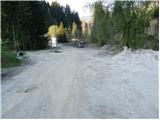
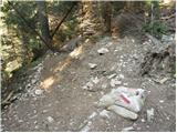
From the parking lot, head onto the left road that passes by the dilapidated Nordio hut. The road begins to climb moderately and takes us in switchbacks to a spot exposed to falling rocks. Despite the mesh protection installed somewhat above the road, caution is needed. It is best to leave this section as quickly as possible. After that, we cross the stream and continue climbing north to a junction. To the right, a direct path branches off to Ojstrnik, but we continue straight ahead on the forest road, which soon turns into a hiking trail. The trail then leads us to a meadow, which we walk across to the state border. Here we can already see the alpine pasture, which is just a few steps away.
From the alpine pasture, we return to the state border information board and a few meters above it, find the marked trail leading to Planina Bistrica. The junction is marked only with Austrian markers. The trail then enters a dark forest and initially traverses the slopes almost horizontally, then joins the direct path from the Nordio hut.
The trail continues steeply uphill through the forest. The steepness then eases, and the trail leads us out of the forest onto the pastures of Planina Bistrica. Next follows another ten minutes of walking on a gentle meadow to the huts on the alpine pasture, which we can already see ahead.
On the alpine pasture, we reach a gravel road, where we turn right to the signposts. We continue on the marked trail towards "Goriacher Alm". The wide trail, which climbs only gently, takes us to the Chapel of Maria Schnee in ten minutes.
Rifugio Nordio - Lom 45 minutes, Lom - Planina Bistrica 45 minutes, Planina Bistrica - Chapel of Maria Schnee 10 minutes.

Photos:
 1
1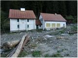 2
2 3
3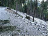 4
4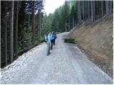 5
5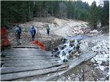 6
6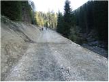 7
7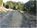 8
8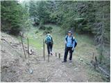 9
9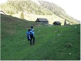 10
10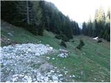 11
11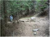 12
1213
 14
14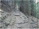 15
15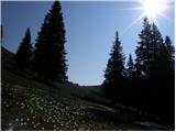 16
16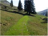 17
17 18
18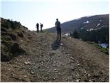 19
19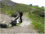 20
20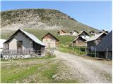 21
21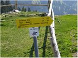 22
22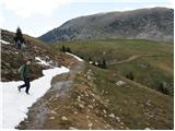 23
23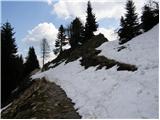 24
24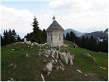 25
25
Discussion about the trip Rifugio Nordio - Maria Schnee below Gozman (via Lom)
To post a comment you must log in:
If you do not yet have a username, you must first
register.