Rifugio Pelizzo - Dom na Matajure
Starting point: Rifugio Pelizzo (1320 m)
| Latitude/Longitude: | 46,20300°N 13,53910°E |
| |
Walking time: 40 min
Difficulty: easy marked way
Elevation gain: 225 m
Elevation difference along the route: 225 m
Map: Julijske Alpe - zahodni del 1:50.000
Recommended equipment (summer):
Recommended equipment (winter): ice axe, crampons
Views: 6.947
 | 2 people like this post |
Access to starting point:
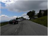
From the road Tolmin - Kobarid, in the settlement Idrsko to the left (from the direction Kobarid right) a steep road branches off towards the village Livek. We head onto the mentioned road, which after approximately 5 km of ascent brings us to the mentioned village. We continue driving on an ever narrower road which leads into Italy. On the other side of the border, the road starts descending, and we follow it through villages Polava / Polava and Čepletišče / Cepletischis to a somewhat larger crossroad, where we continue right in the direction of village Matajur / Montemaggiore and mountain hut Rifugio Pelizzo. We follow the road, which ascends relatively steeply further on, at the next crossroads in the direction of the mentioned mountain hut. We park on the organized parking lot right below the mountain hut Rifugio Pelizzo.
Route description:
From the parking lot we first ascend the stairs to the mountain hut, then continue in the direction of "Monte Matajur" and "Dom na Matajure". The path ahead moderately ascends a panoramic grassy slope, from which beautiful views open up on Slavia Friulana and the Julian Alps. Higher up, the path leads through a belt of raspberry bushes, then brings us to the marked junction, where we continue left in the direction of "Dom na Matajure" (straight Matajur, right Livek).
Immediately after the junction, the path entirely flattens and continues crossing panoramic grassy slopes to the left. We follow this pleasant and well-maintained footpath all the way to the mountain hut, which we reach after less than 10 minutes of walking from the junction.
Photos:
 1
1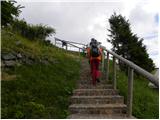 2
2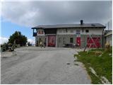 3
3 4
4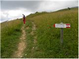 5
5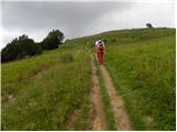 6
6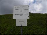 7
7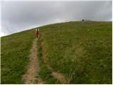 8
8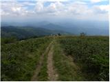 9
9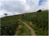 10
10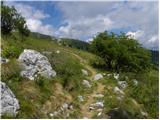 11
11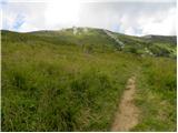 12
12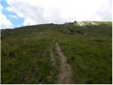 13
13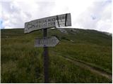 14
14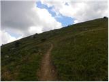 15
15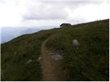 16
16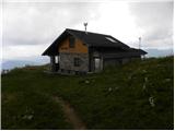 17
17
Discussion about the trip Rifugio Pelizzo - Dom na Matajure
|
| Kriška31. 07. 2010 |
On the signpost for the hut it says it's closed. Is it generally closed, or only on certain days? (Probably written somewhere at the hut itself?).
|
|
|
|
| Tadej31. 07. 2010 |
We were at Dom na Matajure during the week, so the hut was closed. The door says the hut is open from Saturday from 14:00 onwards and all day Sunday.
|
|
|
To post a comment you must log in:
If you do not yet have a username, you must first
register.