Rifugio Pelizzo - Monte Mataiur/Matajur
Starting point: Rifugio Pelizzo (1320 m)
| Latitude/Longitude: | 46,20300°N 13,53910°E |
| |
Walking time: 50 min
Difficulty: easy marked way
Elevation gain: 322 m
Elevation difference along the route: 322 m
Map: Julijske Alpe - zahodni del 1:50.000
Recommended equipment (summer):
Recommended equipment (winter): ice axe, crampons
Views: 35.959
 | 2 people like this post |
Access to starting point:
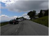
From the Tolmin–Kobarid road, in the village of Idrsko a steep road branches off to the left (from the direction of Kobarid to the right) towards the village of Livek. We take this road, which after about 5 km of ascent brings us to the mentioned village. We continue driving on an increasingly narrower road that leads to Italy. On the other side of the border the road starts to descend, and we follow it through the villages of Polava and Čepletišče (Cepletischis) to a somewhat larger intersection, where we turn right towards the village of Matajur (Montemaggiore) and the mountain hut Rifugio Pelizzo. We faithfully follow the road, which subsequently ascends relatively steeply, at the subsequent intersections in the direction of the mentioned hut. We park in the large arranged parking lot right below the hut Rifugio Pelizzo.
Route description:
From the large arranged parking lot we first ascend by stairs to the mountain hut Rifugio Pelizzo, from where already at the very beginning a beautiful view opens onto the Venetian Slovenia. At the hut we continue in the direction of the signposts for the summit of Matajur (Italian Monte Matajur) and Dom na Matajure. The path subsequently leads us across wide, moderately ascending and extremely scenic grassy slopes that are full of mountain flowers in spring and summer. During the easy ascent we can enjoy wonderful views that in good weather reach all the way from the Friulian plain and the Adriatic Sea in the south to the mighty peaks of the Julian Alps in the north.
Higher up the well-trodden trail leads us through a short stretch of raspberry bushes and low shrubbery, then brings us to a marked mountain junction. Here we continue straight up towards the summit, while to the left a path branches off towards the nearby Dom na Matajure, and to the right a path that leads back towards Livek and Avsa.
A little further from the junction the path gently bends to the right and for a short time levels out completely, offering a pleasant break during the ascent. Soon after the trail turns straight again towards the summit and begins to ascend gradually more steeply over the upper grassy slope. This final section of the path offers an ever wider horizon, and after a few minutes of pleasant walking brings us to the very 1642-metre-high summit of Matajur, where a scenic chapel and a registration box stand.

Photos:
 1
1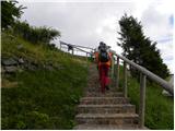 2
2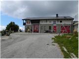 3
3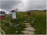 4
4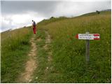 5
5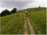 6
6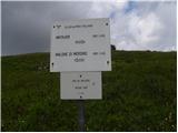 7
7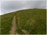 8
8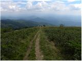 9
9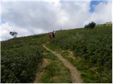 10
10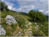 11
11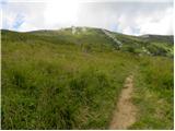 12
12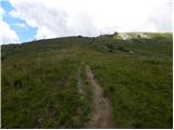 13
13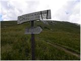 14
14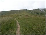 15
15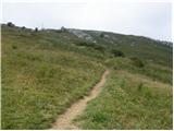 16
16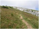 17
17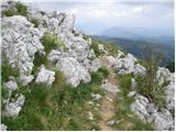 18
18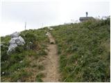 19
19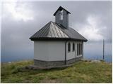 20
20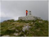 21
21
Discussion about the trip Rifugio Pelizzo - Monte Mataiur/Matajur
|
| el rocco16. 08. 2012 |
Yesterday 15.8.2012, on a day off work, we did a family trip to these parts. In the morning first to Matajur (recommend early as it's properly hot later, no panic though as there's not much walking..), followed by swimming in the Nadiža at Napoleon's bridge, visit to the WWI museum in Kobarid, afternoon lunch in Most na Soči and home.. In short, great trip that I recommend to all  ) )
|
|
|
|
| el rocco16. 08. 2012 |
Ah, and also for history buffs. During WWI, the summit of Matajur was captured by the famous Erwin Rommel, later better known as the Desert Fox. )
|
|
|
|
| balon1. 05. 2014 |
I'm wondering if there's any snow on the top or if it's slippery and the risk of slipping is high.
Balončki
|
|
|
|
| link_1. 05. 2014 |
We were today from Avša down to Pelizzo and back up to Avša. On the southern slopes it's wet and even just the ground is slippery. But with a bit of caution it's doable.
|
|
|
|
| balon2. 05. 2014 |
Thanks Link, us too. It was fantastic. Just a note that at the end of the village Savoja (or something similar) we had to turn back because of a physical barrier/detour to Stermica. Otherwise it was great.
|
|
|
|
| slavkovoda10. 08. 2014 |
After three ascents to Matajur from Avsa, this time I chose the Italian variant starting from Koča (Rifugio) Pelizzo. First east to Marsinska planina, then north past the huts and a small lake to the summit of Matajur. Then descent to the Slovenian Dom na Matajure and further or back to the starting point. Everything is well marked. Really nice tour, only a bit spoiled by the mist swirling around. Suitable also for families with small children. Recommended!
|
|
|
|
| spela marela27. 07. 2015 |
I'm curious if there are pastures up there or a possibility of encountering cows and bulls? A bit unusual question, but I have no desire to meet them.
|
|
|
|
| Smetar27. 07. 2015 |
Not on this path (at least when I last went in dry conditions there were none - but I'm not sure if there still aren't any), but from Avsa up near Mrzli vrh there are quite a few...
|
|
|
|
| Tajka6728. 04. 2023 17:50:54 |
Nice short hike, clouds covered the neighboring mountains today. Will have to go up once more. The hut on Matajur is closed....shame.
|
|
|
|
| darinka416. 10. 2023 15:46:26 |
I'll just ask here, has anyone hiked to Matajur via Sentiero Alpinistico Via Palma? This trail is supposed to be 15 km long and about 1500 m elevation gain.
|
|
|
|
| jax16. 10. 2023 16:34:15 |
I've been there, yes. What can I say? Extremely steep forest, fairly poorly marked, pulling on roots, especially in the wet (which is quite common there), quite dangerous for slipping. One of the more unpleasant paths I've walked. About halfway, the fixed ropes start and from there on it's at least mentally much easier, although there are still no great aesthetic experiences. But you're happy when the world opens up above and fitness-wise it's a good tour. Watch out on the descent too - the path also goes through wet and exposed terrain there, where caution is needed.
So - hard to give a straightforward answer on whether I recommend it. Strictly speaking, the path is not "beautiful". But these are mountains and - you still feel good when you get over it. Then everyone has to decide for themselves.
|
|
|
|
| darinka416. 10. 2023 17:28:14 |
Thanks to both. I didn't expect anyone to walk there at all. We'll see how it goes. I haven't been to Matajur for sure about twenty-eight years.
|
|
|
|
| darinka416. 10. 2023 18:10:36 |
Indeed, I've never been in a hurry to Matajur. Now it's about time
|
|
|
|
| sim11116. 10. 2023 19:38:40 |
Via Palma was renovated a couple of years ago, the steel cables were replaced. The path is very steep, when you reach Marsinsko planino the terrain levels out, for descent I recommend the path to Stupizzo/Štupco, which is less than half an hour walk from the starting point at Robič.
|
|
|
|
| jax16. 10. 2023 19:50:27 |
As far as I know, the steel cables weren't replaced, but installed - before that the path was completely unprotected, now the upper half is quite extensively equipped with fixed ropes. Certainly easier now, but still a serious matter.
Regarding the descent, I agree, that's the most pleasant. But it should be mentioned that it's not exactly a walk there either.
|
|
|
|
| VanSims17. 10. 2023 12:14:56 |
This June I walked Via Palma. The path is above all very very steep and requires above all a lot of fitness. That there's no joke with the path in this sense is already evident in the first meters, from the signpost by the road. It's technically demanding, but for someone who has already encountered somewhat more serious fixed ropes, topographically it shouldn't be a big problem. Caution of course, as on any protected path. Harness recommended for less experienced, helmet of course for everyone.
Regarding the descent, yeah it's not exactly a walk. Maybe in the upper part, but not in the lower. There it's steep and can also be slippery. A very careful step is needed. It's all the more dangerous because many people don't know this and you can suddenly slip if you don't have this information, and because the comfortable upper part lulls you and because they think 'the path is descent anyway'. Fatigue from the ascent also plays its part.
Careful also on the road back to Robič. It's quite busy. Even during the day caution is needed, especially now in this season if it's already dusk and dark. Mandatory light, reflector and/or reflective vest, ...
|
|
|
|
| darinka417. 10. 2023 13:41:53 |
Today 17.10. we walked this path. With beautiful views. Nicely secured path with steel cables. All three of us are thrilled with the path. At the top beautiful views with a touch of wind.
|
|
|
|
| mirank17. 10. 2023 21:22:12 |
There are no fixed ropes on the path described here, as you will scare all tourists. Because of scribbles like the last 4 posts, the forum is losing clarity, since this belongs under current conditions. If you can't do it otherwise, then comment under the description of the path you are referring to.
|
|
|
|
| darinka419. 10. 2023 16:41:28 |
Mirank, I was looking for that path but couldn't find it, the one I was asking about. Otherwise I would have written there so as not to confuse anyone. I think there's nothing wrong with someone describing their experiences on the path. I don't believe that someone who is not used to steep and of course slippery paths would go there. This way you at least learn something new. Because we really didn't know it. So thanks again to everyone for the impressions from this path.
|
|
|
|
| mirank20. 10. 2023 20:17:31 |
If you didn't find it, then I don't know why you posted here. Isn't it enough to write your impressions under current conditions where it also belongs. Especially since the next day you posted a perfectly fine entry under current conditions equipped with photos.
|
|
|
To post a comment you must log in:
If you do not yet have a username, you must first
register.