Rifugio Pelizzo - Monte Mataiur/Matajur (via Fonte Skrila)
Starting point: Rifugio Pelizzo (1320 m)
| Latitude/Longitude: | 46,20300°N 13,53910°E |
| |
Route name: via Fonte Skrila
Walking time: 1 h 15 min
Difficulty: easy marked way
Elevation gain: 322 m
Elevation difference along the route: 400 m
Map: Julijske Alpe - zahodni del 1:50.000
Recommended equipment (summer):
Recommended equipment (winter): ice axe, crampons
Views: 12.751
 | 4 people like this post |
Access to starting point:
A) On the Slovenian side:
From the road Tolmin - Kobarid, in the settlement Idrsko to the left (from the direction Kobarid right) steep two-lane road branches off towards the village Livek (approximately 5 km). Here we continue on an ever narrower road into Italy. On the other side of the border, the road starts slightly descending, at village Polava again widens, and slightly ascends towards the village Čepletišče / Cepletischis. From here we descend towards the crossroad (0.5 km), where we continue right in the direction of village Matajur / Montemaggiore and Rifugio Pelizzo. Straight Sauodnja / Savogna. From Livek to the village Matajur is approximately 10 km, and to Rifugio Pelizzo 13 km.
B) On the Italian side:
From the Gorizia direction we drive on a regional road towards Udine, to the turn-off for Krmin / Cormons. At the roundabout on the first exit we turn towards Krmin / Cormons and Čedad / Cividale and we drive under the underpass and then we immediately turn left. In the larger and awkward crossroad in Krmin we turn towards Čedad / Cividale del Friuli. We continue driving through more settlements on the carefully treated Friulian plain. In good visibility we will see our destination Matajur in company of Krn at first on our right side, and from Čedad straight in front of us. In Čedad we get to the traffic light crossroad next to a building, in which is at first pharmacy (farmacia) and then bank. At the crossroad, we turn sharply right (straight in front of us entrance into the old part of the town and large free parking lot). To the famous Hudičev most there is only a few minutes of walking.
We continue to a smaller roundabout, in front of which there are more signposts, among them also brown sign for Kolovrat. From here further we follow the signs for Kolovrat. By the river Nadiža we drive towards the settlement Špeter Slovenov / San Pietro al Natisone. Approximately 1 km before Špeter we get to a crossroad in the settlement Muost/Puint/Ponte San Quirino. Here we turn right (straight Špeter), left over a bridge road from Čedad on other bank of river Nadiža, on which leads the path that you can find on Google Maps. We still follow the signs for Kolovrat, but only for approximately 1.5 km, where the road branches off to the right towards Kolovrat and former border crossing Solarij / Solarie. We continue straight to bigger settlement Sauodnja / Savogna, also center of the eponymous municipality. Here we turn right over a bridge and we continue on the main road. We could also go after the bridge left upwards, but the path is very steep and narrow. On the bridge we see also red signs for Rifugio Pelizzo. The path soon starts ascending in zig-zags (approx. 3 km and 6 sharp turns). On the top we come to the next turn-off, where we turn left towards the village Matajur / Montemaggiore and Rifugio Pelizzo. Straight in front of us village Čepletišče (Cepletischis) and approximately 6 km to Livek. From the crossroad approximately 5.5 km of moderately ascending two-lane road separates us to the village Matajur. Above the village Matajur the road narrows a little and after 3.5 km in a gentle ascent brings us to Rifugio Pelizzo.
Route description:
We park on the parking lot at Rifugio Pelizzo on the mountain pasture Planina v Lazeh. The word rifugio in a literal translation means refuge, but in Italian also the mountain hut or cottage. Pelizzo by size belongs more among the latter. In snow conditions there is a road closure above the village Matajur. The shortest path to Rifugio Pelizzo is along the mildly ascending road (approximately 45 min of walking), which we can shorten several times on steep shortcuts.
From the parking lot at Rifugio Pelizzo we step to the turn below the observatory, where signs for Fonte Skrila point us left. The path descends towards the house, which we see below the observatory, and continues past a wall below the house. The footpath starts descending on a grassy slope towards the forest on our left. After a few steps, we will notice an unmarked footpath which branches off on our left. We continue on the marked footpath, which for a few meters steeply descends and then turns to the left, towards the forest. The nearly flat path brings us after a few minutes to a spring. From here the footpath starts mildly ascending diagonally through the forest to a turn-off, where a signpost for Matajur and Fonte Skrila points us left uphill, straight ahead the footpath continues to Palestra di roccia. The path ascends quite steeply for the next 10-15 minutes. At the end of the ascent from the left joins an unmarked footpath, which at the beginning of the path, below the house, immediately went to the left, through the forest.
The unmarked footpath moderately ascends all the way to the junction with the marked path, so compared to the marked path, which first descends and then ascends more steeply, it is less strenuous for walking. However, walking on it also in dry conditions requires more attention, because the footpath is very narrow and in places crosses steep slopes, which due to the shady position are often iced, and if wet, slippery. The unmarked path in snow conditions mostly is not beaten, if iced, crampons are necessary. If the snow is soft, there is a great risk that we trigger an avalanche. If there is more than 0.5 m of snow, better choose the lower, marked path.
The lower, marked path also in snow conditions mostly is not problematic. If there is snow near 1 m and more, we must be very careful on the part of the path right before Fonte Skrila, where we cross a few meters of slope above the bed of a torrent. In dry conditions a wide flat path leads here and we do not notice the steepness at all. If there is a lot of snow, this part turns into a steep slope, which ends in the bed of a torrent. Here greater caution is needed, because we can trigger an avalanche or slip into the bed of a torrent.
When the footpaths join, the path flattens and turns right for a few more steps through the forest, which soon thins. In front of us we notice the mountain pasture, which rises below the eastern slopes of Matajur.
We continue past the stone trough and water reservoir at Izvir/Fonte Skrila. Skrila is one of three springs, which are on Matajur at an altitude above 1,400 m, which is a great rarity. Perhaps these springs give the fatherly mountain of the Beneški Slovenci special energy.
The path starts from the trough moderately ascending along the right edge of the mountain pasture towards the saddle, where it joins the cart track - old path from Livek. Here also joins a footpath which shortens the bend. In front of us rises the mighty Krn with its neighbors, behind us on our left we clearly see our goal, the peak Matajur. The signpost says that to the top there is still 20 min, but you can calmly add at least another 10 min and enjoy the ever more beautiful views. We continue a few steps on the cart track to the bend, where the blazes direct us to the footpath which leads straight uphill. The cart track in a gentle ascent crosses the southeast slopes of Matajur towards Dom na Matajure. If there is snow near 1 m, you will not see the cart track. If the snow is not consolidated, crossing the slopes towards Dom na Matajure is not recommended, because an avalanche can be triggered from the higher steep slopes above the cart track.
On the path from Rifugio Pelizzo to Fonte Skrila and further towards the saddle, there is usually much more snow than on the south side. If it is not beaten, snowshoes usually come in handy on this part of the path.
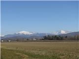
From the bend our path continues on the footpath, which ascends quite steeply to a smaller saddle, where from the right joins the path from Avse. From here the views in front of us expand to the Kanin mountain range and Rombon, Mangrt, Jalovec, and Razor. A shorter ascent follows to the eastern ridge, from which the view reaches all the way from the Dolomites to the Spodnje Bohinjske gore. After crossing the ridge the path moderately ascends for a few more minutes towards the top, which we see all the time in front of us.
From the top of Matajur we can go to Rifugio Pelizzo:
- straight downhill along the former ski slope
- along the northern ridge to Maršinska planina (not recommended in snow conditions),
- along the western ridge to Dom na Matajure and from there:
a) left to Rifugio Pelizzo,
b) right, to the houses at the pond and further left, towards the beginning of Maršinska planina, where a steep path from Dom na Matajure joins, from there further left, to Rifugio Pelizzo, straight to the village Matajur.
c) straight downhill along the steep path to Maršinska planina and further left, to Rifugio Pelizzo or straight to the village Matajur.

Photos:
 1
1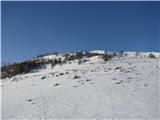 2
2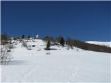 3
3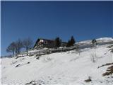 4
4 5
5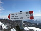 6
6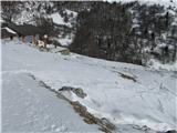 7
7 8
8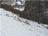 9
9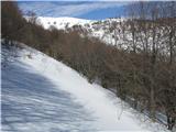 10
10 11
11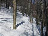 12
12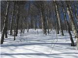 13
13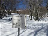 14
14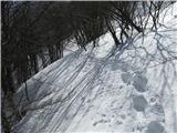 15
15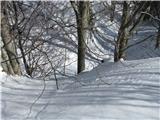 16
16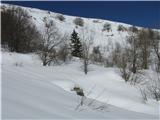 17
17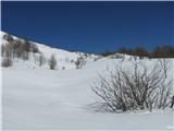 18
18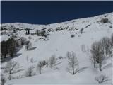 19
19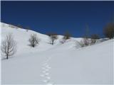 20
20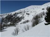 21
21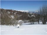 22
22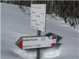 23
23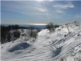 24
24 25
25 26
26 27
27 28
28 29
29 30
30 31
31 32
32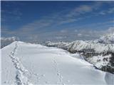 33
33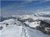 34
34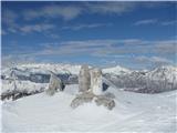 35
35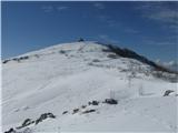 36
36 37
37 38
38 39
39 40
40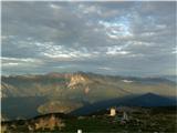 41
41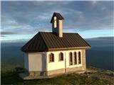 42
42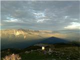 43
43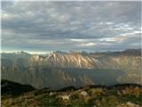 44
44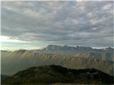 45
45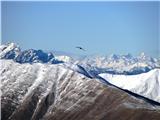 46
46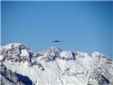 47
47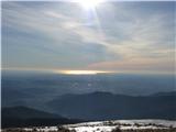 48
48 49
49 50
50
Discussion about the trip Rifugio Pelizzo - Monte Mataiur/Matajur (via Fonte Skrila)
To post a comment you must log in:
If you do not yet have a username, you must first
register.