Rifugio Tolazzi - Rauchkofel
Starting point: Rifugio Tolazzi (1350 m)
| Latitude/Longitude: | 46,59199°N 12,86780°E |
| |
Walking time: 3 h 15 min
Difficulty: partly demanding marked way
Elevation gain: 1110 m
Elevation difference along the route: 1140 m
Map:
Recommended equipment (summer):
Recommended equipment (winter): ice axe, crampons
Views: 3.100
 | 1 person like this post |
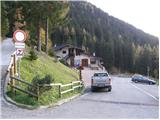
Access to starting point:
From Trbiž/Tarvisio we go on the highway towards Videm/Udine. We leave the highway at the exit for Tolmezzo. At Tolmezzo we then also leave the road which runs towards the mountain pass Passo di Croce Carnico / Plöckenpass and go towards Villa Santina. In Villa Santina at the roundabout, we go straight following the signs Ovaro, Sappada. We follow this road all the way to Forni Avoltri, where we turn right following the signs Collina. We then follow the asphalt road all the way to the parking lot before the mountain hut Tolazzi.
Route description:
From the parking lot at the mountain hut Rifugio Tolazzi we continue on the road following the signs Rif. Lambertenghi-Romanin. After a short ascent, we come to a crossroad, where we continue left on a narrower road (path 144), while to the right the road leads towards the mountain hut Marinelli. We soon leave the road and turn right onto a footpath which starts ascending through the forest. The path runs on the right side of the valley and occasionally a nice view opens up to the mountain walls of Monte Coglians / Hohe Warte on the right and Monte Capolago / Seekopf on the left side of the valley. When we come out of the forest, we will already see the saddle Volaia / Wolayer Pass in front of us, where there is also the mountain hut Rifugio Lambertenghi-Romanin. The path then ascends for some time alongside the cargo cableway, after which path 145 from the mountain hut Rifugio Marinelli joins from the right. A short ascent follows and we soon come to a poorly visible junction, where the path to Monte Capolago / Seekopf branches off to the left, and we continue straight and soon reach the mountain hut Rifugio Lambertenghi-Romanin.
From the mountain hut, we then have approximately 5 minutes' walk to the lake, which is situated on the Austrian side of the saddle Volaia / Wolayer Pass, and to the mountain hut Wolayerseehütte additional 5 minutes.
From the mountain hut, we continue right on a marked path in the direction of the summit Rauchkofel. The path, which first ascends gently, quickly steepens and then ascends over relatively steep grassy slopes. Higher up, the path flattens and turns slightly to the left, bringing us in a moderate ascent to a smaller saddle, where there is a junction. We continue left on a relatively steep path which ascends over the grassy slopes of the mountain. Higher, the path turns slightly to the left and brings us to the main ridge. We continue slightly right on an increasingly steep path, which further ascends over very steep grassy slopes. Further on, the path brings us to steel cables, with the help of which we then ascend to the panoramic summit in a few minutes of additional walking.
Rifugio Tolazzi - Wolayer See 1:45, Wolayer See - Rauchkofel 1:30.

Photos:
 1
1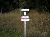 2
2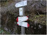 3
3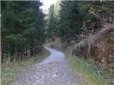 4
4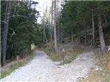 5
5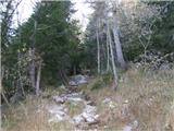 6
6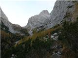 7
7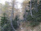 8
8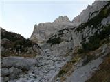 9
9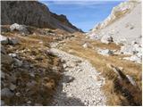 10
10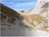 11
11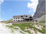 12
12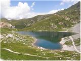 13
13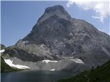 14
14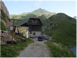 15
15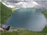 16
16 17
17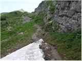 18
18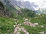 19
19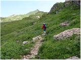 20
20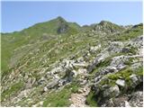 21
21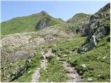 22
22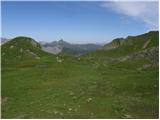 23
23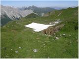 24
24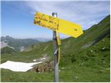 25
25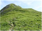 26
26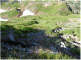 27
27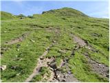 28
28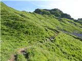 29
29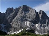 30
30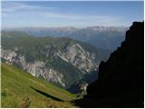 31
31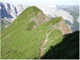 32
32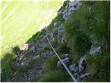 33
33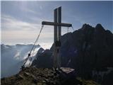 34
34 35
35
Discussion about the trip Rifugio Tolazzi - Rauchkofel
To post a comment you must log in:
If you do not yet have a username, you must first
register.