Rifugio Valparola - Monte Sief
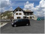
Starting point: Rifugio Valparola (2175 m)
| Latitude/Longitude: | 46,53169°N 11,98868°E |
| |
Walking time: 2 h 10 min
Difficulty: partly demanding marked way
Elevation gain: 249 m
Elevation difference along the route: 480 m
Map: Tabacco 07 1:25.000
Recommended equipment (summer):
Recommended equipment (winter): ice axe, crampons
Views: 2.568
 | 2 people like this post |
Access to starting point:
Access from Gorenjska: Through the border crossings Rateče or Predel to Trbiž / Tarvisio and then continue on the highway in the direction of Vidma / Udine to the Tolmezzo exit. From Tolmezzo we follow the road in the direction of the village Ampezzo and mountain pass Passo della Mauria. The road then descends and brings us to a crossroad, where we continue left (possible also right) in the direction of Cortina d'Ampezzo. At all next crossroads we follow the signs for Cortina d'Ampezzo.
In Cortina d'Ampezzo we then follow the signs for the alpine pass Passo di Falzarego. We follow this ascending road to the mentioned pass, then continue right towards the pass Passo Valparola. At the pass we park on one of the parking lots near the hut Rifugio Valparola.
From Primorska: We drive on the highway towards Venice / Venezia. At Portogruaro we leave the highway towards Venice and continue right on the highway towards Pordenone. At the next highway junction near Conegliano we continue right towards Belluno. Near Belluno the highway ends, and at the next crossroads we continue in the direction of Cortina d'Ampezzo. Further we follow the above description.
Route description:
From the hut Rifugio Valparola we continue towards the southwest following the signs »Settsass, Col di Lana«. The path then crosses grassy slopes on the right side of the lake Lago di Valparola and brings us to a junction. We continue left on path no. 23, while to the right path no. 24 leads towards the summit Setsas.
From the junction the path slightly descends along a grassy slope and then brings us to slightly steeper slopes on the south side of the ridge of peaks Setsas and Le Pale de Gerda. On a shorter section fixed safety gear also assists us. The path then begins to ascend gently and crosses the slopes towards the west. From the path we have a nice view all the time of the precipitous south walls of the peak Setsas; the ridge of peaks Monte Sief and Col di Lana is also nicely visible. The path soon brings us to another junction, where an unmarked path branches off to the right upwards, leading below the precipitous walls towards the summit Pico Setsas.
We continue slightly left on the lower path and further on mostly in a gentle ascent cross the slopes towards the west. This path then brings us to grassy slopes below the summit Picco Setsas, from which a wonderful view opens towards the mountain group Sella. Here we continue left and descend along the path that leads along the fence to the saddle Passo Sief.
At the saddle, where there is a junction, we continue straight along the ridge towards the summit Monte Sief. Here along the path we will notice numerous military tunnels and trenches, which are nicely renovated. We then follow the panoramic path along the military trenches all the way to the summit Monte Sief, from which even nicer views open up also towards the south.

Along the route: Lago di Valparola (2140m), Passo Sief (2209m)
Photos:
 1
1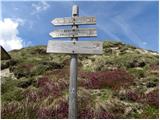 2
2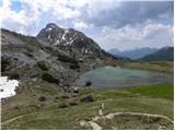 3
3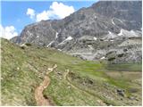 4
4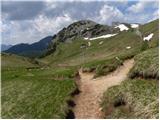 5
5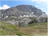 6
6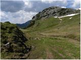 7
7 8
8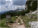 9
9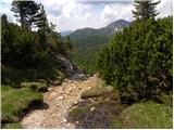 10
10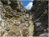 11
11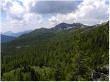 12
12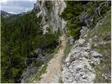 13
13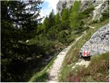 14
14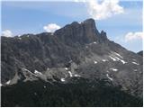 15
15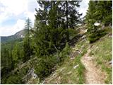 16
16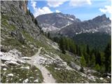 17
17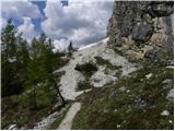 18
18 19
19 20
20 21
21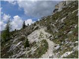 22
22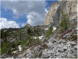 23
23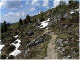 24
24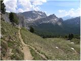 25
25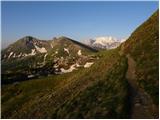 26
26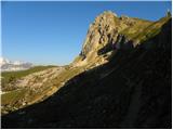 27
27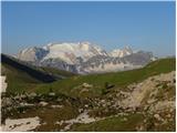 28
28 29
29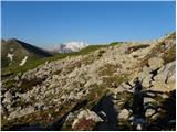 30
30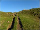 31
31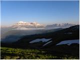 32
32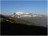 33
33 34
34 35
35 36
36 37
37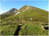 38
38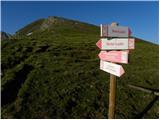 39
39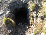 40
40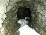 41
41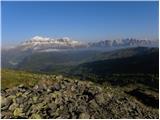 42
42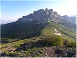 43
43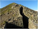 44
44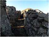 45
45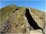 46
46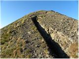 47
47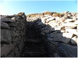 48
48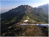 49
49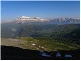 50
50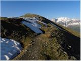 51
51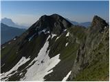 52
52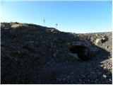 53
53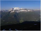 54
54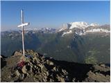 55
55
Discussion about the trip Rifugio Valparola - Monte Sief
To post a comment you must log in:
If you do not yet have a username, you must first
register.