Ristorante Pietofana - Rifugio Ra Valles (via Rifugio Pomedes)
Starting point: Ristorante Pietofana (1675 m)
| Latitude/Longitude: | 46,54074°N 12,09882°E |
| |
Route name: via Rifugio Pomedes
Walking time: 3 h 30 min
Difficulty: very difficult marked way
Via ferrata: B/C
Elevation gain: 795 m
Elevation difference along the route: 868 m
Map: Tabacco 03 1:25.000
Recommended equipment (summer): helmet, self belay set
Recommended equipment (winter): helmet, self belay set, ice axe, crampons
Views: 2.032
 | 2 people like this post |
Access to starting point:
Access from Gorenjska: Through the border crossing Rateče or Predel to Trbiž / Tarvisio and then on the highway in the direction of Vidma / Udine to the exit Tolmezzo. From Tolmezzo we follow the road in the direction of the settlement Ampezzo and the mountain pass Passo della Mauria. The road then descends and brings us to a crossroads, where we continue left (possible also right) in the direction of Cortina d'Ampezzo. At all next crossroads we follow the signs for Cortina d'Ampezzo.
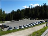
In Cortina d'Ampezzo we then follow the signs for the alpine pass Passo di Falzarego. We follow this ascending road to a crossroads where to the right branches a narrower road towards the restaurant Pie Tofana and the hut Col Druscie. The crossroads is located in the lower part of the road towards the pass Passo Falzarego. At the mentioned crossroads we continue right and follow the asphalt road all the way to the larger parking lot at the restaurant Pietofana.
From the Primorska side: We drive on the highway towards Venice / Venezia. At Portogruaro we leave the highway towards Venice and continue right on the highway towards Pordenone. At the next highway junction near Conegliano we continue right towards Belluno. Near Belluno the highway ends and at the next crossroads we continue in the direction of Cortina d'Ampezzo. Further we follow the above description.
Route description:
From the parking lot we continue on the asphalt road and then turn left onto the macadam road following the signs »Rifugio Pomedes, Forcella Ra Valles«. The macadam road, closed to traffic, starts to ascend and quickly brings us to a marked junction, where the path to the notch Forcella Ra Valles branches off to the right.
At the junction we continue straight on the road, which brings us out of the forest to the ski slope. Here we ascend next to the cableway for some time, then the road turns left across the ski slope. When the road crosses the ski slope, pay attention as our path branches off to the right onto the ski slope. The trail on the ski slope is initially quite poorly visible and brings us back to the right side of the cableway. Further on, the path continues to ascend relatively steeply on the ski slope, always running slightly to the right of the cableway. The quite steep ski slope gradually turns left; later, when we approach the hut Rifugio Duca d'Aosta, it becomes gentler.
Here from the ski slope we turn left and only a short easy walk remains to the hut, from which there is a nice view of the mountains above Cortina d'Ampezzo.
From the hut we continue on the ski slope that runs on the left side of the cableway. To the left a transverse path branches off to the hut Dibona; we continue ahead on the ski slope, which soon becomes quite steep. Grassy slopes are replaced by scree, due to which some caution is needed in a few places. The path then becomes less steep and a view opens towards the hut Pomedes. Here the path turns slightly right towards the cableway and only a short ascent to the hut follows.
We can also reach the hut Rifugio Pomedes by chairlift and thus save 1h 45min of walking.
At the hut we continue north following the signs »Sentiero Attrezzato Giuseppe Olivieri«; we first descend slightly, then cross the scree slopes above the ski slope. The path then brings us below the walls on the eastern side of the peak Punta Anna and ascends several times along the steel cable. Further on, the path ascends diagonally above somewhat steeper slopes and also crosses a few exposed gullies.
Later the path becomes somewhat more demanding, ascending over a vertical ladder and then steeply ascending several times along the steel cable. The path then turns slightly left and ascends a less steep slope. From the path we have a very nice view all the time, especially on the peaks above Cortina d'Ampezzo; to the south, views towards Monte Pelmo and Civetta begin to open. Further on follows another somewhat steeper section of the path, where a ladder and some steel cables assist again. The path then becomes less demanding and brings us to the ski slope from which a view towards Tofana di Mezzo opens.
At the marked junction we continue right downhill towards the hut Rifugio Ra Valles; to the left the path leads to the peaks Punta Anna and Tofana di Mezzo. The path then mostly gently descends and brings us to the hut Ra Valles, where there is also the cable car station.
Descent either via the ascent path or via the easier path (path no. 407) over the notch Forcella Ra Valles.

Photos:
 1
1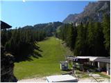 2
2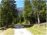 3
3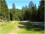 4
4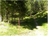 5
5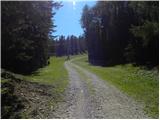 6
6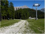 7
7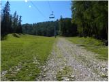 8
8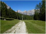 9
9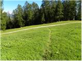 10
10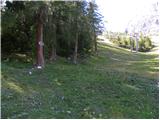 11
11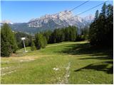 12
12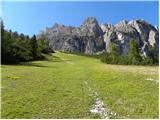 13
13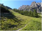 14
14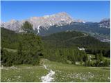 15
15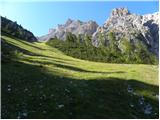 16
16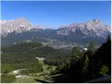 17
17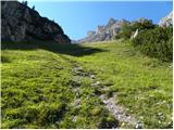 18
18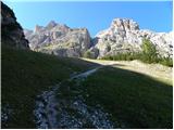 19
19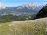 20
20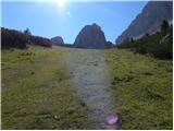 21
21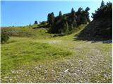 22
22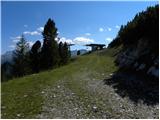 23
23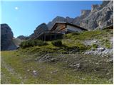 24
24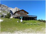 25
25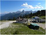 26
26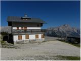 27
27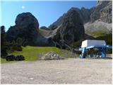 28
28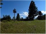 29
29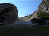 30
30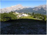 31
31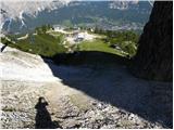 32
32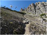 33
33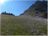 34
34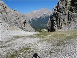 35
35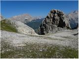 36
36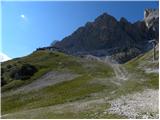 37
37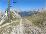 38
38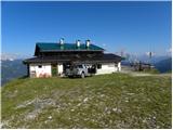 39
39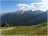 40
40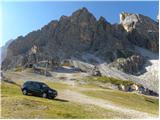 41
41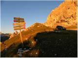 42
42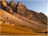 43
43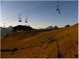 44
44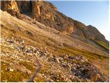 45
45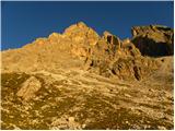 46
46 47
47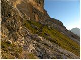 48
48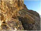 49
49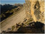 50
50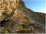 51
51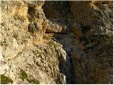 52
52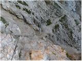 53
53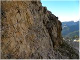 54
54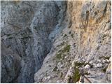 55
55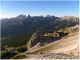 56
56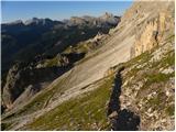 57
57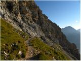 58
58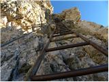 59
59 60
60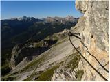 61
61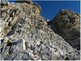 62
62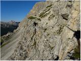 63
63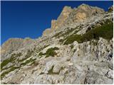 64
64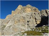 65
65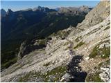 66
66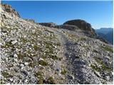 67
67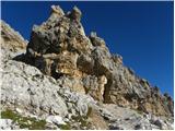 68
68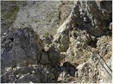 69
69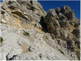 70
70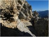 71
71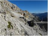 72
72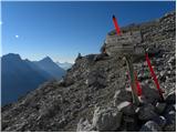 73
73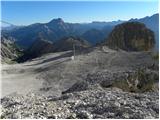 74
74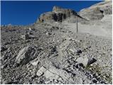 75
75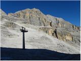 76
76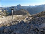 77
77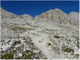 78
78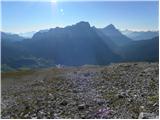 79
79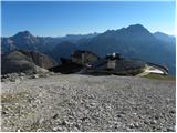 80
80
Discussion about the trip Ristorante Pietofana - Rifugio Ra Valles (via Rifugio Pomedes)
To post a comment you must log in:
If you do not yet have a username, you must first
register.