Robanov kot - Ojstrica (via Kocbekov dom)
Starting point: Robanov kot (650 m)
| Latitude/Longitude: | 46,39480°N 14,70300°E |
| |
Route name: via Kocbekov dom
Walking time: 5 h 45 min
Difficulty: difficult marked way
Elevation gain: 1700 m
Elevation difference along the route: 1850 m
Map: Kamniške in Savinjske Alpe 1:50.000
Recommended equipment (summer): helmet
Recommended equipment (winter): helmet, ice axe, crampons
Views: 8.660
 | 1 person like this post |
Access to starting point:
Via the Volovljek pass (Kranjski Rak) or from Mozirje we drive to Luče, then we follow the signs for Solčava and Logarska dolina. When we arrive in the settlement Robanov Kot, the signs for the alpine valley Robanov kot direct us left onto a side road, along which we drive to the parking lot near the farm Roban, where we park. We can also park 500 m lower, where there is another organized parking lot, but we must not park on the parking lot of the pension Govc-Vršnik, because then there is no space left for the guests of the pension.
Route description:
If we've parked on the lower parking lot we continue on the road to the parking lot at the farm Roban, only a few meters ahead of the last parking lot we arrive at a crossroad, where we continue straight ahead on the road where there is a gate (right Strelovec).
The road towards Robanova planina then goes into the forest and brings us to a junction, where we continue straight ahead further on the road (left partisan hospital 45 min).
The road then brings us out of the forest onto Robanov travnik, where a nice view opens up on the surrounding rock faces. On the other side of the meadow the road goes back into the forest and ascends somewhat more steeply. This is followed by crossing a pasture fence and soon thereafter we emerge from the forest onto the panoramic Robanova planina.
From the mountain pasture we continue following the signs »Korošica, Ojstrica« and a wide path brings us into the forest already after a few meters. After a short ascent the path turns left and crosses several torrent beds. We ascend again through the forest and soon reach a small waterfall below the slopes of Molička peč and Velika Zelenica. Here the path turns right and begins to ascend quite steep slopes with the aid of a steel cable and a few bolts. This is followed by another short ascent through the forest on somewhat gentler slopes, then we reach a somewhat more rocky section of the path. The path then ascends for quite some time on steep slopes above the torrent gorge. The path here is routed over nice passages and is very well secured with a steel cable, so the ascent presents no major difficulties. The path is also assisted by numerous bolts and steps carved into the rock. This is followed by a few more steeper ascents aided by the steel cable and bolts, then the path brings us to gentle slopes covered with dwarf pines. The path then through the dwarf pines in a short descent brings us to a junction, where we continue straight in the direction of Korošica (right Molička planina 10 minutes). A short ascent follows and we join the path from the mountain pasture Podvežak, which after a further short traversing ascent brings us to Sedelce.
From Sedelce we continue straight downhill (left Prag, right Ojstrica via Mala Ojstrica) on the marked path, which begins to descend towards Korošica. After a few minutes of descent we step onto the expansive meadow of Korošica, across which we walk in a few minutes to the mountain hut.
From Kocbekov dom we continue on the marked path in the direction of Ojstrica. The path enters a belt of dwarf pines already a few meters above the hut, where it begins to ascend ever more steeply. After a good 20 minutes of ascent from Kocbekov dom the path levels out, passing onto grassy slopes which are soon replaced by scree. The path ahead crosses two consecutive gullies, then begins to ascend more steeply on an ever more panoramic slope. The path leads us past two less noticeable junctions (in both cases we continue right in the direction of Ojstrica, left Planjava and Škarje) and gradually begins to turn further right. Higher up the path becomes even steeper and transitions to a quite scree-covered slope. Further on the path levels briefly and through a narrow passage brings us to the main ridge of the Kamnik-Savinja Alps. Once on the ridge we continue right on a very steep path, which ascends further over rugged rock. We follow this very steep path, aided by a few bolts, all the way to the summit of Ojstrica, which we reach after about 15 minutes of further walking (in the final section there is a high risk of falling rocks).
Robanov kot - Robanova planina 1:00, Robanova planina - Sedelce 2:45, Sedelce - Kocbekov dom 15 minutes, Kocbekov dom - Ojstrica 1:45.

Photos:
 1
1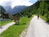 2
2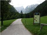 3
3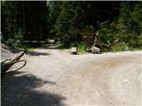 4
4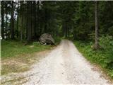 5
5 6
6 7
7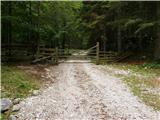 8
8 9
9 10
10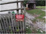 11
11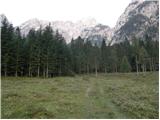 12
12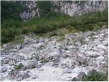 13
13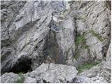 14
14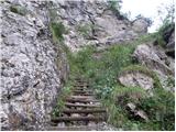 15
15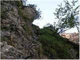 16
16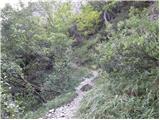 17
17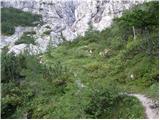 18
18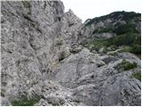 19
19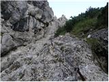 20
20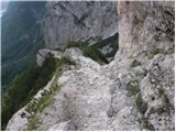 21
21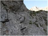 22
22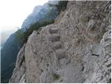 23
23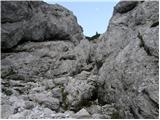 24
24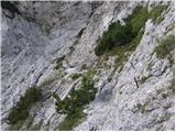 25
25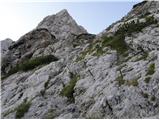 26
26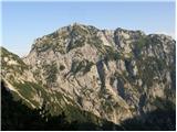 27
27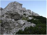 28
28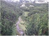 29
29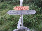 30
30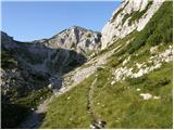 31
31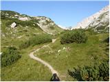 32
32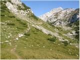 33
33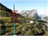 34
34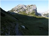 35
35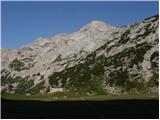 36
36 37
37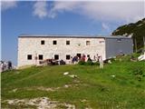 38
38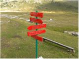 39
39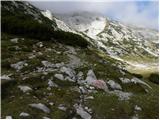 40
40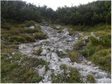 41
41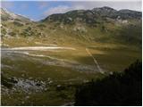 42
42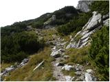 43
43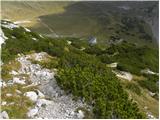 44
44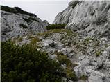 45
45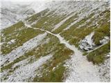 46
46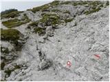 47
47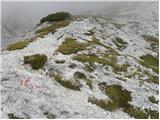 48
48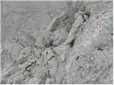 49
49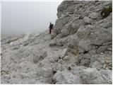 50
50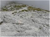 51
51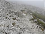 52
52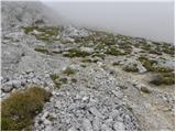 53
53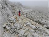 54
54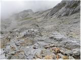 55
55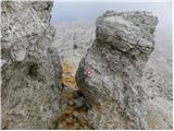 56
56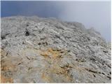 57
57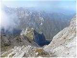 58
58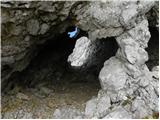 59
59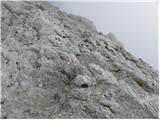 60
60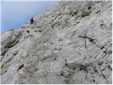 61
61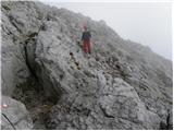 62
62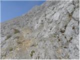 63
63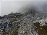 64
64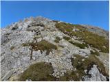 65
65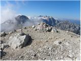 66
66
Discussion about the trip Robanov kot - Ojstrica (via Kocbekov dom)
To post a comment you must log in:
If you do not yet have a username, you must first
register.