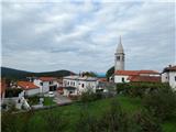
Rodik - Sveti Socerb (Artviže)
Starting point: Rodik (579 m)
| Latitude/Longitude: | 45,62340°N 13,98010°E |
| |
Walking time: 1 h 20 min
Difficulty: easy unmarked way
Elevation gain: 238 m
Elevation difference along the route: 275 m
Map:
Recommended equipment (summer):
Recommended equipment (winter):
Views: 5.790
 | 1 person like this post |
Access to starting point:
A) From the highway Ljubljana - Koper, take the Divača exit, then from the roundabout continue to the exit in the direction of Kozina and Škocjan Caves. We then drive through the underpass under the highway, along the main road towards Kozina to the intersection, where the road towards the settlement Rodik branches off to the left. When we arrive in Rodik, at the intersection at the house with house number Rodik 2, we continue left, then drive on the narrower road which leads us between numerous houses. Through the village we follow the "feeling" that we have to get above the village, where the cycling path (macadam road) starts, which leads towards Artviže (in Rodik there are signs for the mentioned cycling path). We park above the village at a suitable place near the pumping station Rodik 2. Further driving is forbidden.
B) From the highway Koper - Ljubljana, take the Kozina exit, then continue driving towards Ilirska Bistrica. From the traffic-light intersection in Kozina, continue straight (left Trst, right Ilirska Bistrica) onto Rodiška Road, along which we continue to the settlement Rodik. When we arrive in Rodik, at the intersection at the house with house number Rodik 2, we continue left, then drive on the narrower road which leads us between numerous houses. Through the village we follow the "feeling" that we have to get above the village, where the cycling path (macadam road) starts, which leads towards Artviže (in Rodik there are signs for the mentioned cycling path). We park above the village at a suitable place near the pumping station Rodik 2. Further driving is forbidden.
Route description:
From the pumping station Rodik 2 we continue on the macadam road, which is closed to public traffic and leads towards Artviže. At first the road ascends quite steeply, then to the right branches off an unmarked path (at first still a road) towards Ajdovščina, about a minute higher to the left a road, alongside which there are signs for the Divaški cycling loop. In both cases we continue on the wider road, which higher flattens and from the slopes of the peak Ajdovščina gradually transitions to the ridge Križandrev. Along the mentioned ridge we are at first still mostly ascending, higher the road also descends a few times. When the forest ends, the road completely flattens, then with occasional views towards Slavnik slowly leads us towards Artviže. A little before the mentioned village, a marked path from the church of St. Mavricij joins from the left. We continue straight, where after a few steps we arrive at the NOB monument and the logbook at Artviže.
From the logbook in the village we continue on the asphalt road, which is not marked. At intersections we keep to the left directions (we overlook the turn-offs to courtyards), the road quickly takes us above the village, where the asphalt ends. We continue the ascent along the panoramic grassy slope, along which we walk in a few minutes to the church of St. Socerb, which is located on the highest summit of the Brkini.

Photos:
 1
1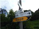 2
2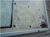 3
3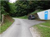 4
4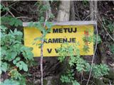 5
5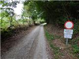 6
6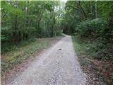 7
7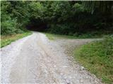 8
8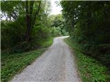 9
9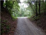 10
10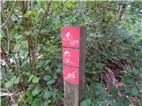 11
11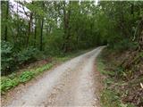 12
12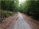 13
13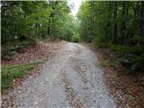 14
14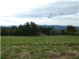 15
15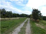 16
16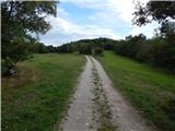 17
17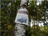 18
18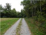 19
19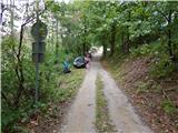 20
20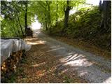 21
21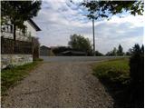 22
22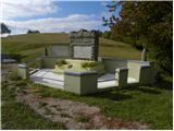 23
23 24
24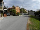 25
25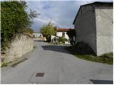 26
26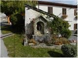 27
27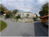 28
28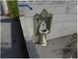 29
29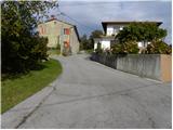 30
30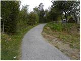 31
31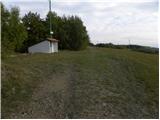 32
32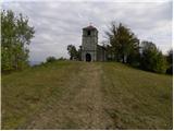 33
33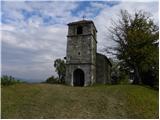 34
34 35
35
Discussion about the trip Rodik - Sveti Socerb (Artviže)
To post a comment you must log in:
If you do not yet have a username, you must first
register.