Rogovilec - Velika Raduha (via planina Arta)
Starting point: Rogovilec (590 m)
| Latitude/Longitude: | 46,39850°N 14,70690°E |
| |
Route name: via planina Arta
Walking time: 4 h 30 min
Difficulty: partly demanding marked way
Elevation gain: 1472 m
Elevation difference along the route: 1500 m
Map: Kamniške in Savinjske Alpe 1:50.000
Recommended equipment (summer): helmet
Recommended equipment (winter): helmet, ice axe, crampons
Views: 22.357
 | 4 people like this post |
Access to starting point:
From Mozirje or over Kranjski Rak we drive through Luče and further past Igla to Rogovilec a little before Solčava. There on the left side by the main road is space for parking.
Route description:
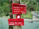
The first two hundred meters of the path run on asphalt to the bridge over Savinja. Then we continue on a footpath above the left bank of Savinja. A little higher we reach a cart track which brings us to the farm Pačnik. The path above the farm still runs on a cart track, then on a footpath. When we overcome this steep part, the footpath descends and a long quite exposed crossing begins. The footpath gently ascends and several times also descends a little downward. Caution is needed at the crossing. Even though the path runs through the forest the whole time, slipping due to the steepness below us could certainly be fatal. The end of the crossing is at a quite well-marked rock. 20 meters to the right of it is the first of several panoramic points in the continuation of the path. There is also the marking for mountain pasture Arta.
The path ahead leads steeply upward along the ridge above the vertical walls of Raduha. When the path higher up flattens, we notice an unmarked hunting path to the left upward.
(HUNTING VARIANT: Hunters use this path and it simply follows the ridge ahead. The path is orientationally undemanding. Until we reach the salt lick for game we just keep to the ridge. To the salt lick it is quite steep. Above the salt lick the path flattens and is well visible. Before we reach the marked path again, hunters have felled two larches for camouflage. We just need to cross over them and we are already on the marked path. By this variant we shorten the path by at least half an hour).
The marked path after a short descent brings us to the road along which we continue to the turn-off for Snežna jama cave. The cave is definitely worth seeing; how and when we find on the web. Past the cave we go further along the road to the log cabin on mountain pasture Arta and before it to the left across the pasture upward into the forest, which with altitude becomes lower and higher up turns into dwarf pines. The higher we are, the more beautiful the views become. At the altitude of M. Rta the path above a short grassy slope turns right. If we step to the edge HERE, a beautiful view opens up on Robanov kot and our starting point Rogovilec. The path ahead runs again among dwarf pines. Soon we also spot the summit. When we come out of the dwarf pines onto the grassy summit slope we go left along the dwarf pines to the edge above the long wall of Raduha and safely along the edge to the summit of Raduha. Along this edge new views into the valley open up with every step. The panorama from the summit of Raduha is unique.
We can descend by the approach route or via a very demanding climbing path to Grohat and further past the farm of Tolstovršnik to Rogovilec.

Photos:
 1
1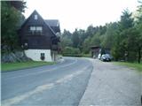 2
2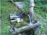 3
3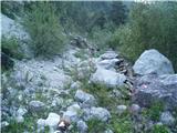 4
4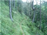 5
5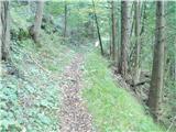 6
6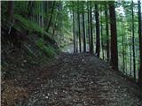 7
7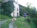 8
8 9
9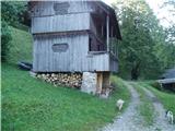 10
10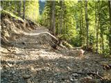 11
11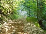 12
12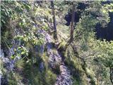 13
13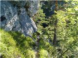 14
14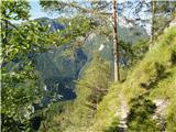 15
15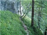 16
16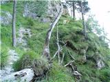 17
17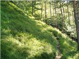 18
18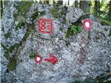 19
19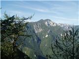 20
20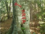 21
21 22
22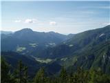 23
23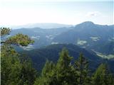 24
24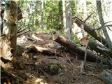 25
25 26
26 27
27 28
28 29
29 30
30 31
31 32
32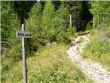 33
33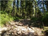 34
34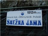 35
35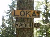 36
36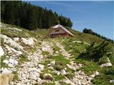 37
37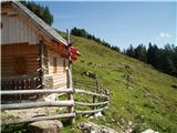 38
38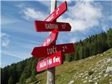 39
39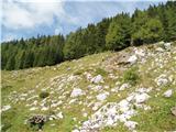 40
40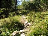 41
41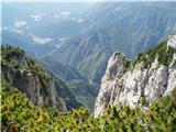 42
42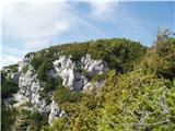 43
43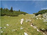 44
44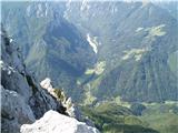 45
45 46
46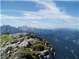 47
47 48
48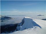 49
49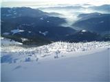 50
50
Discussion about the trip Rogovilec - Velika Raduha (via planina Arta)
|
| MarkoS12. 09. 2009 |
The central section of the path along the narrow trail below the Raduha cliffs and above the abyss is very interesting. Very nice and somewhat seriously exposed. Worth hiking. The rest was less interesting to me, especially the intermediate section onward from this part toward Snežna jama. If the goal isn't to go from bottom to top, I recommend perhaps just returning the same way.
|
|
|
|
| micamaca17. 08. 2010 |
I always shorten the hunting path a bit my own way, continue along the ridge behind the nose (great views in between, if you go to the rocks) and arrive much higher than Arta
|
|
|
|
| hohohodec21. 04. 2011 |
Does anyone know if there is still snow on Raduha? So, do I need ice axe and crampons on Sunday, 24.04.2011?
|
|
|
|
| Katuroc22. 04. 2011 |
Hi, was up there on 19.4. from the hut at Loka, snow still from the turn-off to Durce (probably some has melted since Tuesday), but it's wind-packed, so no need for ice axe and crampons.
|
|
|
|
| hohohodec23. 04. 2011 |
Thanks, Katuroc!
So I'll have a nice trip on Sunday!
|
|
|
|
| miri23. 04. 2011 |
By today, very little of it is left. Would need an anti-dust mask most. Everything is dried out.
|
|
|
|
| hohohodec23. 04. 2011 |
Then I'll go in Bedouin clothes
What worries me most is 40% - 60% cloud cover on www.meteo.si - but if it's suspicious, I won't force it.
Thanks, cheers!
|
|
|
|
| HPD-"3P"7. 05. 2013 |
Hi, is there still snow up there? I'm planning to go on Sunday, so I'm interested what equipment I should take. Thanks in advance 
Best from Varaždin
|
|
|
|
| Jure8721. 07. 2013 |
Yesterday I went down this path from Raduha back to the valley. For the descent, the path from Snežna jama to the valley seems very unpleasant to me, as it includes very long traverses at constant elevation, and where you descend, the drops are very steep and the path is full of needles and leaves, so it's quite slippery. In the wet it must be even worse. Otherwise a nice trip. 
|
|
|
|
| gamsek18. 08. 2013 |
GPS points for the route:
1. ROGOVILEC – 33TVM 77480 38351
2. KMETIJA PAČNIK – 33TVM 78709 37618
3. SKALA Z OZNAKAMI – 33TVM 79983 37271
4. LOVSKA OPAZOVALINICA – 33TVM 79987 38043
5. LESENA OGRAJA – 33TVM 79720 38482
6. KOČA NA ARTI – 33TVM 80236 38761
7. KT NA 1930m – 33TVM 79493 38942
8. VRH VELIKE RADUHE – 33TVM 79893 39620
The trail is demanding due to elevation gain and the section in picture 14, where you need to grip roots to cross 2-3m of path. Further on the trail is solid again. Good physical condition is not superfluous :-) It's a good day trip.
LP
|
|
|
|
| bo_zl4. 07. 2015 |
Nice circular tour that I completed today. Rogovilec-Grohat-Raduha (via climbing path) - Loka pod Raduho-Rogovilec (past Planina Arta and Snežna jama).
The start to Tolstovršnik warms you up well ; then mostly a mountain stroll to Grohat. The climbing path, despite the heat in the valley, was quite wet and slippery. From Snežna jama to Rogovilec very long. Shortly after Snežna jama several new forest roads (skid roads) cross the path, with newly felled trees in many places. So it's somewhat difficult to find the path again in the middle of the forest. I hope they clean up soon and mark it properly  . Then the path becomes very exposed in several places. Really don't recommend hiking in wet conditions; today the grass and leaves were dry. For ascent maybe slightly less dangerous, but in my opinion you have to really punish your knees. But the section from Rogovilec to Grohat and from Snežna jama to Rogovilec is perfect for lovers of peace. Didn't meet a single person on either section despite nice Saturday. . Then the path becomes very exposed in several places. Really don't recommend hiking in wet conditions; today the grass and leaves were dry. For ascent maybe slightly less dangerous, but in my opinion you have to really punish your knees. But the section from Rogovilec to Grohat and from Snežna jama to Rogovilec is perfect for lovers of peace. Didn't meet a single person on either section despite nice Saturday.
|
|
|
|
| garmont8. 06. 2016 |
The above-mentioned trail has been newly marked in the section where there are plenty of new skid roads, so there are no more problems with followability in that part.
|
|
|
|
| nejc jakob13. 05. 2018 |
Just to correct you, the farm is called Račnik. Best regards
|
|
|
|
| rok.si10. 06. 2019 |
For all who will descend this trail and come to the devastation due to windthrow right below Snežna jama... If there are new markers somewhere I missed them and had quite orientation problems.
From Snežna jama we descend a few minutes along one of the tracks down to the parking lot. When we position ourselves on the road and look up towards Snežna jama, we need to go along a solid forest road to the left and after a few minutes we reach a marker on the rock.
|
|
|
|
| JV2. 08. 2024 08:13:17 |
Has anyone gone up this path recently? Condition? Regards
|
|
|
|
| Roberto-MMLM11. 08. 2024 12:15:25 |
This trail is not just partially difficult, it is also frequently very exposed and veeery long trail to a summit that is nothing special, if you run out of water somewhere here you'll hardly find drinkable water, except more at the beginning. Yesterday 10.8.24 I was on this trail, not a single soul on this trail, no lack of nettles and overgrowth, the trail is not newly arranged and poorly marked on some sections, and full of obstacles. The path where it branches left to pl. Arta is passable with some effort, while the path to Loke is visible for a while and poorly marked then suddenly disappears and is impassable, when you turn back you can't find the return path, you get lost quickly. Back and over Arta. At the starting point we searched for the climbing trail, wasted more than 1 hour, then we go on this mentioned trail, bitter aftertaste at the start. This trail rises steeply all the time and doesn't relent, if you have a 15kg backpack and go on such a trail have 3 liters of water. The trail is hard and very strenuous. The trail is difficult to very difficult, definitely not easy. There are many sections where you can fall very high in a second. I do not recommend this trail to everyone by any means, it's not particularly well-trodden either. Snežna jama is closed since summer 2023 anyway, nothing is moving, no drinking water anywhere, have supplies.
|
|
|
To post a comment you must log in:
If you do not yet have a username, you must first
register.