Rosstratte - Dobratsch / Dobrač (by road)
Starting point: Rosstratte (1732 m)
| Latitude/Longitude: | 46,59290°N 13,71130°E |
| |
Route name: by road
Walking time: 2 h
Difficulty: easy marked way
Elevation gain: 434 m
Elevation difference along the route: 515 m
Map:
Recommended equipment (summer):
Recommended equipment (winter): ice axe, crampons
Views: 39.233
 | 2 people like this post |
Access to starting point:
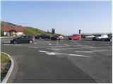
First, we drive to Kranjska Gora, then we continue driving towards Rateče. When we arrive at Podkoren, we leave the main road and continue driving right towards Korensko sedlo. From the saddle, we descend to the Austrian side, where in the valley we turn right towards Beljak / Villach. Further on, we drive through the village Ločilo / Hart to Beljak, where signs for Spittal direct us to the bypass road past the town. The road then soon brings us to Judendorf (area of Beljak), and we notice signs for Beljaška alpine road / Villacher Alpenstrasse a little further on. Here we turn right and follow the road to the parking lot, which is located at an altitude of 1732 m (road is payable 14 eur personal car and 8 eur motor, July 2012).
From Korensko sedlo to the top of Beljaška road is approximately 32 km.
Route description:
From the parking lot, we continue on a narrower asphalt road which is closed to public traffic by a traffic sign. Asphalt soon ends and the road brings us past a grazing fence to a marked junction, where a marked path branches off to the right towards Plajberk pri Beljaku / Bad Bleiberg, and we continue left and proceed along an ascending macadam road which leads towards the summit of Dobrač. After a short ascent, we arrive at a sharp right turn, in the middle of which an unmarked path branches off towards Dobrač, and we continue for a short time on a relatively steep and increasingly panoramic road. Higher up, where the slope flattens somewhat, we arrive at a marked junction. At the mentioned junction, we leave the road and continue slightly left on a marked footpath which begins to ascend more steeply on a grassy slope. The not too steep path then quickly brings us past a bench to the summit of Zehnernock, which we recognize by the hut on top.
We bypass the mentioned hut on the left side, then descend along the edge of the cliffs. There follows a few minutes of relatively gentle walking along the path, from which a nice view opens towards the valley, Karawanks and Julian Alps. When the cliffs on the left side transition to less steep slopes, the path begins to descend. There follows a few minutes of descent, then we join the previously mentioned unmarked path.
Here we continue straight ahead on initially still gentle path, then we enter a belt of dwarf pines, through which we begin to ascend more steeply. The path soon flattens and leads us for a while through more plateau-like terrain. There follows a short steep ascent and the path brings us to a panoramic ridge, along which we continue the ascent. Since the ridge is wide and quite gentle on the right side, it causes us no difficulties. Higher up, we join the macadam road, along which we walk in a few steps to the hut Ludwig Walter-Haus.
From the hut, in one minute of further walking, we ascend to the German chapel, and from there along a somewhat narrower ridge to the summit and the Slovenian chapel.
The section of the path between the German church and the summit of Dobrač is dangerous for slipping in snow.

Photos:
 1
1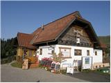 2
2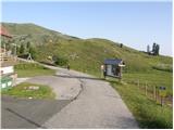 3
3 4
4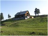 5
5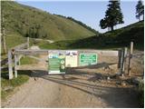 6
6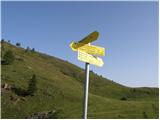 7
7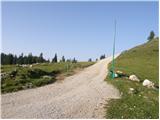 8
8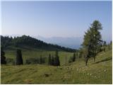 9
9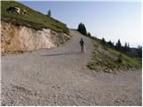 10
10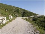 11
11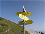 12
12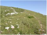 13
13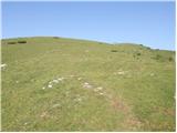 14
14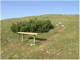 15
15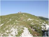 16
16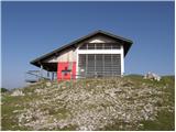 17
17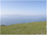 18
18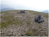 19
19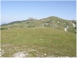 20
20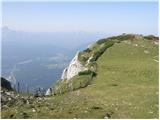 21
21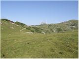 22
22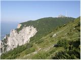 23
23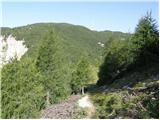 24
24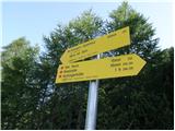 25
25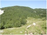 26
26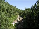 27
27 28
28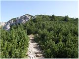 29
29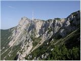 30
30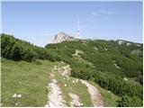 31
31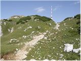 32
32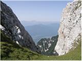 33
33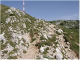 34
34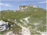 35
35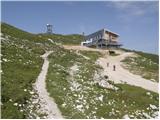 36
36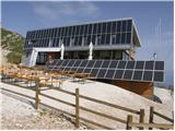 37
37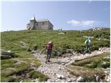 38
38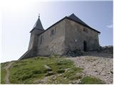 39
39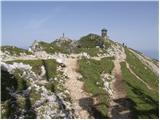 40
40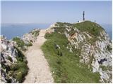 41
41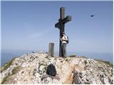 42
42 43
43
Discussion about the trip Rosstratte - Dobratsch / Dobrač (by road)
|
| tulipan10. 07. 2016 |
On the switchback in picture 10, it's more sensible to turn left towards the viewpoint platform. The paths join at picture 25. Avoids the ascent towards Zehnernock and the descent.
|
|
|
|
| Fulcrum24. 09. 2016 |
Today I was on Dobrač via the described route.
The Villacher Alpenstraße costs 16.50 EUR for a car and 10 EUR for a motorcycle. Along the road there are 11 parking lots where you can stop and see various sights, from wonderful views to the alpine botanical garden, which is open only in the summer months.
PS There is a cross on the top, which apparently doesn't bother anyone in Austria.
|
|
|
|
| Laščan11. 08. 2018 |
Does anyone perhaps know if there is mass at Veliki Šmaren here? Thanks!
|
|
|
|
| J.P.13. 01. 2024 18:41:01 |
In wintertime (November-April) the road is not charged but parking. Parking meters are placed at the parking lots. 1.80€/h LP
|
|
|
To post a comment you must log in:
If you do not yet have a username, you must first
register.