Rudnik v Topli - Mala Peca
Starting point: Rudnik v Topli (1080 m)
| Latitude/Longitude: | 46,48590°N 14,76470°E |
| |
Walking time: 2 h 10 min
Difficulty: easy marked way
Elevation gain: 651 m
Elevation difference along the route: 700 m
Map: Kamniške in Savinjske Alpe 1:50.000
Recommended equipment (summer):
Recommended equipment (winter): ice axe, crampons
Views: 8.516
 | 1 person like this post |
Access to starting point:
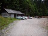
A) We drive to Črna na Koroškem (to here from Ravne na Koroškem or from Šoštanj through the mountain pass Spodnje Sleme), and then we continue driving towards Koprivna. Further on, we ascend along the Meža River, and we drive along it to the crossroads, where the road into the Topla valley branches off to the right. The path ahead leads us along the Topla stream, and we drive on the ascending road to the parking lot by the entrance to the mine in Topla.
B) We drive to Luče (to here from Mozirje or from Kamnik over the mountain pass Volovljek (Kranjski Rak)), and then we continue driving towards Logarska dolina. In the village Solčava, we leave the main road towards Logarska dolina and continue driving right in the direction of Podolševa, mountain pass Spodnje Sleme and Črna na Koroškem. Further on, the road loses its asphalt surface, and after a few kilometres at the crossroads in Podolševa we turn right towards Črna na Koroškem. The road, which further on mainly ascends transversely, eventually brings us to the mountain pass Spodnje Sleme. From the mountain pass the road starts descending, and we follow it in the direction of Črna na Koroškem. When after a few kilometres we descend into the valley, at the crossroads we turn right towards Črna na Koroškem (left Koprivna). On the main road we descend only for a short time, and then the signs for the Topla valley direct us left onto the ascending road. The path ahead leads us along the Topla stream, and we drive on the ascending road to the parking lot by the entrance to the mine in Topla.
Route description:
At the end of the parking lot, we arrive at the intersection of two rougher macadam roads, where we turn sharply left in the direction of the mountain hut Dom na Peci. Further on, the road crosses a clearing above the parking lot and a little higher brings us to the next intersection, where we continue right (left entrance to the mine - 5 minutes). The path ahead leads us along the road, which gradually turns into a cart track; this then brings us a little further to the next marked junction.
We continue on the lower wider cart track (slightly left Knipsovo sedlo), which further crosses a pasture fence and behind it brings us to a trough with water. The path ahead crosses a partly panoramic meadow, after which it enters the forest and starts to ascend more steeply. Higher up, the path leads us through a gully, behind which it starts to ascend through the grass-covered forest. A little higher still, we arrive at the spot where the sign »novo trasirana pot« directs us left into the steep slope (the old path is closed due to a landslide that prevents safe passage). For a short time we ascend steeply, then the path brings us to the aforementioned landslide, which we reach higher than the old path. Even on the new path route, the passage is somewhat awkward and dangerous for slipping. On the other side of the landslide slope, the path again starts to ascend steeply and further on returns to the renovated old path. The path ahead, in moderate ascent, crosses the slopes towards the east, and we follow it to the junction at the hunting cottage (we notice the hunting cottage on the right side, and it is somewhat set back from the path).
From the junction we continue in the direction of the mountain hut Dom na Peci, and after a few minutes the path brings us to the next junction.
Here we continue directly to the mountain hut Dom na Peci, which is just a few minutes' walk away, or we can continue right to the cave of King Matjaž, which is about 5 minutes' walk away. If we continue past the cave, the path is about 10 minutes longer.
At the mountain hut Dom na Peci we notice numerous hiking signposts, and we take the path in the direction of Mala Peca. The path ascends steeply for some 10 metres, then levels out and brings us to the summit of Mala Peca, from which a beautiful view opens up.

Photos:
 1
1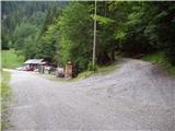 2
2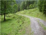 3
3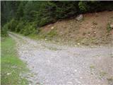 4
4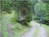 5
5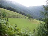 6
6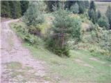 7
7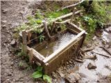 8
8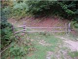 9
9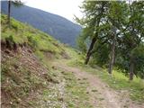 10
10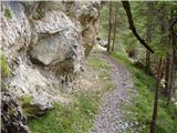 11
11 12
12 13
13 14
14 15
15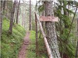 16
16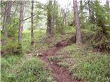 17
17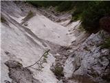 18
18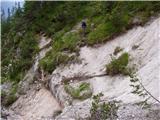 19
19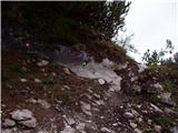 20
20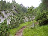 21
21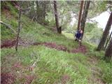 22
22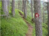 23
23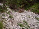 24
24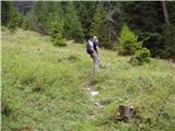 25
25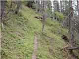 26
26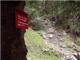 27
27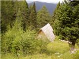 28
28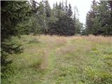 29
29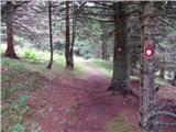 30
30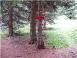 31
31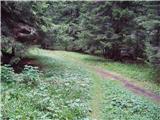 32
32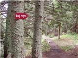 33
33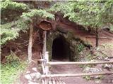 34
34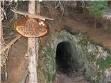 35
35 36
36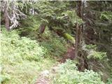 37
37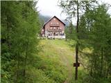 38
38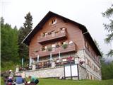 39
39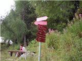 40
40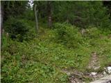 41
41 42
42
Discussion about the trip Rudnik v Topli - Mala Peca
To post a comment you must log in:
If you do not yet have a username, you must first
register.