Rudnik v Topli - Petzen (Kordeschkopf) (Peca (Kordeževa glava)) (via Knipsovo sedlo)
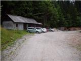
Starting point: Rudnik v Topli (1080 m)
| Latitude/Longitude: | 46,48590°N 14,76470°E |
| |
Route name: via Knipsovo sedlo
Walking time: 2 h 45 min
Difficulty: easy unmarked way
Elevation gain: 1045 m
Elevation difference along the route: 1045 m
Map: Kamniške in Savinjske Alpe 1:50.000
Recommended equipment (summer):
Recommended equipment (winter): ice axe, crampons
Views: 45.024
 | 3 people like this post |
Access to starting point:
A) We drive to Črna na Koroškem (up to here from Ravne na Koroškem or from Šoštanj via the Spodnje Sleme pass), and then we continue driving towards Koprivna. Further on, we ascend along the Meža river, and we drive alongside it to the junction, where the road into the Topla valley branches off to the right. The path ahead leads us along the Topla stream, and we drive on the ascending road to the parking lot by the entrance to the mine in Topla.
B) We drive to Luče (up to here from Mozirje or from Kamnik via the Volovljek pass (Kranjski Rak)), and then we continue driving towards Logarska dolina. In the village Solčava we leave the main road towards Logarska dolina and continue driving right in the direction of Podolševa, the Spodnje Sleme pass and Črna na Koroškem. Further on, the road loses its asphalt surface, and after a few kilometers at the junction in Podolševa we turn right towards Črna na Koroškem. The road, which further mostly ascends crosswise, brings us after some time to the Spodnje Sleme pass. From the pass the road starts descending, and we follow it in the direction of Črna na Koroškem. When after a few kilometers we descend into the valley, at the junction we turn right towards Črna na Koroškem (left Koprivna). On the main road we descend only briefly, and then the signs for the Topla valley direct us left onto the ascending road. The path ahead leads us along the Topla stream, and we drive on the ascending road to the parking lot by the entrance to the mine in Topla.
Route description:
At the end of the parking lot we arrive at a junction of two poorer macadam roads, where we turn sharply left in the direction of the Dom na Peci hut. Further on the road crosses a clearing above the parking lot and brings us only a little higher to the next junction, where we continue right (left entrance to the mine - 5 minutes). The path ahead leads us along the road, which gradually turns into a cart track; this then brings us a little further to the next marked junction.
At the mentioned junction we continue left (slightly right to Dom na Peci) in the direction of Knipsovo sedlo (on the signposts Knepsovo sedlo) and further ascend along a grassy cart track. Higher up we join a rocky cart track, which crosses the slopes to the left; we ascend along it to the point where the signs for Peca and Knipsovo sedlo direct us steeply uphill to the right.
Further on the path ascends steeply, crossing steep slopes to the left (on this section there is particular risk of slipping when wet). After 10 minutes of steep ascent the path crosses a grassy gully, then on the other side it ascends even more steeply. The very steep path brings us higher to a small vantage point, from which a fine view opens towards Raduha. Just a little higher on a tree we notice a signpost directing us left. The path ahead leads through gradually sparser forest, from which we occasionally get some views. Further on the path goes among dwarf pines, where the steepness begins to ease. There then follows about 15 minutes of easy walking, and the path brings us to Knipsovo sedlo, where there are information boards.
From the saddle we continue right (left to Končnikov vrh, Bistriška špica and Kumer) and follow the path in the direction of Kordeževa glava. The path ahead first rises slightly, then descends into a sort of indistinct little valley between Velika glava and Kordeževa glava. After the short descent we reach this little valley, then begin to ascend towards the highest peak of Peca, which amid ever finer views we soon reach.
The path to Knipsovo sedlo is only signposted and not blazed, but orientationally not particularly difficult. Since the path is very steep, hiking poles will be useful. When wet, on sections of the path there is risk of slipping due to the considerable steepness, so greater caution is required then.

Along the route: Knipsovo sedlo (2012m)
Photos:
 1
1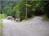 2
2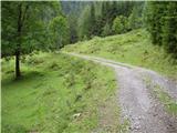 3
3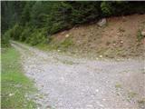 4
4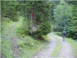 5
5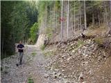 6
6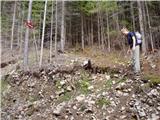 7
7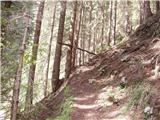 8
8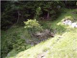 9
9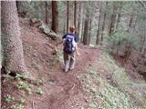 10
10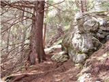 11
11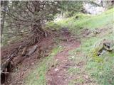 12
12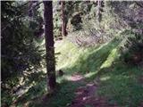 13
13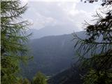 14
14 15
15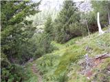 16
16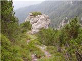 17
17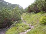 18
18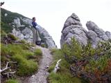 19
19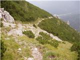 20
20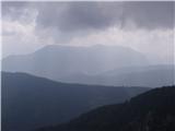 21
21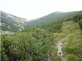 22
22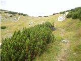 23
23 24
24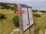 25
25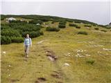 26
26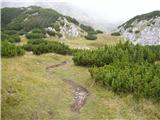 27
27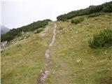 28
28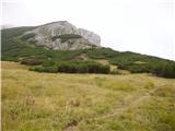 29
29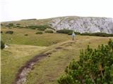 30
30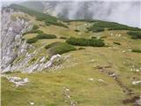 31
31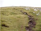 32
32 33
33
Discussion about the trip Rudnik v Topli - Petzen (Kordeschkopf) (Peca (Kordeževa glava)) (via Knipsovo sedlo)
Show older messages
|
| urosl7. 06. 2009 |
Yesterday we went up this trail, but it's not even approximately as easy as it says here. It's also poorly marked. We walked 2h, but at the sign at the saddle we didn't know exactly where to go. Down we took a very difficult path to the hut on Peca, full of precipices, so this Peca is not such a small cat's cough, and we also missed the easier path down because it's really poorly marked!
Otherwise everything is ok, especially the hosts are extremely friendly, and they have great vampe!!!
|
|
|
|
| A20097. 06. 2009 |
Maybe it would be good to prepare for the trip before the tour, so you don't wander on demanding paths unnecessarily.
You can conquer Peca without problems even with a dog (which can't use hands...), orientation is completely undemanding. Of course it's smart to spend 5-10 min beforehand knowing where you're going...
|
|
|
|
| jprim8. 06. 2009 |
I was also on Peca yesterday with my husband (maybe we met somewhere), you write about the markings, that's not accurate, I think everything is well marked, if you don't know something, better ask others or inquire at the hut, yesterday on the climbing route it didn't seem sensible to me, last year we were on this path in good weather, even then the rock seems friendlier, everything together is more optimistic.
Safe steps!
|
|
|
|
| urosl9. 06. 2009 |
We went up Knipsova, which is not marked, only occasionally signposted with a green arrow. When you reach the saddle though, if it's your first time up you don't know left or right, because that arrow in the picture up here is no longer there.
Down we went via the climbing route, so we only passed the hut on the return.
Oh and also; We couldn't ask anyone en route as on Saturday we met no one, only three were logged in the summit book before us!
Nice mountain greetings!
|
|
|
|
| jprim9. 06. 2009 |
Regarding entries, that doesn't guarantee how many people were at the summit, we don't sign in and don't collect stamps either, I know it's not the best regarding book entries, but that's not my interest. When were you at the summit, if it's no secret.
LP!
|
|
|
|
| Sam.volk9. 06. 2009 |
Peca is well marked. I've already said once that you have to look and not just push forward. Lp
|
|
|
|
| urosl9. 06. 2009 |
We were at the summit around 11.
|
|
|
|
| jprim9. 06. 2009 |
Somewhere around that time we too, or probably already descending from the summit.
LP!
|
|
|
|
| Planinček10. 06. 2009 |
You two couldn't have met, since you were up there on different days.
|
|
|
|
| jprim10. 06. 2009 |
Well, you're right, read the dates too. Thanks for the warning.
|
|
|
|
| ožbolt10. 06. 2009 |
I was there with family and dog on Sunday too - first time! The path via Knipsovo sedlo isn't marked, but it's well trodden and reliably leads you to the top of the saddle. Further on the path is marked and we had no problems. Also the part where the path splits (right difficult path, left easy path) is nicely marked! Otherwise nice trip.
|
|
|
|
| bandy27. 06. 2009 |
While reading this forum, I was tempted lately to write something, but today I checked it out myself. I know the described trail, as well as the others on Peca, but I hadn't gone to Knipsovo sedlo this year yet, so due to the weather I chose this trail today. The markings from Topla to Knipsa are really very sparse. When we leave the road for the trail that leads steeply upwards, there's a signpost, then until the arrow up top there's nothing more (picture 12). On two rocks I noticed green stains as if someone wanted to draw something but didn't finish  . It's true that before leaving you take time to check how the trail goes, what you need, etc., but still I think markings have their purpose, not for me since I know the trail, but for someone going for the first time. In my opinion, they just give a sense of security that you're on the right path. Otherwise, the trail is well trodden. From Knipsa to the summit, the markings are so dense that even a blind man would find the way (a little joke). From the summit towards the hut you won't get lost if you watch where the arrow is pointing. I returned via Mali Peca and back to Topla via Zajčja peč, the trail is also very well marked, just a few fallen trees across the path, but they pose no obstacle, easy to pass. The weather today really wasn't favorable, but still there's something to see on Peca. Best regards. . It's true that before leaving you take time to check how the trail goes, what you need, etc., but still I think markings have their purpose, not for me since I know the trail, but for someone going for the first time. In my opinion, they just give a sense of security that you're on the right path. Otherwise, the trail is well trodden. From Knipsa to the summit, the markings are so dense that even a blind man would find the way (a little joke). From the summit towards the hut you won't get lost if you watch where the arrow is pointing. I returned via Mali Peca and back to Topla via Zajčja peč, the trail is also very well marked, just a few fallen trees across the path, but they pose no obstacle, easy to pass. The weather today really wasn't favorable, but still there's something to see on Peca. Best regards.
|
|
|
|
| Matjaz_656. 09. 2009 |
I too was today 1st time on Peca and had no problems ... the path is nicely trodden
according to the above description I just followed the Knips sign on picture 4 ... and through the forest came directly to the track and junction on picture 6
Peca
|
|
|
|
| jackman26. 05. 2010 |
Yesterday I was at the summit via Knipsovo sedlo. I was lucky to choose the right path. There are many path and trail junctions, but their marking is below any criticism. One can stray off anywhere. I recommend the other path to the summit (the easier one via koča, which is marked).
The path via Knipsovo sedlo is steep, but not so much yet that I could claim it's one of Slovenia's steepest paths. There's still lots of snow, and snow crossings too. Caution isn't superfluous!
|
|
|
|
| divjipetelin27. 05. 2010 |
Thank God there are still paths that are not marked and not as crowded as beach promenades. When I first went on this path, I had no problems.
|
|
|
|
| Parkeljc29. 05. 2010 |
Thank God, the paths where you can easily get lost are MARKED!!! Why look for the right path, expose yourself to danger if it's not necessary? There are also traffic signs on the road.. Divjipetelin, I'm really curious how you would react if you were driving on a road with potholes (not to say holes) and drove into one, and there was no traffic sign warning you about it by the road? It is true that markers are lacking and consequently the paths are always worse marked. For a novice who doesn't know the mountains, it's easy to stray from the path,.. If I want company - I go on the trodden path, if I don't - I go where there are fewer people,...
|
|
|
|
| teja logar14. 06. 2010 |
Hi,
I'm mainly interested in experiences with 4-legged ones over Knipsovo sedlo: is it okay for a medium-sized dog (medium schnauzer) or too demanding in terms of jumps, steepness... You really write that you were on Peca also with dogs, but via Knips?
Thanks for info and have a nice day
|
|
|
|
| Petr14. 06. 2010 |
Teja, no problems for the dog on Knips. It's just steep, not exposed nor technically demanding. But if you continue from the summit to the hut, of course stick to the left on the easy path and not right on the secured one.
|
|
|
|
| Sam.volk14. 06. 2010 |
Don't force the dog on the secured path to Peca. All other paths are suitable for the four-legged friend. Best regards
|
|
|
|
| izigov14. 06. 2010 |
Good evening
Today Medo (Bernese mountain dog) and I did the route: Topla - Knepsovo sedlo - Summit - hut on Peca - Topla
all without problems and both satisfied at the end
Best regards from Carinthia
Izidor
|
|
|
|
| teja logar22. 06. 2010 |
Big thanks for the info! tomorrow Luna and I are going on a beautiful tour to Peca, because you were so kind and gave me the sought-after info. See you somewhere in the mountains
|
|
|
|
| atlet8827. 06. 2010 |
I'm interested if you can drive by car on the Austrian side of Peca to the lake at around 1700 meters?
|
|
|
|
| free4. 02. 2011 |
since Carinthians say nothing about their Peč and hide descriptions and data like a snake's legs, some info from that end. today on this path (also called from Fajmut), circular to Peč. Road drivable to parking bp. so fajmut-knips-kordeževa glava-hut on Peč- fajmut or mine. path trodden to saddle, to top a bit less. crampons not needed for ascent (soft, no ice), recommended for descent to hut, because smoothed- Path follows description, but as once written in this forum, go to the mark on trunk (pic 4) and you come directly to signpost. No other marks, but since trodden, no need. don't know how if new snow falls. no crowds today, wind on top, beach just below. if too little for you then also king Matjaž castles or skiing on ski slope in Črni. so: everyone there (less crowds elsewhere) 
|
|
|
|
| Domch4. 04. 2012 |
On 31.3.2012 I walked this path. Nice path with magnificent views of the KS Alps. The path is steep and mostly in the shade, up on the Austrian side there are still some larger snow patches but nothing dangerous. The summit has been completely dry for a while. Definitely the most beautiful path to Peca.
|
|
|
|
| Janiel749. 06. 2012 |
Yesterday took advantage of the good weather forecast and conquered Peč too. Combined the route a bit. Up from Rudnik Topla past King Matjaž's cave to Dom na Peci. Warning: at one spot the path drops into the valley so you have to squeeze narrowly along the rocks to pass. To the summit via the climbing path. Down via Knepsovo sedlo. The sign in picture 14 is on the ground, didn't notice the signpost either. But the path is so well trodden you don't need extra help.
|
|
|
|
| Domch9. 06. 2012 |
No need to crawl under that rock as there's no path there anymore. You missed the mark in the canyon. New marked path goes up the canyon and over that rock because avalanche took almost the whole lower path. You can get there but new path is more reliable and nicer too.
|
|
|
|
| Janiel749. 06. 2012 |
Aha. Thanks for the comment Obviously. I got through but it really doesn't look good. Halfway crawling up and a swarm of 20-30 hungry flies attacked me....as punishment
|
|
|
|
| Domch27. 08. 2012 |
On Friday I repeated the tour over Knipsovo sedlo and from the top went to the neighbors at Končnikov vrh and from there to the summit - Kordeževa glava. From the summit I headed back down the climbing path, which as always is impeccably maintained and usable without issues also for descent to Mala Peca. From there back to Topla. Praise to PD Mežica for the new markers, signs, notices and the tidied electrical box in KM cave.
|
|
|
|
| Domch12. 11. 2012 |
On Saturday I was again on the roof of Carinthia. From Rudnik I headed to Mala Peca, from there up the climbing path to Kordeževa glava and then over Knipsovo sedlo down back to Topla. The road is impeccable, likewise the path to Mala Peca, at the top of it 15 cm of snow. The climbing path is completely bare and dry - real autumn. The last ascent and path to Knipsa is wintery with snow about 10-15 cm. Well trodden so no problems. Met Kavko and cleaned up after the carefree hiker.
|
|
|
|
| Bandzo29. 07. 2013 |
On Saturday we returned to Rudnik via this path, so we made a nice loop tour. Definitely prefer going down this path rather than up, although knees suffer. Very steep I had a Jerebikovec deja vu
|
|
|
|
| Enka26. 08. 2013 |
Is mud a problem on this trail? Say, if I were to go up after this rain on Friday...
|
|
|
|
| TejaB27. 08. 2013 |
I don't think so. I don't remember it ever being muddy on this trail.
|
|
|
|
| garmont27. 08. 2013 |
Of course mud can be a problem. It's a very, very steep trail that goes partly through forest and partly over meadows.
|
|
|
|
| Enka27. 08. 2013 |
And how is a person supposed to decide now, after two diametrically opposed opinions ?
|
|
|
|
| ben27. 08. 2013 |
Difficult, but I think if you use poles there probably won't be any problem. But the trail is pretty steep for a while, yeah.
LP B
|
|
|
|
| Enka27. 08. 2013 |
OK, I'd use it only for the ascent anyway, I'd go down past the Hut. Thanks everyone!
|
|
|
|
| garmont27. 08. 2013 |
This is the so-called "Knapovska pot" and it's one of the steepest trails in this part of the mountains. And of course, if a steep trail is muddy then....
|
|
|
|
| TejaB27. 08. 2013 |
"And how is a person supposed to decide now, after two diametrically opposed opinions?"
No, you'll have to go up, then report back on the mud.
The trail is really steep, that's why the water drains off and you can't expect much mud on steep sections, but it will probably still be a bit wet, so you need good hiking boots and poles and a steady step, as always on wet ground. Nothing special then.
|
|
|
|
| Enka28. 08. 2013 |
Haha, TejaB, obviously. Well, I have to admit that now I'm even more interested in the steepness with which you're "scaring" me than the mud. If I go, I'll definitely report back - on the mud and the steepness.
|
|
|
|
| nincokl12. 12. 2013 |
I would be grateful for any information, what is the path like over Knipsovo sedlo, is it traceable and trodden at this time? I would go this weekend
thanks!
|
|
|
|
| nincokl14. 12. 2013 |
Today went from Topla via Knipsovo sedlo, let me tell you, the path is very steep, but regardless of the lots of snow there is a track and it's possible without problems to the top, just warning that a bit below the top of the saddle you need to keep more to the left to ascend some gully, avoid the green low vegetation, I got off track and it was a lot of effort to reach the right path..
from the hut back, me and my group went along the marked path back to the mine in Topla, let me tell you that we first made the track in some places very deep snow, very annoying is also the huge number of fallen trees that require caution.
whoever will go in the next days on this path to the hut it will surely be easier for him, because the track is the right direction!!
|
|
|
|
| katja8713. 01. 2014 |
Yesterday, 12.1.2014, we set off along this path to the top of Peca.
We did a circular tour: Rudnik v Topli - pathless past Knipsovo sedlo - summit Kordeževa glava - Dom na Peci - Votlina Kralja Matjaža - Mala Peca - Rudnik v Topli.
The tour took us 8 hours.
The day was sunny and we had fantastic views
The path to the summit past Knipsovo sedlo is steep, snow starts at 1500m altitude. Luckily the snow wasn't sinking, but we had small crampons on all the way up (large ones wouldn't hurt either), as without them we couldn't have gone up this side. The track is made in places, but in between we had to make it ourselves.
You can see pictures from the hike on the website of Planinsko društvo Matica Murska Sobota: http://www.mojalbum.com/pdmaticams/20140112-peca-brezpotje-mimo-knipsovega-sedla/jutranji-pogled-na-juzne-stene-pece/21406334
|
|
|
|
| poridušan18. 02. 2014 |
Hello. I'm interested if the path from Topla - Peca - Krožna is passable.
Thanks for the answers.
|
|
|
|
| Domch18. 02. 2014 |
It is passable almost always, just a question of what equipment
|
|
|
|
| seflja9. 05. 2016 |
Yesterday from the mine to the saddle and a bit further, couldn't reach the summit, the path is not cleared and snow sinks deeply up to the knees somewhere to the saddle but further it holds. At the saddle fog caught me, afternoon thunderstorm spiced with thunder.
|
|
|
|
| zanana23. 04. 2017 |
Hello! Has anyone been recently to Peca via this path over Knipsovo sedlo? What's the condition? Is there any snow? And is the path now better marked? From the above comments, it can be inferred that it wasn't exactly the easiest to follow... Thanks in advance for the answers and greetings!
|
|
|
|
| S52CI5. 09. 2017 |
I was a bit scared today when you write about the unmarked path. From the parking lot at Rudnik Topla, the markings for Koča na Peci are clearly visible, and shortly after the turn-off for Kneps, you can't miss it further on, at least not in summer conditions, as the path is well-trodden. At Knipsovo sedlo, the mark on the rock leads left towards the summit of Peca - Kordeževa glava. It is true that the marking is a bit faint, as the ascent is hellish. Patches of snow from a few days ago awaited us near the top.
|
|
|
|
| ločanka9. 02. 2020 |
At this time much nicer than at the time of this description. We returned via the path past the hut and dare say it's probably the nicest variant of this circular path.
|
|
|
|
| posavje2814. 09. 2020 |
on Saturday walked the path, back via the climbing route. Nice tour, markings ok, nice view only disturbed by clouds.
|
|
|
|
| trdi19. 06. 2021 22:35:22 |
Today I went down this path, the junction at the saddle is not marked, almost no markings until the valley, but it is well traceable however very very steep and in the upper part littered with scree, so I didn't get down very quickly...
|
|
|
|
| garmont20. 06. 2021 08:17:49 |
This is the unmarked so-called “Knap path”.
It is really steep.
|
|
|
|
| smatjaz20. 06. 2021 21:11:24 |
It's true, I was also on this path today and the marking 2:45 is just a pious wish for normal hikers, that's how much we needed for down and not up.....
|
|
|
|
| lepenatka21. 02. 2025 10:04:58 |
Does anyone know if the path from Topla to Knipsovo sedlo is trodden?
|
|
|
|
| xtrinch26. 06. 2025 09:49:18 |
This path is steep but absolutely super and safe, very well maintained. No abysses or overhangs where you'd feel threatened. Highly recommend for ascent, you're quickly at top with incredible views :-) 3 hours realistic uphill.
|
|
|
To post a comment you must log in:
If you do not yet have a username, you must first
register.