Ruski križ - Koča v Krnici (on forest path)
Starting point: Ruski križ (1036 m)
| Latitude/Longitude: | 46,44440°N 13,77460°E |
| |
Route name: on forest path
Walking time: 45 min
Difficulty: easy marked way
Elevation gain: 77 m
Elevation difference along the route: 165 m
Map: PZS, Kranjska gora z okolico, 1 : 25.000
Recommended equipment (summer):
Recommended equipment (winter):
Views: 23.083
 | 2 people like this post |
Access to starting point:
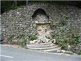
We drive to Kranjska Gora, where we continue driving left in the direction of Vršič or Bovec. Just a little before the 3rd hairpin turn of the Ruska or Vršiška road, we will notice a smaller parking lot by the road, where we park. On the opposite side of the road from the parking lot we can see the cross, and a few meters ahead on the left side the turn-off of the forest road and mountaineering signposts for Koča v Krnici. We can also descend along the mentioned worse macadam road towards Suha Pišnica where there is also a somewhat larger parking lot. A few parking lots are also located a little further along the main road between the 4th hairpin turn and Mihov dom.
To the starting point we can also come from the Primorska side through the Vršič pass.
Route description:
We head onto the worse macadam road, which immediately starts to descend moderately. After a few minutes of descent through the forest, the path levels out and brings us to the parking lot near the bed of Suha Pišnica. Here by the parking lot there is also drinking water. Before the riverbed we can decide to cross on the new wooden footbridge on our left side (the old one was swept away by rising water), and then in the next few 10 meters we follow frequent signs that direct us sharply to the right, away from the private hut on our left, towards the wide path that leads to the alpine pasture V Klinu. This variant is suitable especially when there is a lot of water and crossing the footbridge would be difficult. Alternatively, we can decide to continue straight and cross the riverbed on the narrow footbridge placed on rocks in the riverbed. Just a little after crossing the mentioned stream, the path turns slightly left and brings us out of the forest onto the expansive grassy slopes of the alpine pasture V Klinu, where on the right we notice a larger older hut. When we descend along the path past the mentioned hut, we come to a smaller nicely arranged memorial park dedicated to the unfortunate mountaineers in the surrounding mountains (Mali Tamar). The path leads past this marker on the right side just a few more 10 meters and brings us to the junction with the road that leads to Krnica from the bridge over Velika Pišnica below the former hotel Erika. We join this path and continue on it to the right, but only for a very short time. When the path reaches the expansive dry torrent bed that extends all the way to the opposite valley bank, the road crosses part of the stone debris. Immediately after this crossing, pay attention to the turn-off of the marked trail that directs us from the road to the right into the sparse forest. From there on, the trail leads us in a gentle ascent through the forest, mostly pleasantly soft, only here and there a bit more rocky. Just before the destination, we can see on the right the consequences of a large rockfall that occurred in Krnica in the winter of 2007/2008 in the immediate vicinity of the hut. After approximately 20 minutes of walking along this trail marked with rare blazes, we emerge from the forest and join the road just a few 10 meters before the Koča v Krnici, which arrives at the hut from our left side.

Along the route: planina V Klinu (960m)
The trip can be extended to the following destinations: Pogačnikov dom na Kriških podih (4 h 25 min),
Gubno (4 h 15 min),
Križ,
Planja (6 h 10 min),
Špik (4 h 15 min),
Stenar (5 h 30 min),
Dolkova špica (5 h),
Razor (6 h 25 min),
Velika Martuljška Ponca (6 h 15 min),
Veliki Oltar (5 h 15 min),
Škrlatica (6 h 45 min)
Photos:
 1
1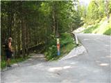 2
2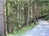 3
3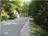 4
4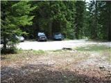 5
5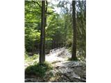 6
6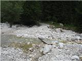 7
7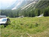 8
8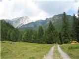 9
9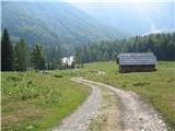 10
10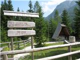 11
11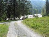 12
12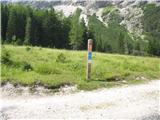 13
13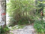 14
14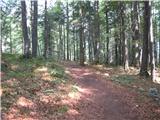 15
15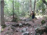 16
16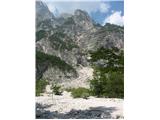 17
17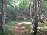 18
18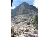 19
19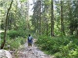 20
20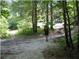 21
21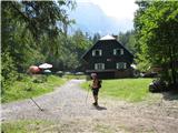 22
22
Discussion about the trip Ruski križ - Koča v Krnici (on forest path)
|
| MašaI19. 07. 2016 |
Great for small children. - The path is easy and varied. Our 3.5-year-old really enjoyed it.
|
|
|
To post a comment you must log in:
If you do not yet have a username, you must first
register.